Buffalo Summit Topo Map Nevada
To zoom in, hover over the map of Buffalo Summit
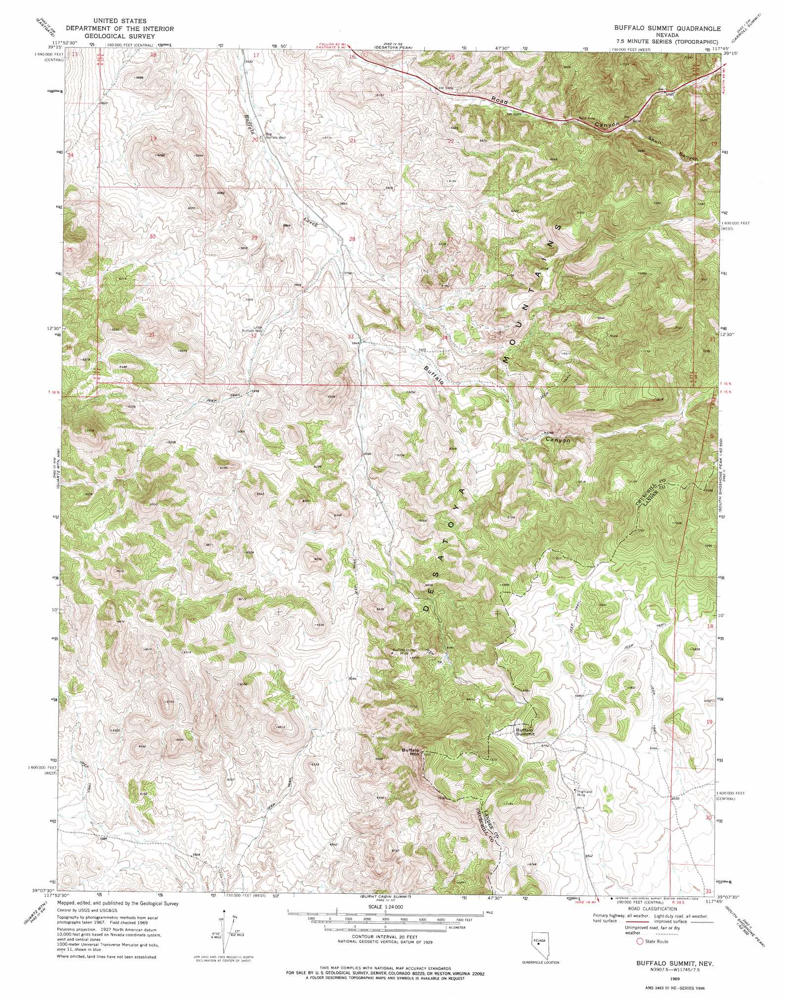
USGS Topo Quad 39117b7 - 1:24,000 scale
| Topo Map Name: | Buffalo Summit |
| USGS Topo Quad ID: | 39117b7 |
| Print Size: | ca. 21 1/4" wide x 27" high |
| Southeast Coordinates: | 39.125° N latitude / 117.75° W longitude |
| Map Center Coordinates: | 39.1875° N latitude / 117.8125° W longitude |
| U.S. State: | NV |
| Filename: | o39117b7.jpg |
| Download Map JPG Image: | Buffalo Summit topo map 1:24,000 scale |
| Map Type: | Topographic |
| Topo Series: | 7.5´ |
| Map Scale: | 1:24,000 |
| Source of Map Images: | United States Geological Survey (USGS) |
| Alternate Map Versions: |
Buffalo Summit NV 1969, updated 1972 Download PDF Buy paper map Buffalo Summit NV 1969, updated 1978 Download PDF Buy paper map Buffalo Summit NV 2011 Download PDF Buy paper map Buffalo Summit NV 2015 Download PDF Buy paper map |
1:24,000 Topo Quads surrounding Buffalo Summit
Wonder Mountain |
Camp Creek Canyon |
Cold Springs |
Basque Summit |
Carroll Summit Ne |
West Gate |
Eastgate |
Desatoya Peak |
Carroll Summit |
Carroll Summit Se |
Bell Mountain |
Quartz Mountain Nw |
Buffalo Summit |
Campbell Creek Ranch |
Gold Park |
Broken Hills |
Quartz Mountain |
Burnt Cabin Summit |
Midas Spring |
South Shoshone Peak |
Mount Annie Ne |
Downeyville |
Ellsworth |
Ione Nw |
Ione |
> Back to 39117a1 at 1:100,000 scale
> Back to 39116a1 at 1:250,000 scale
> Back to U.S. Topo Maps home
Buffalo Summit topo map: Gazetteer
Buffalo Summit: Mines
Buffalo Hump Mine elevation 2083m 6833′Gold Trail Mine elevation 2014m 6607′
Highland Mine elevation 2027m 6650′
Buffalo Summit: Summits
Buffalo Mountain elevation 2299m 7542′Buffalo Summit elevation 2133m 6998′
Buffalo Summit: Valleys
Buffalo Canyon elevation 1783m 5849′Skull Canyon elevation 1943m 6374′
Buffalo Summit: Wells
Big Buffalo Well elevation 1710m 5610′Little Buffalo Well elevation 1800m 5905′
Buffalo Summit digital topo map on disk
Buy this Buffalo Summit topo map showing relief, roads, GPS coordinates and other geographical features, as a high-resolution digital map file on DVD: