Cold Springs Topo Map Nevada
To zoom in, hover over the map of Cold Springs
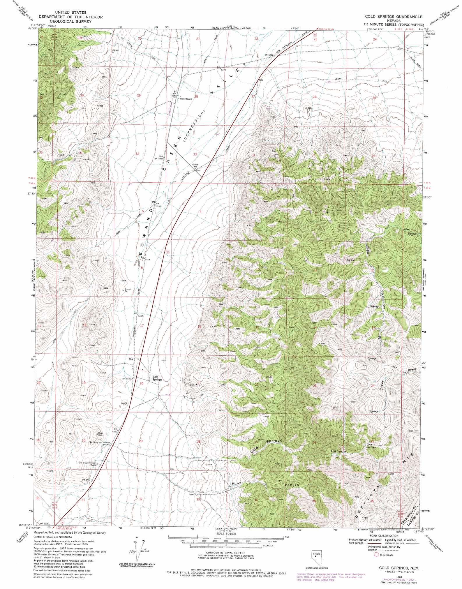
USGS Topo Quad 39117d7 - 1:24,000 scale
| Topo Map Name: | Cold Springs |
| USGS Topo Quad ID: | 39117d7 |
| Print Size: | ca. 21 1/4" wide x 27" high |
| Southeast Coordinates: | 39.375° N latitude / 117.75° W longitude |
| Map Center Coordinates: | 39.4375° N latitude / 117.8125° W longitude |
| U.S. State: | NV |
| Filename: | o39117d7.jpg |
| Download Map JPG Image: | Cold Springs topo map 1:24,000 scale |
| Map Type: | Topographic |
| Topo Series: | 7.5´ |
| Map Scale: | 1:24,000 |
| Source of Map Images: | United States Geological Survey (USGS) |
| Alternate Map Versions: |
Cold Springs NV 1969, updated 1972 Download PDF Buy paper map Cold Springs NV 1969, updated 1975 Download PDF Buy paper map Cold Springs NV 1969, updated 1983 Download PDF Buy paper map Cold Springs NV 2012 Download PDF Buy paper map Cold Springs NV 2014 Download PDF Buy paper map |
1:24,000 Topo Quads surrounding Cold Springs
Dixie Valley |
Cow Canyon |
Byers Canyon |
Tungsten Mountain |
New Pass Well |
Dixie Valley Se |
Mount Augusta |
Clan Alpine Ranch |
Byers Ranch |
New Pass |
Wonder Mountain |
Camp Creek Canyon |
Cold Springs |
Basque Summit |
Carroll Summit Ne |
West Gate |
Eastgate |
Desatoya Peak |
Carroll Summit |
Carroll Summit Se |
Bell Mountain |
Quartz Mountain Nw |
Buffalo Summit |
Campbell Creek Ranch |
Gold Park |
> Back to 39117a1 at 1:100,000 scale
> Back to 39116a1 at 1:250,000 scale
> Back to U.S. Topo Maps home
Cold Springs topo map: Gazetteer
Cold Springs: Populated Places
Cold Springs elevation 1696m 5564′Cold Springs: Springs
Cedar Springs Number Four elevation 2060m 6758′Cedar Springs Number One elevation 2389m 7837′
Cedar Springs Number Three elevation 2142m 7027′
Cedar Springs Number Two elevation 2185m 7168′
Cold Springs elevation 1782m 5846′
Cold Springs elevation 2338m 7670′
Cold Springs: Valleys
Cold Springs Canyon elevation 1820m 5971′Pony Canyon elevation 1744m 5721′
Cold Springs digital topo map on disk
Buy this Cold Springs topo map showing relief, roads, GPS coordinates and other geographical features, as a high-resolution digital map file on DVD: