Byers Ranch Topo Map Nevada
To zoom in, hover over the map of Byers Ranch
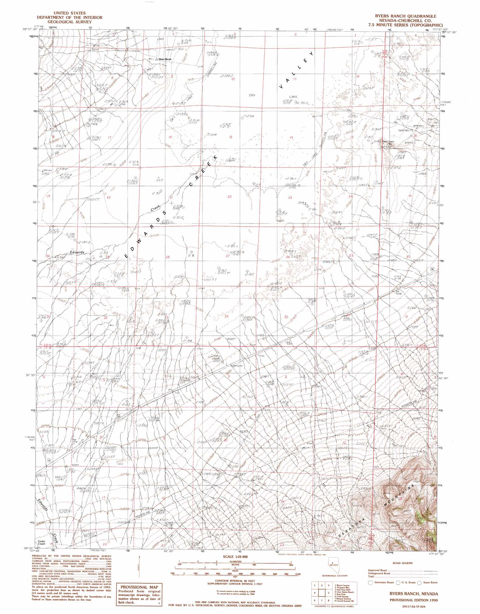
USGS Topo Quad 39117e6 - 1:24,000 scale
| Topo Map Name: | Byers Ranch |
| USGS Topo Quad ID: | 39117e6 |
| Print Size: | ca. 21 1/4" wide x 27" high |
| Southeast Coordinates: | 39.5° N latitude / 117.625° W longitude |
| Map Center Coordinates: | 39.5625° N latitude / 117.6875° W longitude |
| U.S. State: | NV |
| Filename: | o39117e6.jpg |
| Download Map JPG Image: | Byers Ranch topo map 1:24,000 scale |
| Map Type: | Topographic |
| Topo Series: | 7.5´ |
| Map Scale: | 1:24,000 |
| Source of Map Images: | United States Geological Survey (USGS) |
| Alternate Map Versions: |
Byers Ranch NV 1990, updated 1990 Download PDF Buy paper map Byers Ranch NV 2011 Download PDF Buy paper map Byers Ranch NV 2014 Download PDF Buy paper map |
1:24,000 Topo Quads surrounding Byers Ranch
Humboldt Salt Marsh |
Bernice Canyon |
Shoshone Meadows |
Shoshone Meadows Se |
Gilbert Creek Sw |
Cow Canyon |
Byers Canyon |
Tungsten Mountain |
New Pass Well |
New Pass Peak |
Mount Augusta |
Clan Alpine Ranch |
Byers Ranch |
New Pass |
Mount Airy |
Camp Creek Canyon |
Cold Springs |
Basque Summit |
Carroll Summit Ne |
Emigrant Peak |
Eastgate |
Desatoya Peak |
Carroll Summit |
Carroll Summit Se |
Iron Mountain |
> Back to 39117e1 at 1:100,000 scale
> Back to 39116a1 at 1:250,000 scale
> Back to U.S. Topo Maps home
Byers Ranch topo map: Gazetteer
Byers Ranch: Basins
Edwards Creek Valley elevation 1559m 5114′Byers Ranch: Streams
Edwards Creek elevation 1560m 5118′Healys Creek elevation 1644m 5393′
New Pass Creek elevation 1562m 5124′
Byers Ranch: Valleys
Horse Canyon elevation 1845m 6053′Byers Ranch digital topo map on disk
Buy this Byers Ranch topo map showing relief, roads, GPS coordinates and other geographical features, as a high-resolution digital map file on DVD: