Manhattan Mountain Ne Topo Map Nevada
To zoom in, hover over the map of Manhattan Mountain Ne
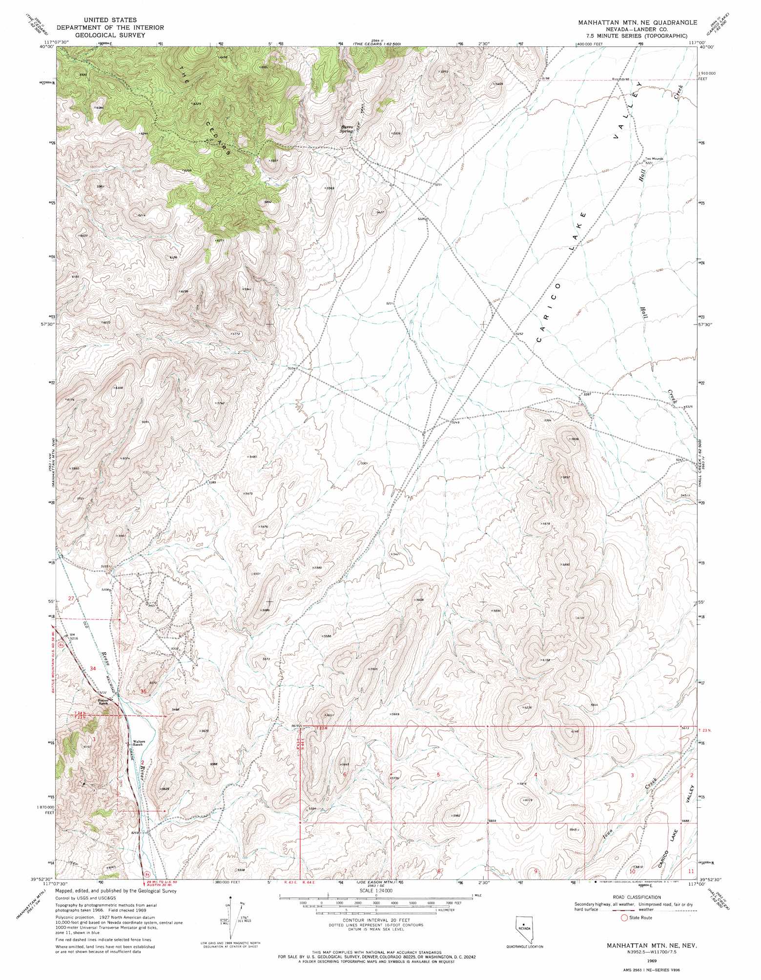
USGS Topo Quad 39117h1 - 1:24,000 scale
| Topo Map Name: | Manhattan Mountain Ne |
| USGS Topo Quad ID: | 39117h1 |
| Print Size: | ca. 21 1/4" wide x 27" high |
| Southeast Coordinates: | 39.875° N latitude / 117° W longitude |
| Map Center Coordinates: | 39.9375° N latitude / 117.0625° W longitude |
| U.S. State: | NV |
| Filename: | o39117h1.jpg |
| Download Map JPG Image: | Manhattan Mountain Ne topo map 1:24,000 scale |
| Map Type: | Topographic |
| Topo Series: | 7.5´ |
| Map Scale: | 1:24,000 |
| Source of Map Images: | United States Geological Survey (USGS) |
| Alternate Map Versions: |
Manhattan Mtn NE NV 1969, updated 1971 Download PDF Buy paper map Manhattan Mountain NE NV 2011 Download PDF Buy paper map Manhattan Mountain NE NV 2014 Download PDF Buy paper map |
1:24,000 Topo Quads surrounding Manhattan Mountain Ne
Fish Creek Basin |
Fish Creek Ranch |
Moss Creek |
Carico Lake North |
Rocky Pass |
Mount Moses Se |
The Cedars Sw |
The Cedars |
Carico Lake South |
Wood Spring Canyon |
Gilbert Creek Ne |
Manhattan Mountain Nw |
Manhattan Mountain Ne |
Hall Creek North |
Corral Canyon |
Gilbert Creek Se |
Manhattan Mountain |
Joe Eason Mountain |
Hall Creek South |
Cowboy Rest Creek |
Mount Airy Ne |
Vigus Butte Nw |
Vigus Butte Ne |
Mount Callaghan |
Grass Valley Ranch |
> Back to 39117e1 at 1:100,000 scale
> Back to 39116a1 at 1:250,000 scale
> Back to U.S. Topo Maps home
Manhattan Mountain Ne topo map: Gazetteer
Manhattan Mountain Ne: Springs
Burro Spring elevation 1703m 5587′Manhattan Mountain Ne: Wells
James Lister Well elevation 1588m 5209′Laborde Well Number Three elevation 1624m 5328′
Manhattan Mountain Ne digital topo map on disk
Buy this Manhattan Mountain Ne topo map showing relief, roads, GPS coordinates and other geographical features, as a high-resolution digital map file on DVD: