Broken Hills Topo Map Nevada
To zoom in, hover over the map of Broken Hills
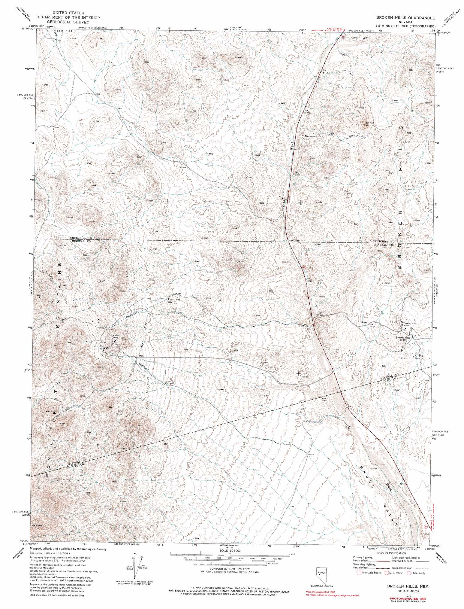
USGS Topo Quad 39118a1 - 1:24,000 scale
| Topo Map Name: | Broken Hills |
| USGS Topo Quad ID: | 39118a1 |
| Print Size: | ca. 21 1/4" wide x 27" high |
| Southeast Coordinates: | 39° N latitude / 118° W longitude |
| Map Center Coordinates: | 39.0625° N latitude / 118.0625° W longitude |
| U.S. State: | NV |
| Filename: | o39118a1.jpg |
| Download Map JPG Image: | Broken Hills topo map 1:24,000 scale |
| Map Type: | Topographic |
| Topo Series: | 7.5´ |
| Map Scale: | 1:24,000 |
| Source of Map Images: | United States Geological Survey (USGS) |
| Alternate Map Versions: |
Broken Hills NV 1972, updated 1975 Download PDF Buy paper map Broken Hills NV 1972, updated 1986 Download PDF Buy paper map Broken Hills NV 2011 Download PDF Buy paper map Broken Hills NV 2014 Download PDF Buy paper map |
1:24,000 Topo Quads surrounding Broken Hills
Frenchman |
Drumm Summit |
West Gate |
Eastgate |
Desatoya Peak |
Chukar Canyon |
Bell Canyon |
Bell Mountain |
Quartz Mountain Nw |
Buffalo Summit |
Big Kasock Mountain |
Slate Mountain |
Broken Hills |
Quartz Mountain |
Burnt Cabin Summit |
Murphys Well |
Mount Annie |
Mount Annie Ne |
Downeyville |
Ellsworth |
Poinsettia Spring |
Ramsey Spring |
Mount Annie Se |
Gabbs |
Paradise Peak |
> Back to 39118a1 at 1:100,000 scale
> Back to 39118a1 at 1:250,000 scale
> Back to U.S. Topo Maps home
Broken Hills topo map: Gazetteer
Broken Hills: Mines
Broken Hills Mine elevation 1630m 5347′Kaiser Mine elevation 1850m 6069′
Broken Hills: Pillars
Ball Rock elevation 1807m 5928′Broken Hills: Populated Places
Broken Hills (historical) elevation 1637m 5370′Broken Hills: Post Offices
Broken Hills Post Office (historical) elevation 1637m 5370′Broken Hills: Springs
Jack O'Connor Spring elevation 1745m 5725′Broken Hills: Wells
Kaiser Well elevation 1720m 5643′Kaiser Well Number Two elevation 1717m 5633′
Broken Hills digital topo map on disk
Buy this Broken Hills topo map showing relief, roads, GPS coordinates and other geographical features, as a high-resolution digital map file on DVD: