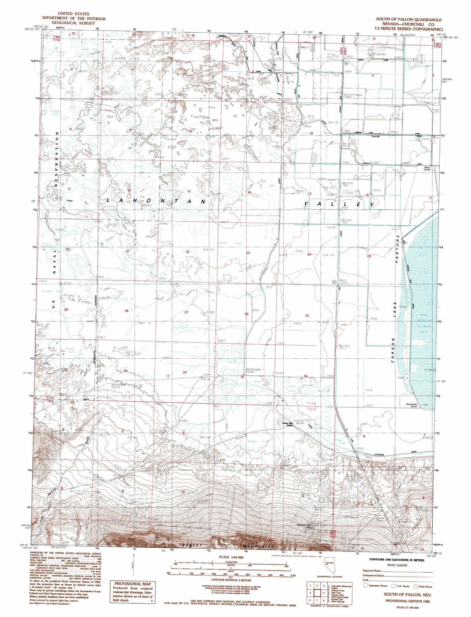
South Of Fallon Topo Map Nevada
To zoom in, hover over the map of South Of Fallon
USGS Topo Quad 39118c7 - 1:24,000 scale
| Topo Map Name: | South Of Fallon |
| USGS Topo Quad ID: | 39118c7 |
| Print Size: | ca. 21 1/4" wide x 27" high |
| Southeast Coordinates: | 39.25° N latitude / 118.75° W longitude |
| Map Center Coordinates: | 39.3125° N latitude / 118.8125° W longitude |
| U.S. State: | NV |
| Filename: | o39118c7.jpg |
| Download Map JPG Image: | South Of Fallon topo map 1:24,000 scale |
| Map Type: | Topographic |
| Topo Series: | 7.5´ |
| Map Scale: | 1:24,000 |
| Source of Map Images: | United States Geological Survey (USGS) |
| Alternate Map Versions: |
South of Fallon NV 1985, updated 1985 Download PDF Buy paper map South of Fallon NV 2011 Download PDF Buy paper map South of Fallon NV 2014 Download PDF Buy paper map |
1:24,000 Topo Quads surrounding South Of Fallon
Hazen |
Soda Lake West |
Soda Lake East |
Indian Lakes |
Stillwater |
Lahontan Dam |
Sheckler Reservoir |
Fallon |
Grimes Point |
Lahontan Mountains |
Hooten Well |
Salt Cave |
South Of Fallon |
Carson Lake |
Bunejug Mountains |
Parker Butte |
Wild Horse Basin |
Russell Spit |
Allen Springs |
Diamond Field Jack Wash |
Hinkson Slough |
Weber Reservoir |
Weber Dam |
Terrill Mountains |
Red Ridge |
> Back to 39118a1 at 1:100,000 scale
> Back to 39118a1 at 1:250,000 scale
> Back to U.S. Topo Maps home
South Of Fallon topo map: Gazetteer
South Of Fallon: Canals
Carson Lake 1 Drain elevation 1197m 3927′Carson Lake A1 Extension Drain elevation 1201m 3940′
G 3 Canal elevation 1197m 3927′
G Line Canal elevation 1195m 3920′
G Line Drain elevation 1201m 3940′
G Line Extension Drain elevation 1195m 3920′
West Carson Lake Drain elevation 1193m 3914′
South Of Fallon: Parks
Pony Express Monument elevation 1228m 4028′Pony Express Monument elevation 1195m 3920′
South Of Fallon: Streams
Sam Spring Wash elevation 1199m 3933′South Of Fallon: Wells
Nineteen Mile Well elevation 1238m 4061′South Of Fallon digital topo map on disk
Buy this South Of Fallon topo map showing relief, roads, GPS coordinates and other geographical features, as a high-resolution digital map file on DVD: