Wonder Mountain Topo Map Nevada
To zoom in, hover over the map of Wonder Mountain
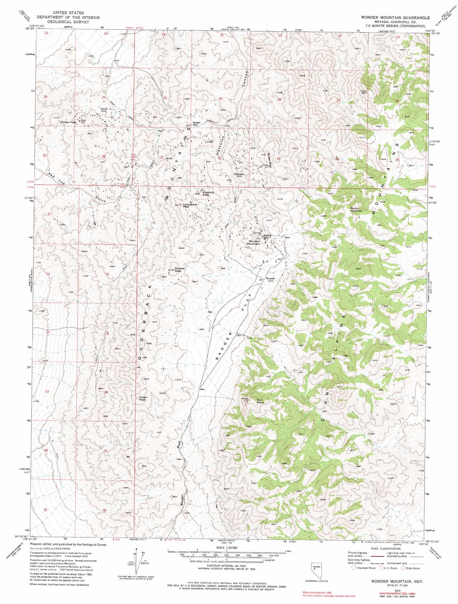
USGS Topo Quad 39118d1 - 1:24,000 scale
| Topo Map Name: | Wonder Mountain |
| USGS Topo Quad ID: | 39118d1 |
| Print Size: | ca. 21 1/4" wide x 27" high |
| Southeast Coordinates: | 39.375° N latitude / 118° W longitude |
| Map Center Coordinates: | 39.4375° N latitude / 118.0625° W longitude |
| U.S. State: | NV |
| Filename: | o39118d1.jpg |
| Download Map JPG Image: | Wonder Mountain topo map 1:24,000 scale |
| Map Type: | Topographic |
| Topo Series: | 7.5´ |
| Map Scale: | 1:24,000 |
| Source of Map Images: | United States Geological Survey (USGS) |
| Alternate Map Versions: |
Wonder Mountain NV 1972, updated 1975 Download PDF Buy paper map Wonder Mountain NV 1972, updated 1981 Download PDF Buy paper map Wonder Mountain NV 1972, updated 1987 Download PDF Buy paper map Wonder Mountain NV 2011 Download PDF Buy paper map Wonder Mountain NV 2014 Download PDF Buy paper map |
1:24,000 Topo Quads surrounding Wonder Mountain
Cox Canyon |
I X L Canyon |
Dixie Valley |
Cow Canyon |
Byers Canyon |
Table Mountain |
Job Peak |
Dixie Valley Se |
Mount Augusta |
Clan Alpine Ranch |
La Plata Canyon |
Pirouette Mountain |
Wonder Mountain |
Camp Creek Canyon |
Cold Springs |
Frenchman |
Drumm Summit |
West Gate |
Eastgate |
Desatoya Peak |
Chukar Canyon |
Bell Canyon |
Bell Mountain |
Quartz Mountain Nw |
Buffalo Summit |
> Back to 39118a1 at 1:100,000 scale
> Back to 39118a1 at 1:250,000 scale
> Back to U.S. Topo Maps home
Wonder Mountain topo map: Gazetteer
Wonder Mountain: Flats
Badger Flat elevation 1793m 5882′Wonder Mountain: Gaps
Geiger Gap elevation 1611m 5285′Wonder Mountain: Mines
Jack Pot Mine elevation 1657m 5436′Vulcher Mine elevation 1584m 5196′
Wonder Mine elevation 1887m 6190′
Wonder Mountain: Populated Places
Kingston (historical) elevation 1316m 4317′Red Top (historical) elevation 1421m 4662′
Wonder Mountain: Post Offices
Hercules Post Office (historical) elevation 1607m 5272′Kingston Post Office (historical) elevation 1316m 4317′
Victor Post Office (historical) elevation 1392m 4566′
Wonder Post Office (historical) elevation 1784m 5853′
Wonder Mountain: Ranges
Louderback Mountains elevation 1900m 6233′Wonder Mountain: Springs
Hercules Spring elevation 1658m 5439′Wonder Mountain: Summits
Camelback Peak elevation 1937m 6354′Crown Peak elevation 2008m 6587′
Dickey Peak elevation 1495m 4904′
Driscoll Peak elevation 1942m 6371′
Porphyry Peak elevation 1900m 6233′
Queen Peak elevation 1829m 6000′
Round Mountain elevation 2112m 6929′
Twin Peaks elevation 2162m 7093′
Wonder Mountain elevation 1900m 6233′
Wonder Mountain: Valleys
Strayhorse Gulch elevation 1474m 4835′Wonder Mountain digital topo map on disk
Buy this Wonder Mountain topo map showing relief, roads, GPS coordinates and other geographical features, as a high-resolution digital map file on DVD: