Soda Lake Nw Topo Map Nevada
To zoom in, hover over the map of Soda Lake Nw
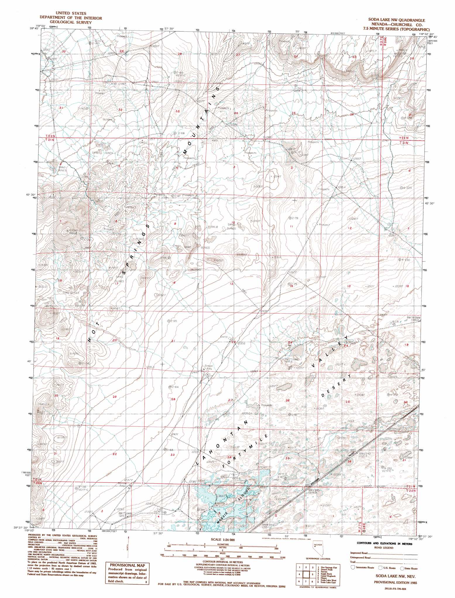
USGS Topo Quad 39118f8 - 1:24,000 scale
| Topo Map Name: | Soda Lake Nw |
| USGS Topo Quad ID: | 39118f8 |
| Print Size: | ca. 21 1/4" wide x 27" high |
| Southeast Coordinates: | 39.625° N latitude / 118.875° W longitude |
| Map Center Coordinates: | 39.6875° N latitude / 118.9375° W longitude |
| U.S. State: | NV |
| Filename: | o39118f8.jpg |
| Download Map JPG Image: | Soda Lake Nw topo map 1:24,000 scale |
| Map Type: | Topographic |
| Topo Series: | 7.5´ |
| Map Scale: | 1:24,000 |
| Source of Map Images: | United States Geological Survey (USGS) |
| Alternate Map Versions: |
Soda Lake NW NV 1985, updated 1985 Download PDF Buy paper map Soda Lake NW NV 2011 Download PDF Buy paper map Soda Lake NW NV 2014 Download PDF Buy paper map |
1:24,000 Topo Quads surrounding Soda Lake Nw
Black Warrior Peak |
Telephone Well |
Jessup |
White Plains |
Ocala |
Juniper Peak |
Hot Springs Flat |
Desert Peak |
Parran |
Carson Sink Sw |
Two Tips |
Eagle Rock |
Soda Lake Nw |
Upsal Hogback |
Battleground Point |
Fernley East |
Hazen |
Soda Lake West |
Soda Lake East |
Indian Lakes |
Silver Springs North |
Lahontan Dam |
Sheckler Reservoir |
Fallon |
Grimes Point |
> Back to 39118e1 at 1:100,000 scale
> Back to 39118a1 at 1:250,000 scale
> Back to U.S. Topo Maps home
Soda Lake Nw topo map: Gazetteer
Soda Lake Nw: Plains
Fortymile Desert elevation 1199m 3933′Soda Lake Nw: Ranges
Hot Springs Mountains elevation 1334m 4376′Soda Lake Nw digital topo map on disk
Buy this Soda Lake Nw topo map showing relief, roads, GPS coordinates and other geographical features, as a high-resolution digital map file on DVD: