Lone Rock Se Topo Map Nevada
To zoom in, hover over the map of Lone Rock Se
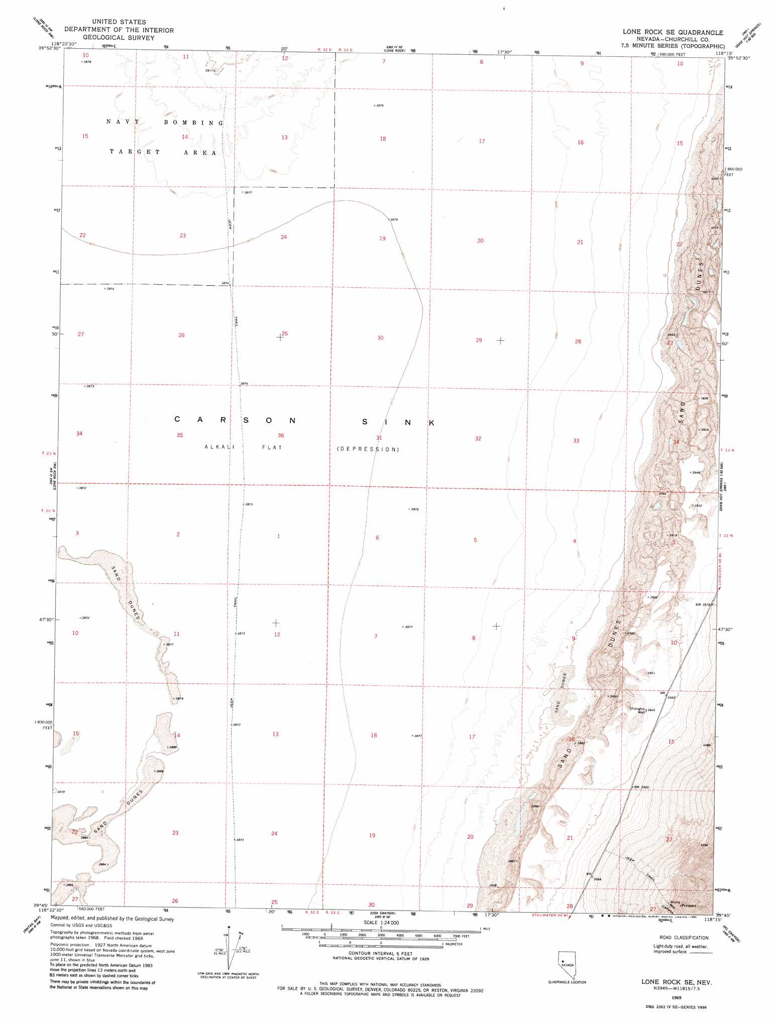
USGS Topo Quad 39118g3 - 1:24,000 scale
| Topo Map Name: | Lone Rock Se |
| USGS Topo Quad ID: | 39118g3 |
| Print Size: | ca. 21 1/4" wide x 27" high |
| Southeast Coordinates: | 39.75° N latitude / 118.25° W longitude |
| Map Center Coordinates: | 39.8125° N latitude / 118.3125° W longitude |
| U.S. State: | NV |
| Filename: | o39118g3.jpg |
| Download Map JPG Image: | Lone Rock Se topo map 1:24,000 scale |
| Map Type: | Topographic |
| Topo Series: | 7.5´ |
| Map Scale: | 1:24,000 |
| Source of Map Images: | United States Geological Survey (USGS) |
| Alternate Map Versions: |
Lone Rock SE NV 1969, updated 1972 Download PDF Buy paper map Lone Rock SE NV 2011 Download PDF Buy paper map Lone Rock SE NV 2014 Download PDF Buy paper map |
1:24,000 Topo Quads surrounding Lone Rock Se
Granite Point |
Wildhorse Pass |
Wildhorse Spring |
Buena Vista Hills North |
Cornish Peak |
Lovelock Indian Caves |
Lone Rock Nw |
Lone Rock |
Buena Vista Hills South |
Dixie Hot Springs Ne |
Carson Sink Se |
Lone Rock Sw |
Lone Rock Se |
Fondaway Canyon |
Dixie Hot Springs |
Stillwater Ne |
Pintail Bay |
Cox Canyon |
I X L Canyon |
Dixie Valley |
Stillwater |
Foxtail Lake |
Table Mountain |
Job Peak |
Dixie Valley Se |
> Back to 39118e1 at 1:100,000 scale
> Back to 39118a1 at 1:250,000 scale
> Back to U.S. Topo Maps home
Lone Rock Se topo map: Gazetteer
Lone Rock Se: Valleys
Mill Canyon elevation 1223m 4012′Lone Rock Se: Wells
Fisk Well elevation 1206m 3956′Shanghai Well elevation 1204m 3950′
Lone Rock Se digital topo map on disk
Buy this Lone Rock Se topo map showing relief, roads, GPS coordinates and other geographical features, as a high-resolution digital map file on DVD: