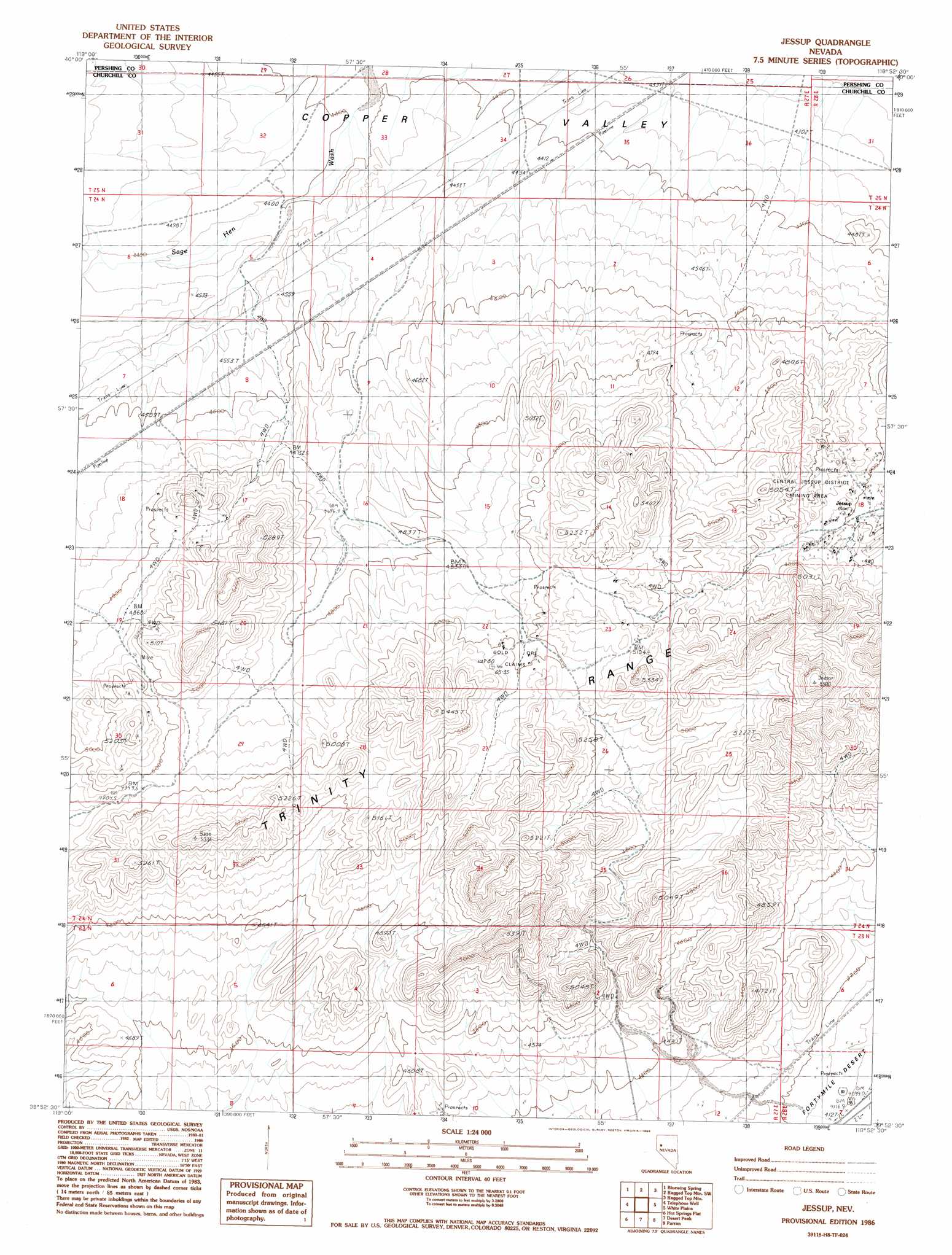
Jessup Topo Map Nevada
To zoom in, hover over the map of Jessup
USGS Topo Quad 39118h8 - 1:24,000 scale
| Topo Map Name: | Jessup |
| USGS Topo Quad ID: | 39118h8 |
| Print Size: | ca. 21 1/4" wide x 27" high |
| Southeast Coordinates: | 39.875° N latitude / 118.875° W longitude |
| Map Center Coordinates: | 39.9375° N latitude / 118.9375° W longitude |
| U.S. State: | NV |
| Filename: | o39118h8.jpg |
| Download Map JPG Image: | Jessup topo map 1:24,000 scale |
| Map Type: | Topographic |
| Topo Series: | 7.5´ |
| Map Scale: | 1:24,000 |
| Source of Map Images: | United States Geological Survey (USGS) |
| Alternate Map Versions: |
Jessup NV 1986, updated 1986 Download PDF Buy paper map Jessup NV 2011 Download PDF Buy paper map Jessup NV 2014 Download PDF Buy paper map |
1:24,000 Topo Quads surrounding Jessup
Tunnel Spring |
Bob Spring |
Blue Wing Flat South |
Lowry Well |
Trinity Peak |
Sage Hen Spring |
Bluewing Spring |
Ragged Top Mountain Sw |
Ragged Top Mountain |
Toulon Peak |
Black Warrior Peak |
Telephone Well |
Jessup |
White Plains |
Ocala |
Juniper Peak |
Hot Springs Flat |
Desert Peak |
Parran |
Carson Sink Sw |
Two Tips |
Eagle Rock |
Soda Lake Nw |
Upsal Hogback |
Battleground Point |
> Back to 39118e1 at 1:100,000 scale
> Back to 39118a1 at 1:250,000 scale
> Back to U.S. Topo Maps home
Jessup topo map: Gazetteer
Jessup: Mines
Gold Ore Claims elevation 1529m 5016′Superior Mining Claim elevation 1434m 4704′
Jessup digital topo map on disk
Buy this Jessup topo map showing relief, roads, GPS coordinates and other geographical features, as a high-resolution digital map file on DVD: