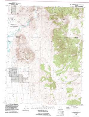
Mctarnahan Hill Topo Map Nevada
To zoom in, hover over the map of Mctarnahan Hill
USGS Topo Quad 39119a6 - 1:24,000 scale
| Topo Map Name: | Mctarnahan Hill |
| USGS Topo Quad ID: | 39119a6 |
| Print Size: | ca. 21 1/4" wide x 27" high |
| Southeast Coordinates: | 39° N latitude / 119.625° W longitude |
| Map Center Coordinates: | 39.0625° N latitude / 119.6875° W longitude |
| U.S. State: | NV |
| Filename: | o39119a6.jpg |
| Download Map JPG Image: | Mctarnahan Hill topo map 1:24,000 scale |
| Map Type: | Topographic |
| Topo Series: | 7.5´ |
| Map Scale: | 1:24,000 |
| Source of Map Images: | United States Geological Survey (USGS) |
| Alternate Map Versions: |
McTarnahan Hill NV 1968, updated 1971 Download PDF Buy paper map McTarnahan Hill NV 1968, updated 1976 Download PDF Buy paper map McTarnahan Hill NV 1968, updated 1983 Download PDF Buy paper map McTarnahan Hill NV 1968, updated 1991 Download PDF Buy paper map McTarnahan Hill NV 1994, updated 1994 Download PDF Buy paper map McTarnahan Hill NV 2011 Download PDF Buy paper map McTarnahan Hill NV 2014 Download PDF Buy paper map |
1:24,000 Topo Quads surrounding Mctarnahan Hill
> Back to 39119a1 at 1:100,000 scale
> Back to 39118a1 at 1:250,000 scale
> Back to U.S. Topo Maps home
Mctarnahan Hill topo map: Gazetteer
Mctarnahan Hill: Basins
Onion Valley elevation 1873m 6145′Mctarnahan Hill: Dams
Mexican Dam elevation 1410m 4625′Quilici Dam (historical) elevation 1410m 4625′
Mctarnahan Hill: Mines
Alex Eske Mine elevation 2000m 6561′Bunker Hill Mine elevation 1810m 5938′
Capitol Mine elevation 1581m 5187′
Smith Brothers Mine elevation 2037m 6683′
United Mining Company Mine elevation 2037m 6683′
Valley View Mine elevation 1960m 6430′
Yerington Mine elevation 1794m 5885′
Mctarnahan Hill: Populated Places
Johnson Lane elevation 1469m 4819′Mctarnahan Hill: Springs
Saratoga Hot Spring elevation 1433m 4701′Mctarnahan Hill: Streams
Clear Creek elevation 1414m 4639′Mctarnahan Hill: Summits
Hot Springs Mountain elevation 1808m 5931′McTarnahan Hill elevation 2073m 6801′
Mctarnahan Hill: Valleys
Carson Valley elevation 1414m 4639′Mctarnahan Hill: Wells
Buckbrush Well elevation 1453m 4767′Williams Canyon Well elevation 1615m 5298′
Mctarnahan Hill digital topo map on disk
Buy this Mctarnahan Hill topo map showing relief, roads, GPS coordinates and other geographical features, as a high-resolution digital map file on DVD:


