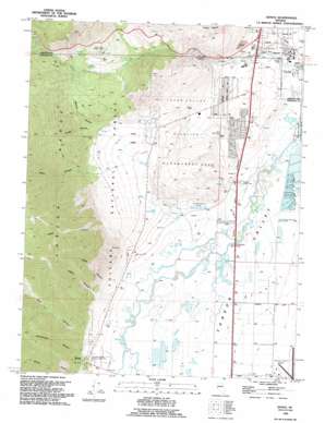
Genoa Topo Map Nevada
To zoom in, hover over the map of Genoa
USGS Topo Quad 39119a7 - 1:24,000 scale
| Topo Map Name: | Genoa |
| USGS Topo Quad ID: | 39119a7 |
| Print Size: | ca. 21 1/4" wide x 27" high |
| Southeast Coordinates: | 39° N latitude / 119.75° W longitude |
| Map Center Coordinates: | 39.0625° N latitude / 119.8125° W longitude |
| U.S. State: | NV |
| Filename: | o39119a7.jpg |
| Download Map JPG Image: | Genoa topo map 1:24,000 scale |
| Map Type: | Topographic |
| Topo Series: | 7.5´ |
| Map Scale: | 1:24,000 |
| Source of Map Images: | United States Geological Survey (USGS) |
| Alternate Map Versions: |
Genoa NV 1968, updated 1972 Download PDF Buy paper map Genoa NV 1968, updated 1976 Download PDF Buy paper map Genoa NV 1968, updated 1983 Download PDF Buy paper map Genoa NV 1994, updated 1994 Download PDF Buy paper map Genoa NV 2012 Download PDF Buy paper map Genoa NV 2014 Download PDF Buy paper map |
| FStopo: | US Forest Service topo Genoa is available: Download FStopo PDF Download FStopo TIF |
1:24,000 Topo Quads surrounding Genoa
> Back to 39119a1 at 1:100,000 scale
> Back to 39118a1 at 1:250,000 scale
> Back to U.S. Topo Maps home
Genoa topo map: Gazetteer
Genoa: Airports
Douglas County Airport elevation 1435m 4708′Parker Airport elevation 1440m 4724′
Genoa: Basins
Jacks Valley elevation 1544m 5065′Genoa: Bridges
Cradlebaugh Bridge elevation 1418m 4652′Genoa: Canals
Heyburn Ditch elevation 1425m 4675′Genoa: Lakes
Ambrosetti Pond elevation 1419m 4655′Genoa: Parks
Fuji Park elevation 1459m 4786′Jacks Valley Wildlife Management Area elevation 1524m 5000′
Mormon Station Historic State Monument elevation 1458m 4783′
Snyder Meadows State Park elevation 1771m 5810′
Tahoe-Carson Speedway elevation 1435m 4708′
Genoa: Populated Places
Bridge House elevation 1419m 4655′Cradlebaugh (historical) elevation 1419m 4655′
Genoa elevation 1465m 4806′
Indian Hills elevation 1452m 4763′
Stewart elevation 1439m 4721′
Genoa: Post Offices
Cradlebaugh Post Office (historical) elevation 1419m 4655′Genoa Post Office elevation 1470m 4822′
Stewart Branch Post Office (historical) elevation 1439m 4721′
Genoa: Ranges
Indian Hills elevation 1624m 5328′Genoa: Springs
Hobo Hot Springs elevation 1485m 4872′Sulphur Springs elevation 1420m 4658′
Genoa: Streams
Williams Slough elevation 1418m 4652′Genoa: Valleys
Adams Canyon elevation 1581m 5187′Bennett Canyon elevation 1586m 5203′
Chedic Canyon elevation 1595m 5232′
Childs Canyon elevation 1469m 4819′
Clear Creek Canyon elevation 1493m 4898′
Genoa Canyon elevation 1477m 4845′
James Canyon elevation 1532m 5026′
Schoolhouse Canyon elevation 1483m 4865′
Sierra Canyon elevation 1466m 4809′
Voltaire Canyon elevation 1618m 5308′
Water Canyon elevation 1646m 5400′
Genoa digital topo map on disk
Buy this Genoa topo map showing relief, roads, GPS coordinates and other geographical features, as a high-resolution digital map file on DVD:


