Martin Canyon Topo Map Nevada
To zoom in, hover over the map of Martin Canyon
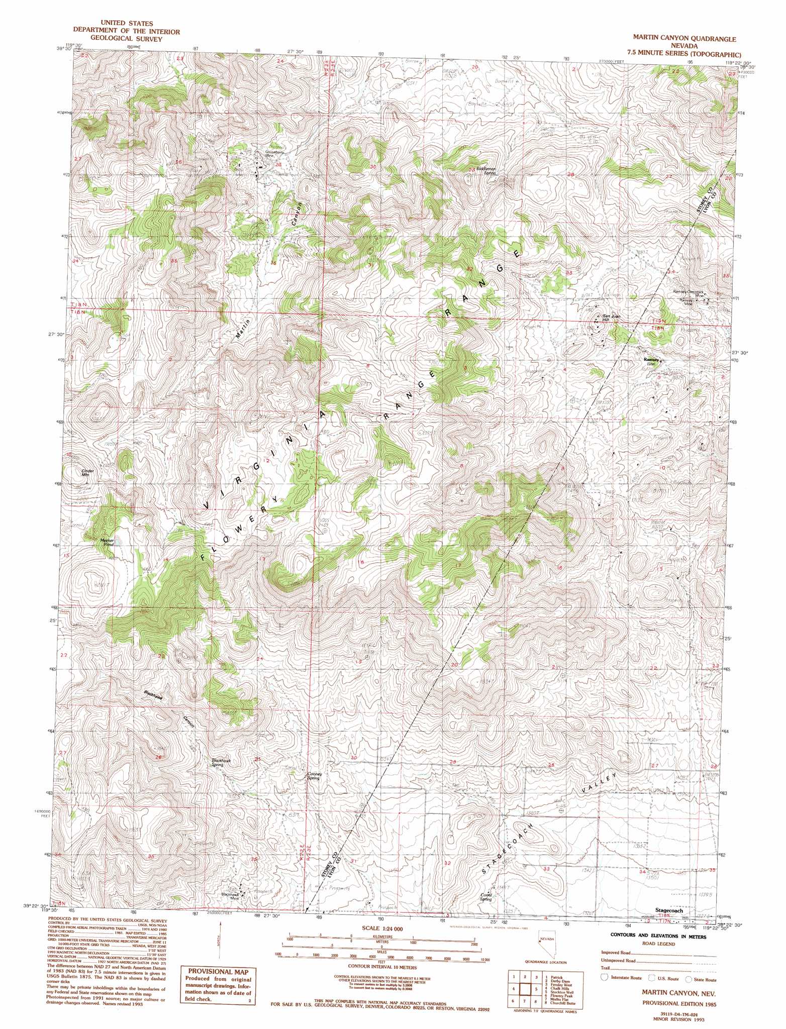
USGS Topo Quad 39119d4 - 1:24,000 scale
| Topo Map Name: | Martin Canyon |
| USGS Topo Quad ID: | 39119d4 |
| Print Size: | ca. 21 1/4" wide x 27" high |
| Southeast Coordinates: | 39.375° N latitude / 119.375° W longitude |
| Map Center Coordinates: | 39.4375° N latitude / 119.4375° W longitude |
| U.S. State: | NV |
| Filename: | o39119d4.jpg |
| Download Map JPG Image: | Martin Canyon topo map 1:24,000 scale |
| Map Type: | Topographic |
| Topo Series: | 7.5´ |
| Map Scale: | 1:24,000 |
| Source of Map Images: | United States Geological Survey (USGS) |
| Alternate Map Versions: |
Martin Canyon NV 1985, updated 1985 Download PDF Buy paper map Martin Canyon NV 1985, updated 1993 Download PDF Buy paper map Martin Canyon NV 2011 Download PDF Buy paper map Martin Canyon NV 2014 Download PDF Buy paper map |
1:24,000 Topo Quads surrounding Martin Canyon
Griffith Canyon |
Spanish Springs Peak |
Olinghouse |
Wadsworth |
Two Tips |
Vista |
Patrick |
Derby Dam |
Fernley West |
Fernley East |
Steamboat |
Chalk Hills |
Martin Canyon |
Stockton Well |
Silver Springs North |
Virginia City |
Flowery Peak |
Misfits Flat |
Churchill Butte |
Silver Springs South |
New Empire |
Dayton |
Como |
Churchill Canyon Well |
Wabuska |
> Back to 39119a1 at 1:100,000 scale
> Back to 39118a1 at 1:250,000 scale
> Back to U.S. Topo Maps home
Martin Canyon topo map: Gazetteer
Martin Canyon: Dams
Gooseberry Mine Tailings Dam elevation 1644m 5393′Martin Canyon: Lakes
Meeker Pond elevation 2045m 6709′Martin Canyon: Mines
Blackhawk Mine elevation 1522m 4993′Cinder Mountain Mine elevation 2050m 6725′
Goose Valley Mine elevation 1701m 5580′
Gooseberry Mine elevation 1669m 5475′
Lizard Mine elevation 1552m 5091′
Ramsey Mine elevation 1678m 5505′
Ramsey-Comstock Mine elevation 1642m 5387′
San Juan Mine elevation 1697m 5567′
Windy Day Mine elevation 1721m 5646′
Martin Canyon: Populated Places
Ramsey (historical) elevation 1673m 5488′Martin Canyon: Post Offices
Ramsey Post Office (historical) elevation 1673m 5488′Martin Canyon: Reservoirs
Cooney Reservoir elevation 1660m 5446′Gooseberry Tailings Reservoir elevation 1644m 5393′
Martin Canyon: Springs
Biddleman Spring elevation 1711m 5613′Blackhawk Spring elevation 1628m 5341′
Cooney Spring elevation 1575m 5167′
Corral Spring elevation 1349m 4425′
Martin Canyon: Summits
Cinder Mountain elevation 2080m 6824′San Juan Hill elevation 1752m 5748′
Martin Canyon: Valleys
Blackhawk Canyon elevation 1551m 5088′Martin Canyon elevation 1549m 5082′
Martin Canyon digital topo map on disk
Buy this Martin Canyon topo map showing relief, roads, GPS coordinates and other geographical features, as a high-resolution digital map file on DVD: