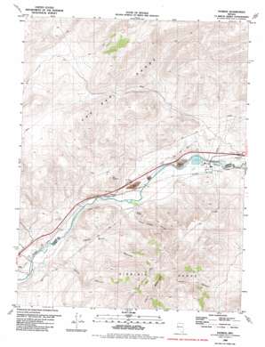
Patrick Topo Map Nevada
To zoom in, hover over the map of Patrick
USGS Topo Quad 39119e5 - 1:24,000 scale
| Topo Map Name: | Patrick |
| USGS Topo Quad ID: | 39119e5 |
| Print Size: | ca. 21 1/4" wide x 27" high |
| Southeast Coordinates: | 39.5° N latitude / 119.5° W longitude |
| Map Center Coordinates: | 39.5625° N latitude / 119.5625° W longitude |
| U.S. State: | NV |
| Filename: | o39119e5.jpg |
| Download Map JPG Image: | Patrick topo map 1:24,000 scale |
| Map Type: | Topographic |
| Topo Series: | 7.5´ |
| Map Scale: | 1:24,000 |
| Source of Map Images: | United States Geological Survey (USGS) |
| Alternate Map Versions: |
Patrick NV 1970, updated 1973 Download PDF Buy paper map Patrick NV 1980, updated 1980 Download PDF Buy paper map Patrick NV 2011 Download PDF Buy paper map Patrick NV 2014 Download PDF Buy paper map |
1:24,000 Topo Quads surrounding Patrick
> Back to 39119e1 at 1:100,000 scale
> Back to 39118a1 at 1:250,000 scale
> Back to U.S. Topo Maps home
Patrick topo map: Gazetteer
Patrick: Canals
McCarran Ditch elevation 1320m 4330′Patrick: Cliffs
Chalk Bluff elevation 1409m 4622′Giants Throne elevation 1415m 4642′
Patrick: Crossings
Clark Interchange elevation 1311m 4301′Patrick Interchange elevation 1327m 4353′
Patrick: Mines
McCarran Pit elevation 1311m 4301′Patrick: Populated Places
Patrick elevation 1305m 4281′Patrick: Post Offices
Tracy Clark Rural Branch Post Office (historical) elevation 1306m 4284′Patrick: Reservoirs
Tracy Pond elevation 1298m 4258′Patrick: Summits
Clark Mountain elevation 2194m 7198′Old Lonesome elevation 1572m 5157′
Patrick: Valleys
Chalk Bluff Canyon elevation 1318m 4324′Giants Throne Canyon elevation 1348m 4422′
Hafed Canyon elevation 1334m 4376′
Patrick digital topo map on disk
Buy this Patrick topo map showing relief, roads, GPS coordinates and other geographical features, as a high-resolution digital map file on DVD:


