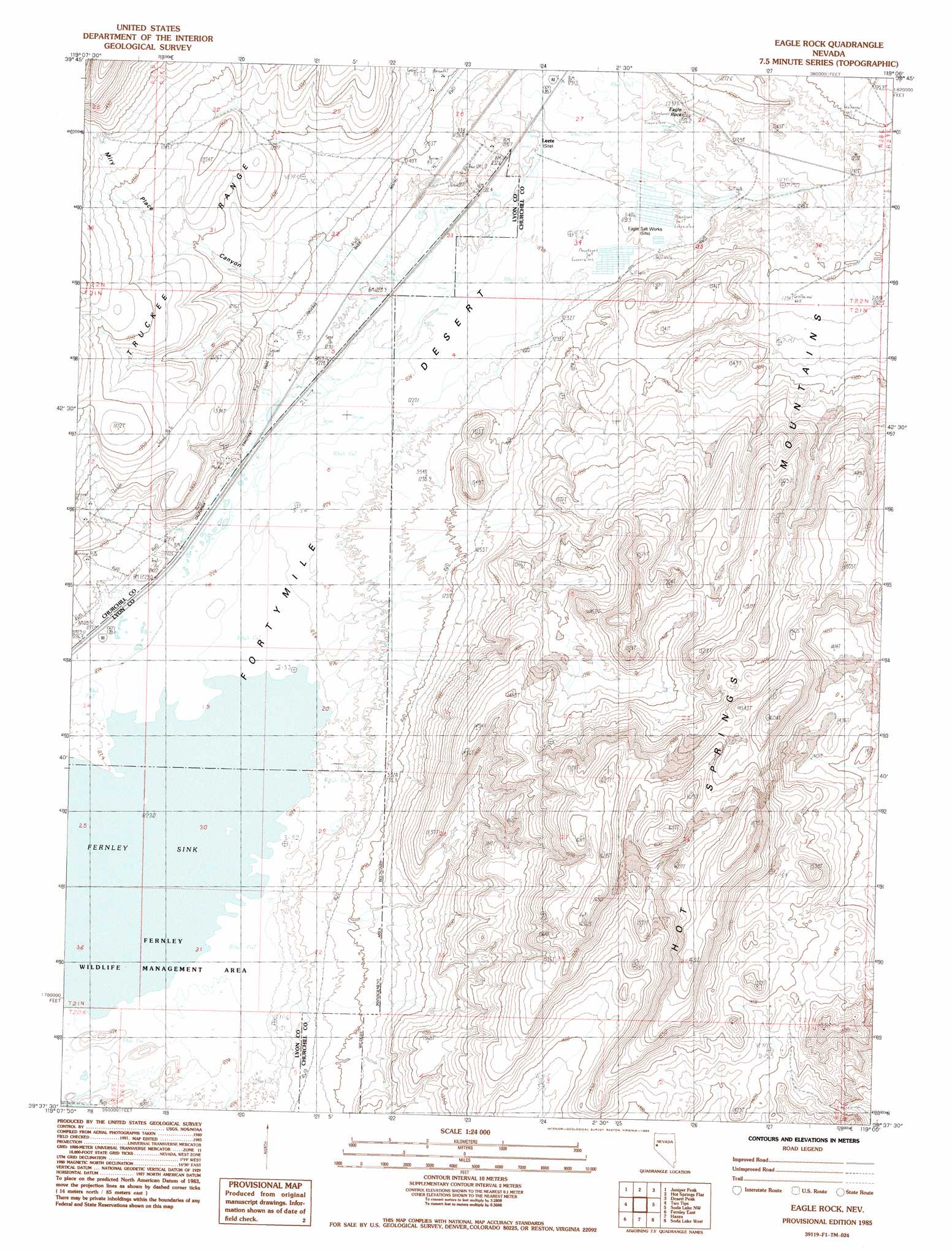
Eagle Rock Topo Map Nevada
To zoom in, hover over the map of Eagle Rock
USGS Topo Quad 39119f1 - 1:24,000 scale
| Topo Map Name: | Eagle Rock |
| USGS Topo Quad ID: | 39119f1 |
| Print Size: | ca. 21 1/4" wide x 27" high |
| Southeast Coordinates: | 39.625° N latitude / 119° W longitude |
| Map Center Coordinates: | 39.6875° N latitude / 119.0625° W longitude |
| U.S. State: | NV |
| Filename: | o39119f1.jpg |
| Download Map JPG Image: | Eagle Rock topo map 1:24,000 scale |
| Map Type: | Topographic |
| Topo Series: | 7.5´ |
| Map Scale: | 1:24,000 |
| Source of Map Images: | United States Geological Survey (USGS) |
| Alternate Map Versions: |
Eagle Rock NV 1985, updated 1985 Download PDF Buy paper map Eagle Rock NV 2011 Download PDF Buy paper map Eagle Rock NV 2014 Download PDF Buy paper map |
1:24,000 Topo Quads surrounding Eagle Rock
Russell Peak |
Black Warrior Peak |
Telephone Well |
Jessup |
White Plains |
Nixon |
Juniper Peak |
Hot Springs Flat |
Desert Peak |
Parran |
Wadsworth |
Two Tips |
Eagle Rock |
Soda Lake Nw |
Upsal Hogback |
Fernley West |
Fernley East |
Hazen |
Soda Lake West |
Soda Lake East |
Stockton Well |
Silver Springs North |
Lahontan Dam |
Sheckler Reservoir |
Fallon |
> Back to 39119e1 at 1:100,000 scale
> Back to 39118a1 at 1:250,000 scale
> Back to U.S. Topo Maps home
Eagle Rock topo map: Gazetteer
Eagle Rock: Parks
Fernley Wildlife Management Area elevation 1224m 4015′Eagle Rock: Pillars
Eagle Rock elevation 1238m 4061′Eagle Rock: Populated Places
Leete (historical) elevation 1231m 4038′Eagle Rock: Post Offices
Leete Post Office (historical) elevation 1231m 4038′Eagle Rock: Springs
Eagle Salt Works Spring elevation 1231m 4038′Eagle Rock: Valleys
Miry Place Canyon elevation 1261m 4137′Eagle Rock digital topo map on disk
Buy this Eagle Rock topo map showing relief, roads, GPS coordinates and other geographical features, as a high-resolution digital map file on DVD: