Wadsworth Topo Map Nevada
To zoom in, hover over the map of Wadsworth
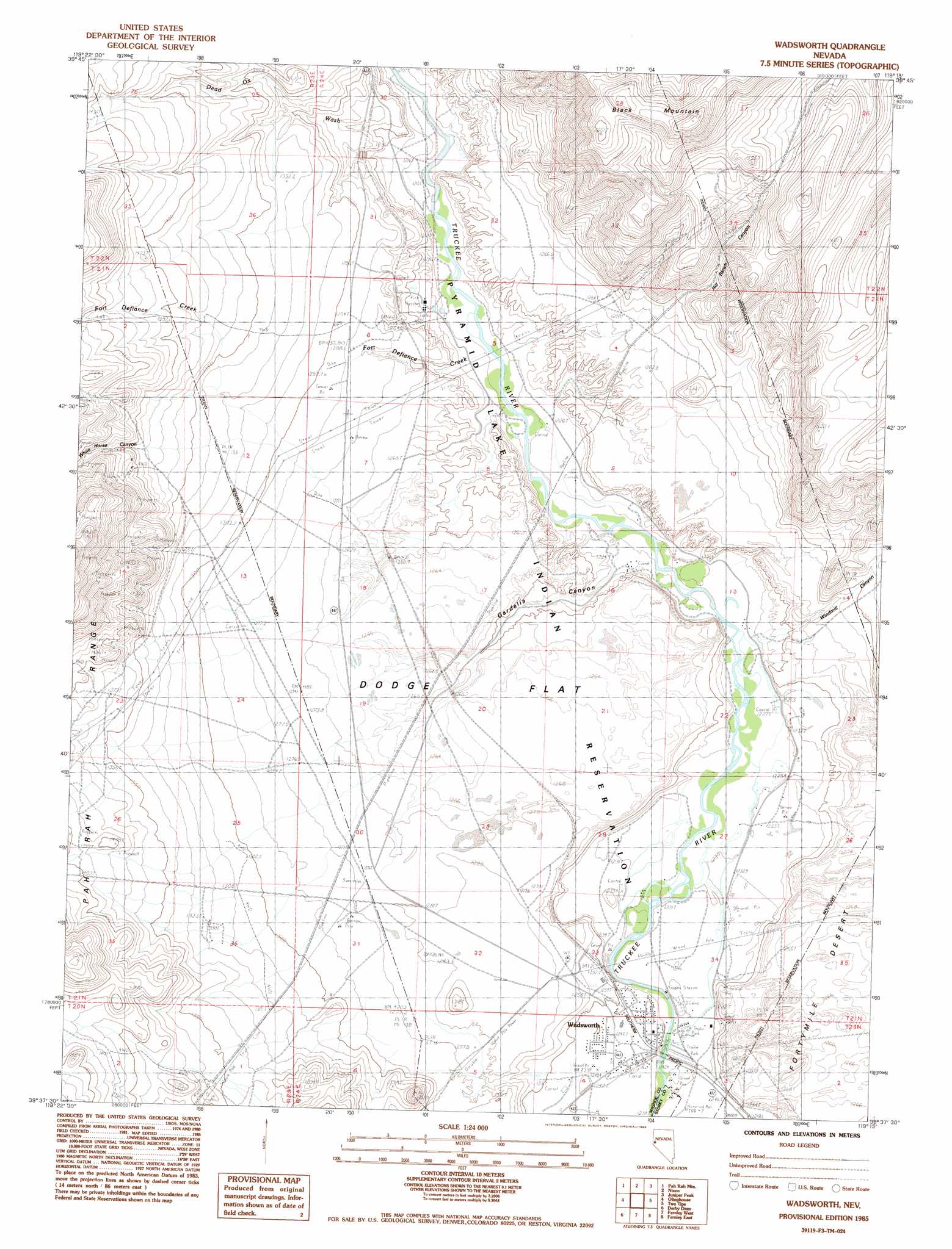
USGS Topo Quad 39119f3 - 1:24,000 scale
| Topo Map Name: | Wadsworth |
| USGS Topo Quad ID: | 39119f3 |
| Print Size: | ca. 21 1/4" wide x 27" high |
| Southeast Coordinates: | 39.625° N latitude / 119.25° W longitude |
| Map Center Coordinates: | 39.6875° N latitude / 119.3125° W longitude |
| U.S. State: | NV |
| Filename: | o39119f3.jpg |
| Download Map JPG Image: | Wadsworth topo map 1:24,000 scale |
| Map Type: | Topographic |
| Topo Series: | 7.5´ |
| Map Scale: | 1:24,000 |
| Source of Map Images: | United States Geological Survey (USGS) |
| Alternate Map Versions: |
Wadsworth NV 1985, updated 1985 Download PDF Buy paper map Wadsworth NV 1985, updated 1985 Download PDF Buy paper map Wadsworth NV 1985, updated 1986 Download PDF Buy paper map Wadsworth NV 2011 Download PDF Buy paper map Wadsworth NV 2014 Download PDF Buy paper map |
1:24,000 Topo Quads surrounding Wadsworth
Sutcliffe |
Nixon Nw |
Russell Peak |
Black Warrior Peak |
Telephone Well |
Moses Rock |
Pah Rah Mountain |
Nixon |
Juniper Peak |
Hot Springs Flat |
Spanish Springs Peak |
Olinghouse |
Wadsworth |
Two Tips |
Eagle Rock |
Patrick |
Derby Dam |
Fernley West |
Fernley East |
Hazen |
Chalk Hills |
Martin Canyon |
Stockton Well |
Silver Springs North |
Lahontan Dam |
> Back to 39119e1 at 1:100,000 scale
> Back to 39118a1 at 1:250,000 scale
> Back to U.S. Topo Maps home
Wadsworth topo map: Gazetteer
Wadsworth: Airports
Wadsworth Airport (historical) elevation 1265m 4150′Wadsworth: Crossings
Lower Crossing (historical) elevation 1239m 4064′Wadsworth: Flats
Dodge Flat elevation 1267m 4156′Wadsworth: Populated Places
Dodge elevation 1268m 4160′Wadsworth elevation 1242m 4074′
Wadsworth: Post Offices
Wadsworth Post Office elevation 1242m 4074′Wadsworth: Ranges
Diabase Hills elevation 1579m 5180′Wadsworth: Streams
Dead Ox Wash elevation 1211m 3973′Fort Defiance Creek elevation 1219m 3999′
Millers Creek elevation 1352m 4435′
Wadsworth: Summits
Red White and Blue Mountain elevation 1390m 4560′Wadsworth: Valleys
Gardella Canyon elevation 1224m 4015′Hill Ranch Canyon elevation 1299m 4261′
Tiger Canyon elevation 1370m 4494′
White Horse Canyon elevation 1384m 4540′
Windmill Canyon elevation 1231m 4038′
Wadsworth digital topo map on disk
Buy this Wadsworth topo map showing relief, roads, GPS coordinates and other geographical features, as a high-resolution digital map file on DVD: