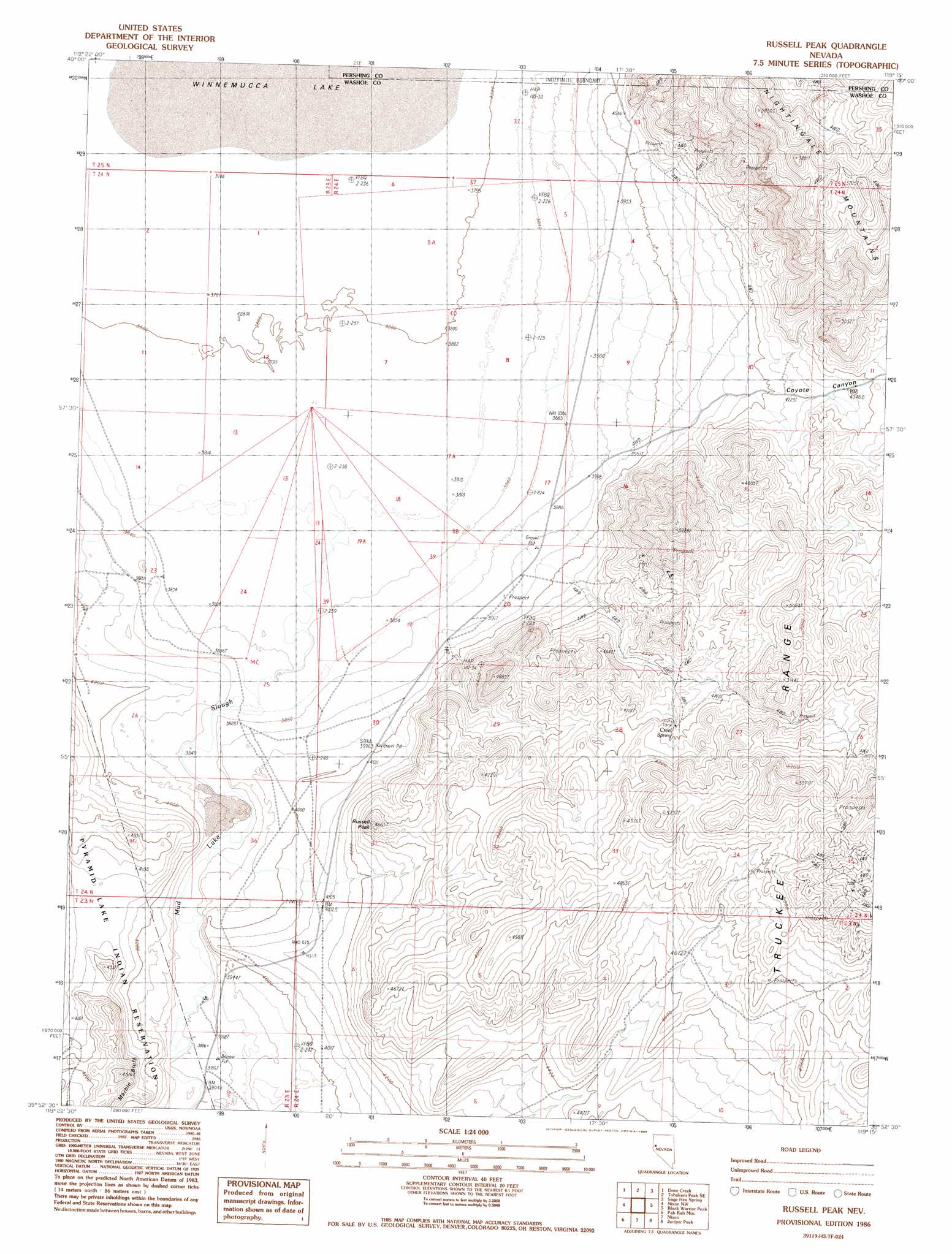
Russell Peak Topo Map Nevada
To zoom in, hover over the map of Russell Peak
USGS Topo Quad 39119h3 - 1:24,000 scale
| Topo Map Name: | Russell Peak |
| USGS Topo Quad ID: | 39119h3 |
| Print Size: | ca. 21 1/4" wide x 27" high |
| Southeast Coordinates: | 39.875° N latitude / 119.25° W longitude |
| Map Center Coordinates: | 39.9375° N latitude / 119.3125° W longitude |
| U.S. State: | NV |
| Filename: | o39119h3.jpg |
| Download Map JPG Image: | Russell Peak topo map 1:24,000 scale |
| Map Type: | Topographic |
| Topo Series: | 7.5´ |
| Map Scale: | 1:24,000 |
| Source of Map Images: | United States Geological Survey (USGS) |
| Alternate Map Versions: |
Russell Peak NV 1986, updated 1986 Download PDF Buy paper map Russell Peak NV 2011 Download PDF Buy paper map Russell Peak NV 2014 Download PDF Buy paper map |
1:24,000 Topo Quads surrounding Russell Peak
Pyramid Ne |
Tohakum Peak Nw |
Tohakum Peak Ne |
Tunnel Spring |
Bob Spring |
Dove Creek |
Tohakum Peak Se |
Sage Hen Spring |
Bluewing Spring |
|
Sutcliffe |
Nixon Nw |
Russell Peak |
Black Warrior Peak |
Telephone Well |
Moses Rock |
Pah Rah Mountain |
Nixon |
Juniper Peak |
Hot Springs Flat |
Spanish Springs Peak |
Olinghouse |
Wadsworth |
Two Tips |
Eagle Rock |
> Back to 39119e1 at 1:100,000 scale
> Back to 39118a1 at 1:250,000 scale
> Back to U.S. Topo Maps home
Russell Peak topo map: Gazetteer
Russell Peak: Mines
White Caps Mine elevation 1385m 4543′Russell Peak: Springs
Creel Spring elevation 1390m 4560′Russell Peak: Summits
Russell Peak elevation 1393m 4570′Russell Peak: Valleys
Coyote Canyon elevation 1187m 3894′Russell Peak digital topo map on disk
Buy this Russell Peak topo map showing relief, roads, GPS coordinates and other geographical features, as a high-resolution digital map file on DVD: