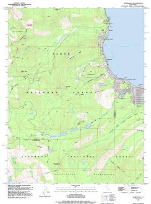
Homewood Topo Map California
To zoom in, hover over the map of Homewood
USGS Topo Quad 39120a2 - 1:24,000 scale
| Topo Map Name: | Homewood |
| USGS Topo Quad ID: | 39120a2 |
| Print Size: | ca. 21 1/4" wide x 27" high |
| Southeast Coordinates: | 39° N latitude / 120.125° W longitude |
| Map Center Coordinates: | 39.0625° N latitude / 120.1875° W longitude |
| U.S. State: | CA |
| Filename: | o39120a2.jpg |
| Download Map JPG Image: | Homewood topo map 1:24,000 scale |
| Map Type: | Topographic |
| Topo Series: | 7.5´ |
| Map Scale: | 1:24,000 |
| Source of Map Images: | United States Geological Survey (USGS) |
| Alternate Map Versions: |
Homewood CA 1955, updated 1956 Download PDF Buy paper map Homewood CA 1955, updated 1959 Download PDF Buy paper map Homewood CA 1955, updated 1970 Download PDF Buy paper map Homewood CA 1955, updated 1984 Download PDF Buy paper map Homewood CA 1992, updated 1994 Download PDF Buy paper map Homewood CA 1992, updated 1994 Download PDF Buy paper map Homewood CA 2012 Download PDF Buy paper map Homewood CA 2015 Download PDF Buy paper map |
| FStopo: | US Forest Service topo Homewood is available: Download FStopo PDF Download FStopo TIF |
1:24,000 Topo Quads surrounding Homewood
> Back to 39120a1 at 1:100,000 scale
> Back to 39120a1 at 1:250,000 scale
> Back to U.S. Topo Maps home
Homewood topo map: Gazetteer
Homewood: Airports
Homewood Seaplane Base elevation 1902m 6240′Homewood: Basins
Cothrin Cove elevation 2193m 7194′Homewood: Bays
McKinney Bay elevation 1900m 6233′Homewood: Dams
Quail Lake 326 Dam elevation 2095m 6873′Homewood: Flats
Barker Meadow elevation 2209m 7247′Miller Meadows elevation 2167m 7109′
Homewood: Gaps
Barker Pass elevation 2332m 7650′Homewood: Lakes
Bear Lake elevation 2299m 7542′Buck Lake elevation 2277m 7470′
Duck Lake elevation 2328m 7637′
Ellis Lake elevation 2497m 8192′
Lake Louise elevation 2363m 7752′
Lily Lake elevation 2170m 7119′
Lily Pond elevation 2023m 6637′
Lost Lake elevation 2347m 7700′
McKinney Lake elevation 2081m 6827′
Miller Lake elevation 2171m 7122′
Richardson Lake elevation 2255m 7398′
Homewood: Mines
Noonchester Mine elevation 2094m 6870′Homewood: Parks
Kailua Park elevation 1916m 6286′Kasian Recreation Area elevation 1899m 6230′
Homewood: Pillars
Stanford Rock elevation 2538m 8326′Homewood: Populated Places
Chamberlands Estates elevation 1968m 6456′Chambers Lodge elevation 1901m 6236′
Homewood elevation 1900m 6233′
Idlewild elevation 1900m 6233′
Pomins elevation 1908m 6259′
Rubicon Springs (historical) elevation 1879m 6164′
Tahoe Pines elevation 1899m 6230′
Tahoma elevation 1911m 6269′
Tahoma Meadows elevation 1928m 6325′
Homewood: Post Offices
Chambers Lodge Post Office (historical) elevation 1901m 6236′Homewood Post Office elevation 1900m 6233′
Tahoma Post Office elevation 1917m 6289′
Homewood: Reservoirs
Quail Lake elevation 2095m 6873′Homewood: Ridges
Blackwood Ridge elevation 2429m 7969′Knee Ridge elevation 2549m 8362′
Homewood: Springs
Rubicon Springs elevation 1852m 6076′Homewood: Streams
Blackwood Creek elevation 1900m 6233′Madden Creek elevation 1900m 6233′
McKinney Creek elevation 1900m 6233′
Middle Fork Blackwood Creek elevation 2001m 6564′
North Fork Blackwood Creek elevation 1977m 6486′
North Miller Creek elevation 2164m 7099′
Homewood: Summits
Barker Peak elevation 2489m 8166′Eagle Rock elevation 1916m 6286′
Ellis Peak elevation 2648m 8687′
Lost Corner Mountain elevation 2516m 8254′
Sourdough Hill elevation 2424m 7952′
Twin Peaks elevation 2701m 8861′
Homewood: Trails
General Creek Trail elevation 2056m 6745′West Shore Bike Trail elevation 1932m 6338′
Homewood: Valleys
Homewood Canyon elevation 1900m 6233′Homewood digital topo map on disk
Buy this Homewood topo map showing relief, roads, GPS coordinates and other geographical features, as a high-resolution digital map file on DVD:


