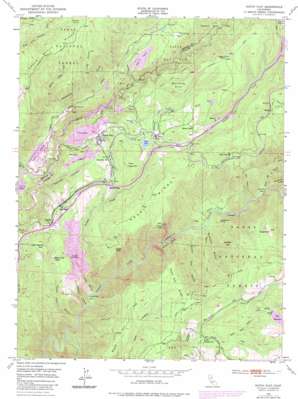
Dutch Flat Topo Map California
To zoom in, hover over the map of Dutch Flat
USGS Topo Quad 39120b7 - 1:24,000 scale
| Topo Map Name: | Dutch Flat |
| USGS Topo Quad ID: | 39120b7 |
| Print Size: | ca. 21 1/4" wide x 27" high |
| Southeast Coordinates: | 39.125° N latitude / 120.75° W longitude |
| Map Center Coordinates: | 39.1875° N latitude / 120.8125° W longitude |
| U.S. State: | CA |
| Filename: | o39120b7.jpg |
| Download Map JPG Image: | Dutch Flat topo map 1:24,000 scale |
| Map Type: | Topographic |
| Topo Series: | 7.5´ |
| Map Scale: | 1:24,000 |
| Source of Map Images: | United States Geological Survey (USGS) |
| Alternate Map Versions: |
Dutch Flat CA 1950, updated 1957 Download PDF Buy paper map Dutch Flat CA 1950, updated 1971 Download PDF Buy paper map Dutch Flat CA 1950, updated 1971 Download PDF Buy paper map Dutch Flat CA 1950, updated 1971 Download PDF Buy paper map Dutch Flat CA 1950, updated 1976 Download PDF Buy paper map Dutch Flat CA 1950, updated 1980 Download PDF Buy paper map Dutch Flat CA 1950, updated 1980 Download PDF Buy paper map Dutch Flat CA 1950, updated 1980 Download PDF Buy paper map Dutch Flat CA 1951 Download PDF Buy paper map Dutch Flat CA 2000, updated 2003 Download PDF Buy paper map Dutch Flat CA 2000, updated 2003 Download PDF Buy paper map Dutch Flat CA 2012 Download PDF Buy paper map Dutch Flat CA 2015 Download PDF Buy paper map |
| FStopo: | US Forest Service topo Dutch Flat is available: Download FStopo PDF Download FStopo TIF |
1:24,000 Topo Quads surrounding Dutch Flat
> Back to 39120a1 at 1:100,000 scale
> Back to 39120a1 at 1:250,000 scale
> Back to U.S. Topo Maps home
Dutch Flat topo map: Gazetteer
Dutch Flat: Bars
Euchre Bar elevation 588m 1929′Pickering Bar elevation 445m 1459′
Dutch Flat: Canals
Pulp Mill Ditch elevation 1079m 3540′Upper Boardmen Canal elevation 1375m 4511′
Dutch Flat: Capes
Iron Point elevation 1005m 3297′Long Point elevation 1190m 3904′
Dutch Flat: Cliffs
Lovers Leap elevation 1220m 4002′Dutch Flat: Dams
Dutch Flat 2 Forebay 61-024 Dam elevation 1016m 3333′Dutch Flat Afterbay 61-023 Dam elevation 823m 2700′
Lake Alta 97-026 Dam elevation 1079m 3540′
Liberty Hill Dam elevation 1148m 3766′
Morning Star Reservoir 325 Dam elevation 1234m 4048′
Dutch Flat: Flats
Pug Ugly elevation 966m 3169′Dutch Flat: Gaps
Giant Gap elevation 538m 1765′Dutch Flat: Lakes
Lake Alta elevation 1080m 3543′Dutch Flat: Mines
Blue Devil Diggings elevation 963m 3159′Christmas Hill Diggings elevation 941m 3087′
Liberty Hill Diggings elevation 1052m 3451′
Narry Red Mine elevation 1022m 3353′
Nichols Diggings elevation 962m 3156′
Stewart Gravel Mine elevation 853m 2798′
Dutch Flat: Populated Places
Alta elevation 1099m 3605′Baxter elevation 1186m 3891′
Casa Loma elevation 1229m 4032′
Drum (historical) elevation 1419m 4655′
Dutch Flat elevation 956m 3136′
Gold Run elevation 979m 3211′
Midas elevation 1266m 4153′
Monte Vista elevation 1014m 3326′
Towle elevation 1126m 3694′
Dutch Flat: Reservoirs
Big Reservoir elevation 1234m 4048′Liberty Hill Reservoir elevation 1148m 3766′
Sugar Pine Reservoir elevation 1100m 3608′
Dutch Flat: Ridges
Giant Gap Ridge elevation 1251m 4104′Moody Ridge elevation 1233m 4045′
Dutch Flat: Springs
Mule Spring elevation 1183m 3881′Red Hill Spring elevation 1234m 4048′
Dutch Flat: Streams
Canyon Creek elevation 455m 1492′Forbes Creek elevation 1071m 3513′
Little Bear Creek elevation 827m 2713′
Million Dollar Creek elevation 788m 2585′
North Fork North Fork American River elevation 584m 1916′
Dutch Flat: Summits
Bogus Point elevation 1104m 3622′Camel Hump elevation 1090m 3576′
Cold Spring Hill elevation 1123m 3684′
Frost Hill elevation 1195m 3920′
Hayden Hill elevation 1159m 3802′
Roach Hill elevation 1131m 3710′
Snakehead Point elevation 739m 2424′
Spaulding Point elevation 1333m 4373′
Sugarloaf elevation 1278m 4192′
Dutch Flat: Trails
Green Valley Trail elevation 1055m 3461′Dutch Flat: Tunnels
Dutch Flat Tunnel elevation 1196m 3923′Dutch Flat: Valleys
Dutch Flat Canyon elevation 762m 2500′Giant Gap Gulch elevation 544m 1784′
Green Valley elevation 553m 1814′
Indiana Ravine elevation 446m 1463′
McIntyre Gulch elevation 550m 1804′
Sheldon Ravine elevation 433m 1420′
Squires Canyon elevation 725m 2378′
Stump Canyon elevation 900m 2952′
Tommy Cain Ravine elevation 425m 1394′
Dutch Flat digital topo map on disk
Buy this Dutch Flat topo map showing relief, roads, GPS coordinates and other geographical features, as a high-resolution digital map file on DVD:


