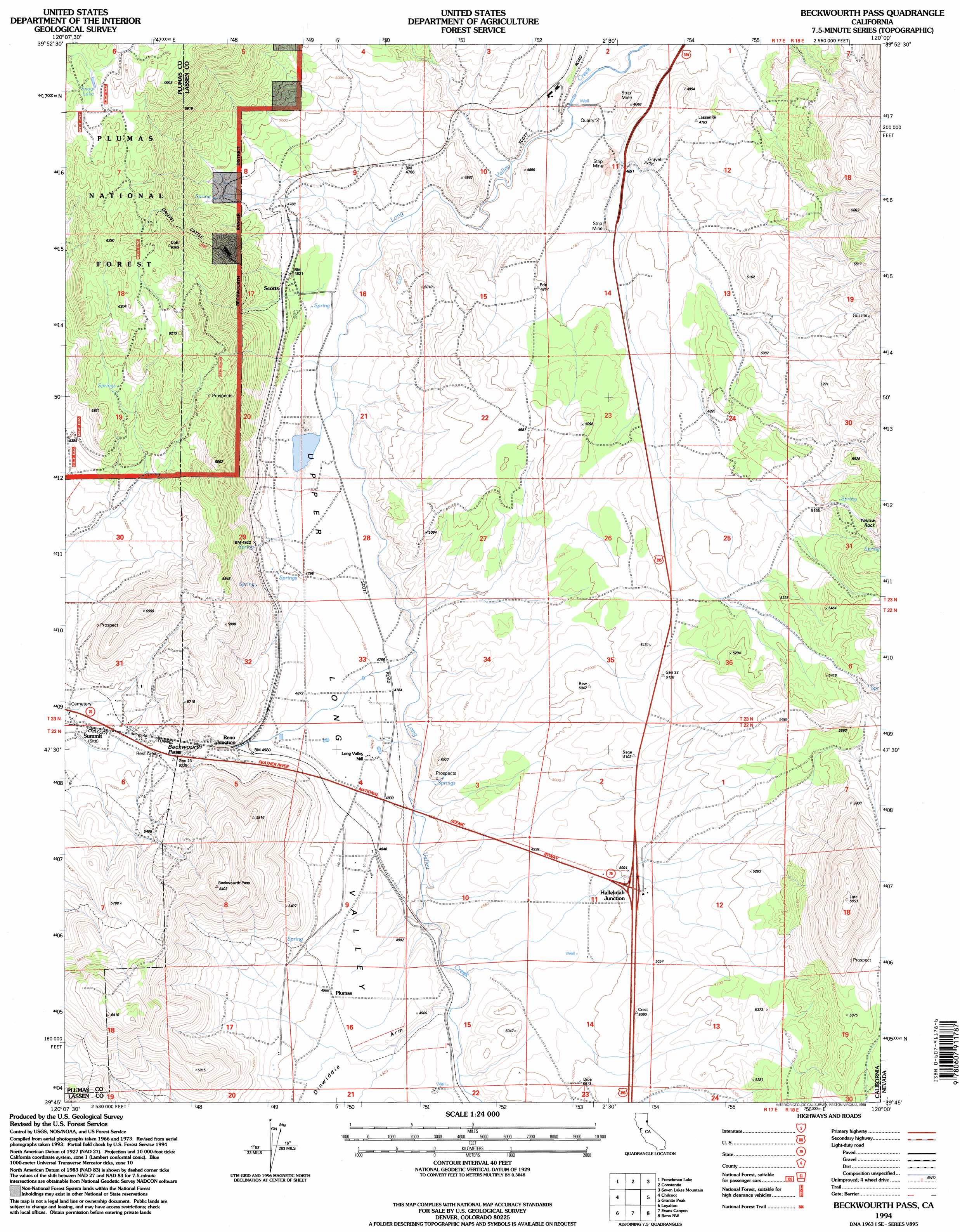
Beckwourth Pass Topo Map California
To zoom in, hover over the map of Beckwourth Pass
USGS Topo Quad 39120g1 - 1:24,000 scale
| Topo Map Name: | Beckwourth Pass |
| USGS Topo Quad ID: | 39120g1 |
| Print Size: | ca. 21 1/4" wide x 27" high |
| Southeast Coordinates: | 39.75° N latitude / 120° W longitude |
| Map Center Coordinates: | 39.8125° N latitude / 120.0625° W longitude |
| U.S. State: | CA |
| Filename: | o39120g1.jpg |
| Download Map JPG Image: | Beckwourth Pass topo map 1:24,000 scale |
| Map Type: | Topographic |
| Topo Series: | 7.5´ |
| Map Scale: | 1:24,000 |
| Source of Map Images: | United States Geological Survey (USGS) |
| Alternate Map Versions: |
Beckwourth Pass CA 1975, updated 1977 Download PDF Buy paper map Beckwourth Pass CA 1994, updated 1998 Download PDF Buy paper map Beckwourth Pass CA 1994, updated 1998 Download PDF Buy paper map Beckwourth Pass CA 2012 Download PDF Buy paper map Beckwourth Pass CA 2015 Download PDF Buy paper map |
| FStopo: | US Forest Service topo Beckwourth Pass is available: Download FStopo PDF Download FStopo TIF |
1:24,000 Topo Quads surrounding Beckwourth Pass
Ferris Creek |
Mckesick Peak |
Doyle |
State Line Peak |
Spanish Flat |
Dixie Mountain |
Frenchman Lake |
Constantia |
Dogskin Mountain |
|
Reconnaissance Peak |
Chilcoot |
Beckwourth Pass |
Granite Peak |
Bedell Flat |
Antelope Valley |
Loyalton |
Evans Canyon |
Reno Nw |
Reno Ne |
Sierraville |
Sardine Peak |
Dog Valley |
Verdi |
Reno |
> Back to 39120e1 at 1:100,000 scale
> Back to 39120a1 at 1:250,000 scale
> Back to U.S. Topo Maps home
Beckwourth Pass topo map: Gazetteer
Beckwourth Pass: Cliffs
Yellow Rock elevation 1643m 5390′Beckwourth Pass: Gaps
Beckwourth Pass elevation 1586m 5203′Beckwourth Pass: Lakes
Snow Lake elevation 1854m 6082′Beckwourth Pass: Populated Places
Chats (historical) elevation 1466m 4809′Hallelujah Junction elevation 1534m 5032′
Plumas elevation 1506m 4940′
Reno Junction elevation 1523m 4996′
Scotts elevation 1466m 4809′
Beckwourth Pass: Trails
Galeppi Cattle Trail elevation 1681m 5515′Beckwourth Pass: Tunnels
Chilcoot Tunnel elevation 1592m 5223′Beckwourth Pass: Valleys
Dinwiddie Arm elevation 1471m 4826′Upper Long Valley elevation 1406m 4612′
Beckwourth Pass digital topo map on disk
Buy this Beckwourth Pass topo map showing relief, roads, GPS coordinates and other geographical features, as a high-resolution digital map file on DVD: