Dixie Mountain Topo Map California
To zoom in, hover over the map of Dixie Mountain
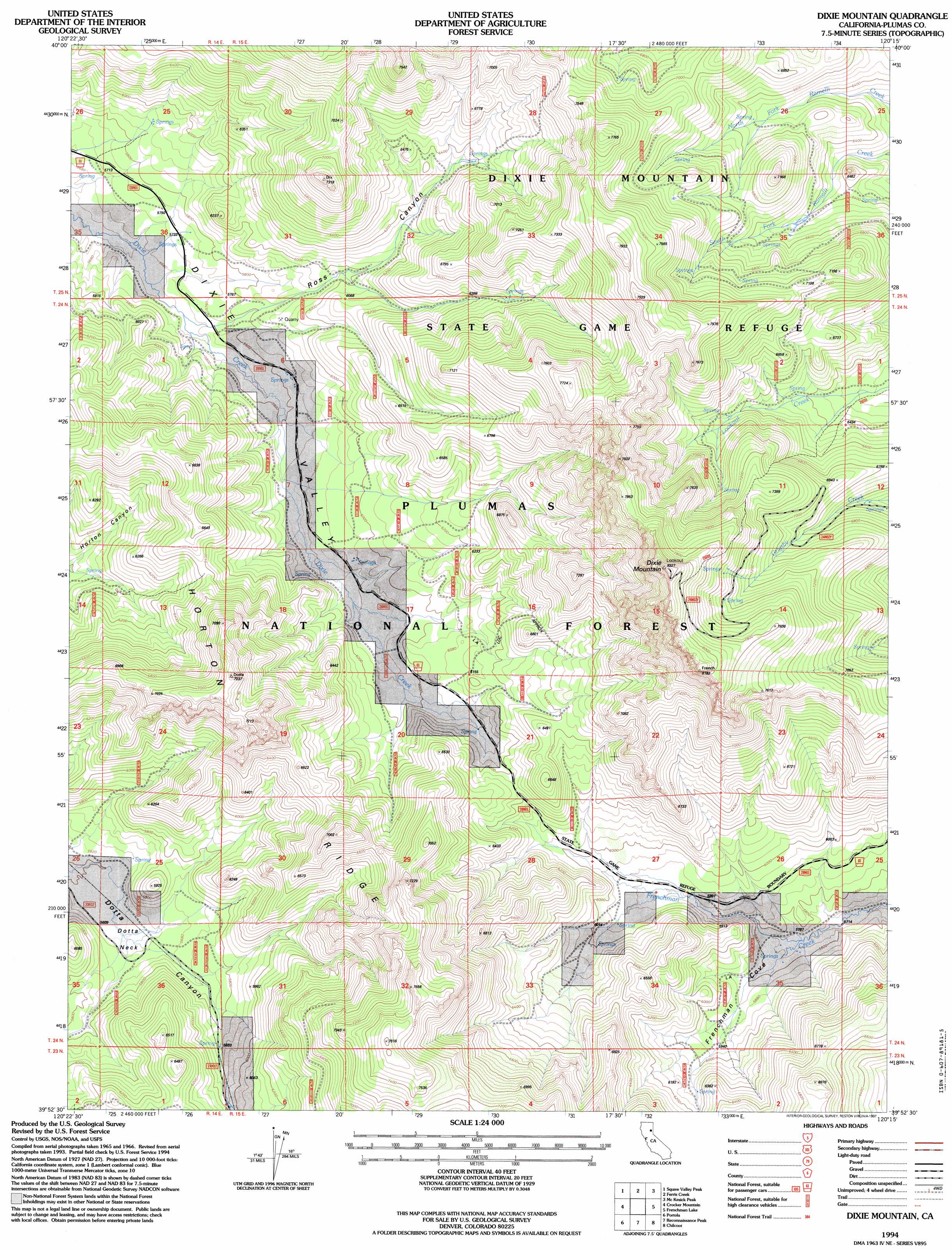
USGS Topo Quad 39120h3 - 1:24,000 scale
| Topo Map Name: | Dixie Mountain |
| USGS Topo Quad ID: | 39120h3 |
| Print Size: | ca. 21 1/4" wide x 27" high |
| Southeast Coordinates: | 39.875° N latitude / 120.25° W longitude |
| Map Center Coordinates: | 39.9375° N latitude / 120.3125° W longitude |
| U.S. State: | CA |
| Filename: | o39120h3.jpg |
| Download Map JPG Image: | Dixie Mountain topo map 1:24,000 scale |
| Map Type: | Topographic |
| Topo Series: | 7.5´ |
| Map Scale: | 1:24,000 |
| Source of Map Images: | United States Geological Survey (USGS) |
| Alternate Map Versions: |
Dixie Mountain CA 1972, updated 1974 Download PDF Buy paper map Dixie Mountain CA 1972, updated 1974 Download PDF Buy paper map Dixie Mountain CA 1994, updated 1997 Download PDF Buy paper map Dixie Mountain CA 2012 Download PDF Buy paper map Dixie Mountain CA 2015 Download PDF Buy paper map |
| FStopo: | US Forest Service topo Dixie Mountain is available: Download FStopo PDF Download FStopo TIF |
1:24,000 Topo Quads surrounding Dixie Mountain
Antelope Lake |
Stony Ridge |
Milford |
Herlong |
Calneva |
Babcock Peak |
Squaw Valley Peak |
Ferris Creek |
Mckesick Peak |
Doyle |
Grizzly Valley |
Crocker Mountain |
Dixie Mountain |
Frenchman Lake |
Constantia |
Blairsden |
Portola |
Reconnaissance Peak |
Chilcoot |
Beckwourth Pass |
Clio |
Calpine |
Antelope Valley |
Loyalton |
Evans Canyon |
> Back to 39120e1 at 1:100,000 scale
> Back to 39120a1 at 1:250,000 scale
> Back to U.S. Topo Maps home
Dixie Mountain topo map: Gazetteer
Dixie Mountain: Capes
Dotta Neck elevation 1714m 5623′Dixie Mountain: Parks
State Game Refuge One-P elevation 2334m 7657′Dixie Mountain: Reservoirs
Twitchell Reservoir elevation 1951m 6400′Dixie Mountain: Ridges
Horton Ridge elevation 1939m 6361′Dixie Mountain: Summits
Dixie Mountain elevation 2537m 8323′Dixie Mountain: Valleys
Frenchman Cove elevation 1759m 5770′Ross Canyon elevation 1760m 5774′
Dixie Mountain digital topo map on disk
Buy this Dixie Mountain topo map showing relief, roads, GPS coordinates and other geographical features, as a high-resolution digital map file on DVD: