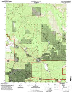
Spring Garden Topo Map California
To zoom in, hover over the map of Spring Garden
USGS Topo Quad 39120h7 - 1:24,000 scale
| Topo Map Name: | Spring Garden |
| USGS Topo Quad ID: | 39120h7 |
| Print Size: | ca. 21 1/4" wide x 27" high |
| Southeast Coordinates: | 39.875° N latitude / 120.75° W longitude |
| Map Center Coordinates: | 39.9375° N latitude / 120.8125° W longitude |
| U.S. State: | CA |
| Filename: | o39120h7.jpg |
| Download Map JPG Image: | Spring Garden topo map 1:24,000 scale |
| Map Type: | Topographic |
| Topo Series: | 7.5´ |
| Map Scale: | 1:24,000 |
| Source of Map Images: | United States Geological Survey (USGS) |
| Alternate Map Versions: |
Spring Garden CA 1950, updated 1958 Download PDF Buy paper map Spring Garden CA 1950, updated 1977 Download PDF Buy paper map Spring Garden CA 1952 Download PDF Buy paper map Spring Garden CA 1994, updated 1998 Download PDF Buy paper map Spring Garden CA 1994, updated 1998 Download PDF Buy paper map Spring Garden CA 2012 Download PDF Buy paper map Spring Garden CA 2015 Download PDF Buy paper map |
| FStopo: | US Forest Service topo Spring Garden is available: Download FStopo PDF Download FStopo TIF |
1:24,000 Topo Quads surrounding Spring Garden
> Back to 39120e1 at 1:100,000 scale
> Back to 39120a1 at 1:250,000 scale
> Back to U.S. Topo Maps home
Spring Garden topo map: Gazetteer
Spring Garden: Flats
Cutter Meadow elevation 1339m 4393′Thompson Valley elevation 1068m 3503′
Spring Garden: Gaps
Lee Summit elevation 1367m 4484′Spring Garden: Mines
Johnson Mine elevation 1450m 4757′Spring Garden: Populated Places
Argentine (historical) elevation 1411m 4629′Greenhorn elevation 1352m 4435′
Massack elevation 1110m 3641′
Spring Garden elevation 1219m 3999′
Spring Garden: Streams
Estray Creek elevation 1171m 3841′Massack Creek elevation 1097m 3599′
Pine Creek elevation 1300m 4265′
Sockum Creek elevation 1074m 3523′
Squirrel Creek elevation 1193m 3914′
Taylor Creek elevation 1186m 3891′
Thompson Creek elevation 1053m 3454′
Spring Garden: Summits
Argentine Rock elevation 2190m 7185′Johnson Hill elevation 1366m 4481′
Lower Taylor elevation 2137m 7011′
Taylor Rock elevation 2220m 7283′
Tower Rock elevation 2342m 7683′
Spring Garden: Tunnels
Spring Garden Tunnel elevation 1306m 4284′Spring Garden: Valleys
Empire Ravine elevation 1241m 4071′Pine Creek Valley elevation 1302m 4271′
Spring Garden digital topo map on disk
Buy this Spring Garden topo map showing relief, roads, GPS coordinates and other geographical features, as a high-resolution digital map file on DVD:


