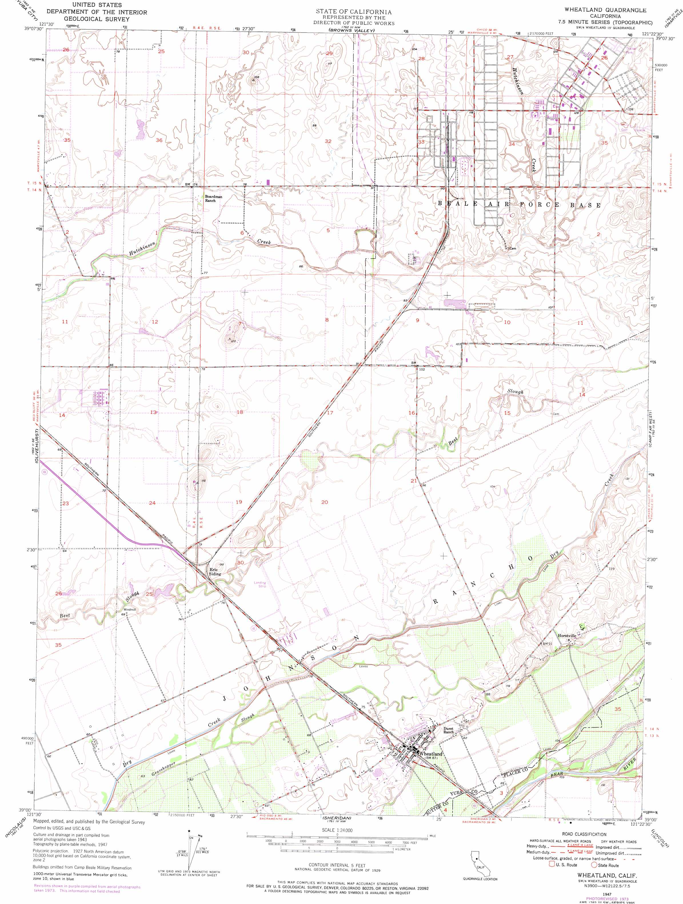
Wheatland Topo Map California
To zoom in, hover over the map of Wheatland
USGS Topo Quad 39121a4 - 1:24,000 scale
| Topo Map Name: | Wheatland |
| USGS Topo Quad ID: | 39121a4 |
| Print Size: | ca. 21 1/4" wide x 27" high |
| Southeast Coordinates: | 39° N latitude / 121.375° W longitude |
| Map Center Coordinates: | 39.0625° N latitude / 121.4375° W longitude |
| U.S. State: | CA |
| Filename: | o39121a4.jpg |
| Download Map JPG Image: | Wheatland topo map 1:24,000 scale |
| Map Type: | Topographic |
| Topo Series: | 7.5´ |
| Map Scale: | 1:24,000 |
| Source of Map Images: | United States Geological Survey (USGS) |
| Alternate Map Versions: |
Wheatland CA 1947, updated 1958 Download PDF Buy paper map Wheatland CA 1947, updated 1966 Download PDF Buy paper map Wheatland CA 1947, updated 1976 Download PDF Buy paper map Wheatland CA 1947, updated 1976 Download PDF Buy paper map Wheatland CA 1949 Download PDF Buy paper map Wheatland CA 2012 Download PDF Buy paper map Wheatland CA 2015 Download PDF Buy paper map |
1:24,000 Topo Quads surrounding Wheatland
Gridley |
Honcut |
Loma Rica |
Oregon House |
French Corral |
Sutter |
Yuba City |
Browns Valley |
Smartville |
Rough And Ready |
Gilsizer Slough |
Olivehurst |
Wheatland |
Camp Far West |
Wolf |
Sutter Causeway |
Nicolaus |
Sheridan |
Lincoln |
Gold Hill |
Knights Landing |
Verona |
Pleasant Grove |
Roseville |
Rocklin |
> Back to 39121a1 at 1:100,000 scale
> Back to 39120a1 at 1:250,000 scale
> Back to U.S. Topo Maps home
Wheatland topo map: Gazetteer
Wheatland: Populated Places
Erle (historical) elevation 35m 114′Horstville elevation 34m 111′
Wheatland elevation 28m 91′
Wheatland: Post Offices
Wheatland Post Office elevation 27m 88′Wheatland digital topo map on disk
Buy this Wheatland topo map showing relief, roads, GPS coordinates and other geographical features, as a high-resolution digital map file on DVD: