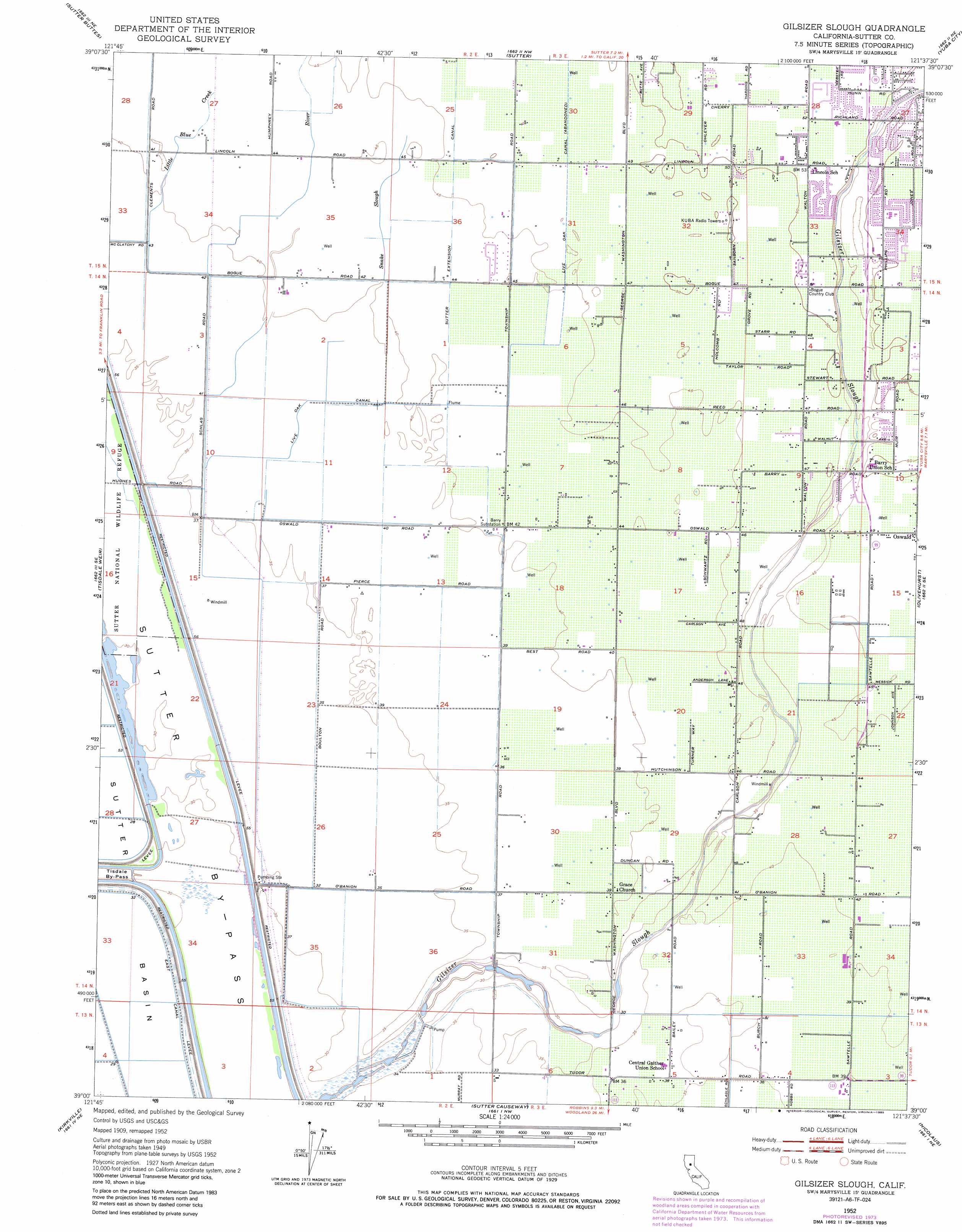
Gilsizer Slough Topo Map California
To zoom in, hover over the map of Gilsizer Slough
USGS Topo Quad 39121a6 - 1:24,000 scale
| Topo Map Name: | Gilsizer Slough |
| USGS Topo Quad ID: | 39121a6 |
| Print Size: | ca. 21 1/4" wide x 27" high |
| Southeast Coordinates: | 39° N latitude / 121.625° W longitude |
| Map Center Coordinates: | 39.0625° N latitude / 121.6875° W longitude |
| U.S. State: | CA |
| Filename: | o39121a6.jpg |
| Download Map JPG Image: | Gilsizer Slough topo map 1:24,000 scale |
| Map Type: | Topographic |
| Topo Series: | 7.5´ |
| Map Scale: | 1:24,000 |
| Source of Map Images: | United States Geological Survey (USGS) |
| Alternate Map Versions: |
Gilsizer Slough CA 1952, updated 1953 Download PDF Buy paper map Gilsizer Slough CA 1952, updated 1974 Download PDF Buy paper map Gilsizer Slough CA 1952, updated 1985 Download PDF Buy paper map Gilsizer Slough CA 2012 Download PDF Buy paper map Gilsizer Slough CA 2015 Download PDF Buy paper map |
1:24,000 Topo Quads surrounding Gilsizer Slough
Sanborn Slough |
Pennington |
Gridley |
Honcut |
Loma Rica |
Meridian |
Sutter Buttes |
Sutter |
Yuba City |
Browns Valley |
Grimes |
Tisdale Weir |
Gilsizer Slough |
Olivehurst |
Wheatland |
Dunnigan |
Kirkville |
Sutter Causeway |
Nicolaus |
Sheridan |
Zamora |
Eldorado Bend |
Knights Landing |
Verona |
Pleasant Grove |
> Back to 39121a1 at 1:100,000 scale
> Back to 39120a1 at 1:250,000 scale
> Back to U.S. Topo Maps home
Gilsizer Slough topo map: Gazetteer
Gilsizer Slough: Airports
Vanderford Ranch Company Airport elevation 13m 42′Gilsizer Slough: Canals
Sutter By-Pass elevation 10m 32′Gilsizer Slough: Guts
Gilsizer Slough elevation 11m 36′Snake Slough elevation 14m 45′
Gilsizer Slough: Populated Places
Abbott elevation 13m 42′Oswald elevation 15m 49′
South Yuba City elevation 16m 52′
Gilsizer Slough: Streams
Little Blue Creek elevation 13m 42′Snake River elevation 8m 26′
Gilsizer Slough digital topo map on disk
Buy this Gilsizer Slough topo map showing relief, roads, GPS coordinates and other geographical features, as a high-resolution digital map file on DVD: