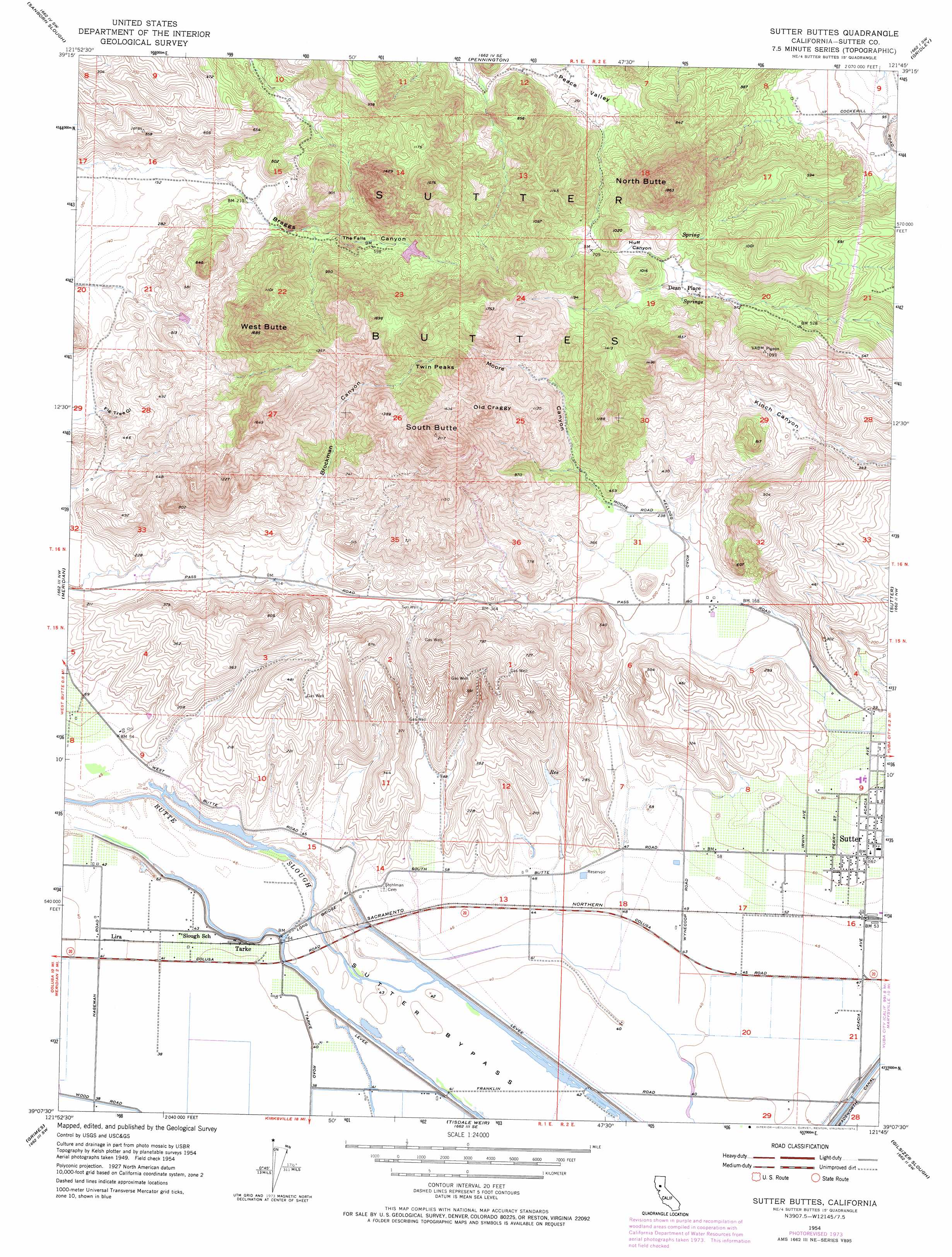
Sutter Buttes Topo Map California
To zoom in, hover over the map of Sutter Buttes
USGS Topo Quad 39121b7 - 1:24,000 scale
| Topo Map Name: | Sutter Buttes |
| USGS Topo Quad ID: | 39121b7 |
| Print Size: | ca. 21 1/4" wide x 27" high |
| Southeast Coordinates: | 39.125° N latitude / 121.75° W longitude |
| Map Center Coordinates: | 39.1875° N latitude / 121.8125° W longitude |
| U.S. State: | CA |
| Filename: | o39121b7.jpg |
| Download Map JPG Image: | Sutter Buttes topo map 1:24,000 scale |
| Map Type: | Topographic |
| Topo Series: | 7.5´ |
| Map Scale: | 1:24,000 |
| Source of Map Images: | United States Geological Survey (USGS) |
| Alternate Map Versions: |
Sutter Buttes CA 1954, updated 1955 Download PDF Buy paper map Sutter Buttes CA 1954, updated 1966 Download PDF Buy paper map Sutter Buttes CA 1954, updated 1974 Download PDF Buy paper map Sutter Buttes CA 1954, updated 1974 Download PDF Buy paper map Sutter Buttes CA 2012 Download PDF Buy paper map Sutter Buttes CA 2015 Download PDF Buy paper map |
1:24,000 Topo Quads surrounding Sutter Buttes
Princeton |
Butte City |
West Of Biggs |
Biggs |
Palermo |
Moulton Weir |
Sanborn Slough |
Pennington |
Gridley |
Honcut |
Colusa |
Meridian |
Sutter Buttes |
Sutter |
Yuba City |
Arbuckle |
Grimes |
Tisdale Weir |
Gilsizer Slough |
Olivehurst |
Wildwood School |
Dunnigan |
Kirkville |
Sutter Causeway |
Nicolaus |
> Back to 39121a1 at 1:100,000 scale
> Back to 39120a1 at 1:250,000 scale
> Back to U.S. Topo Maps home
Sutter Buttes topo map: Gazetteer
Sutter Buttes: Bridges
Long Bridge elevation 13m 42′Sutter Buttes: Falls
The Falls elevation 172m 564′Sutter Buttes: Parks
Sutter Park elevation 26m 85′Sutter Buttes: Populated Places
Dean Place elevation 202m 662′Lira elevation 13m 42′
Mount Vernon elevation 30m 98′
Sutter elevation 23m 75′
Tarke elevation 13m 42′
Sutter Buttes: Ranges
Sutter Buttes elevation 628m 2060′Sutter Buttes: Summits
North Butte elevation 557m 1827′Old Craggy elevation 452m 1482′
South Butte elevation 628m 2060′
Twin Peaks elevation 539m 1768′
West Butte elevation 509m 1669′
Sutter Buttes: Valleys
Braggs Canyon elevation 49m 160′Brockman Canyon elevation 80m 262′
Fig Tree elevation 41m 134′
Huff Canyon elevation 212m 695′
Moore Canyon elevation 88m 288′
Sutter Buttes digital topo map on disk
Buy this Sutter Buttes topo map showing relief, roads, GPS coordinates and other geographical features, as a high-resolution digital map file on DVD: