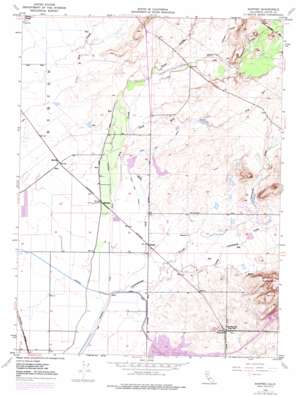
Shippee Topo Map California
To zoom in, hover over the map of Shippee
USGS Topo Quad 39121e6 - 1:24,000 scale
| Topo Map Name: | Shippee |
| USGS Topo Quad ID: | 39121e6 |
| Print Size: | ca. 21 1/4" wide x 27" high |
| Southeast Coordinates: | 39.5° N latitude / 121.625° W longitude |
| Map Center Coordinates: | 39.5625° N latitude / 121.6875° W longitude |
| U.S. State: | CA |
| Filename: | o39121e6.jpg |
| Download Map JPG Image: | Shippee topo map 1:24,000 scale |
| Map Type: | Topographic |
| Topo Series: | 7.5´ |
| Map Scale: | 1:24,000 |
| Source of Map Images: | United States Geological Survey (USGS) |
| Alternate Map Versions: |
Shippee CA 1948, updated 1957 Download PDF Buy paper map Shippee CA 1948, updated 1970 Download PDF Buy paper map Shippee CA 1948, updated 1977 Download PDF Buy paper map Shippee CA 1950 Download PDF Buy paper map Shippee CA 2012 Download PDF Buy paper map Shippee CA 2015 Download PDF Buy paper map |
1:24,000 Topo Quads surrounding Shippee
> Back to 39121e1 at 1:100,000 scale
> Back to 39120a1 at 1:250,000 scale
> Back to U.S. Topo Maps home
Shippee topo map: Gazetteer
Shippee: Canals
Gold Run Canal elevation 53m 173′Shippee: Dams
Dam 194 elevation 59m 193′Shippee: Populated Places
Blavo elevation 42m 137′Oroville Junction elevation 50m 164′
Ramada elevation 42m 137′
Shippee elevation 40m 131′
Shippee: Reservoirs
Thermalito Forebay elevation 62m 203′Shippee: Streams
Campbell Creek elevation 61m 200′Clear Creek elevation 53m 173′
Cottonwood Creek elevation 36m 118′
Dry Creek elevation 40m 131′
Fallager Creek elevation 62m 203′
Gold Run elevation 36m 118′
Little Cottonwood Creek elevation 39m 127′
Shippee digital topo map on disk
Buy this Shippee topo map showing relief, roads, GPS coordinates and other geographical features, as a high-resolution digital map file on DVD:


