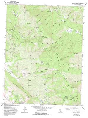
Bartlett Mountain Topo Map California
To zoom in, hover over the map of Bartlett Mountain
USGS Topo Quad 39122b7 - 1:24,000 scale
| Topo Map Name: | Bartlett Mountain |
| USGS Topo Quad ID: | 39122b7 |
| Print Size: | ca. 21 1/4" wide x 27" high |
| Southeast Coordinates: | 39.125° N latitude / 122.75° W longitude |
| Map Center Coordinates: | 39.1875° N latitude / 122.8125° W longitude |
| U.S. State: | CA |
| Filename: | o39122b7.jpg |
| Download Map JPG Image: | Bartlett Mountain topo map 1:24,000 scale |
| Map Type: | Topographic |
| Topo Series: | 7.5´ |
| Map Scale: | 1:24,000 |
| Source of Map Images: | United States Geological Survey (USGS) |
| Alternate Map Versions: |
Bartlett Mtn CA 1958, updated 1961 Download PDF Buy paper map Bartlett Mtn CA 1958, updated 1965 Download PDF Buy paper map Bartlett Mtn CA 1958, updated 1965 Download PDF Buy paper map Bartlett Mtn CA 1958, updated 1980 Download PDF Buy paper map Bartlett Mtn CA 1958, updated 1995 Download PDF Buy paper map Bartlett Mtn CA 1977, updated 1980 Download PDF Buy paper map Bartlett Mountain CA 1996, updated 2001 Download PDF Buy paper map Bartlett Mountain CA 2012 Download PDF Buy paper map Bartlett Mountain CA 2015 Download PDF Buy paper map |
| FStopo: | US Forest Service topo Bartlett Mountain is available: Download FStopo PDF Download FStopo TIF |
1:24,000 Topo Quads surrounding Bartlett Mountain
> Back to 39122a1 at 1:100,000 scale
> Back to 39122a1 at 1:250,000 scale
> Back to U.S. Topo Maps home
Bartlett Mountain topo map: Gazetteer
Bartlett Mountain: Basins
Elk Valley elevation 1027m 3369′Bartlett Mountain: Cliffs
Lincoln Bluff elevation 694m 2276′Bartlett Mountain: Flats
Carter Glades elevation 697m 2286′Ellis Flat elevation 740m 2427′
Middle Creek Flat elevation 852m 2795′
Sawmill Flat elevation 1129m 3704′
The Pocket elevation 897m 2942′
Willow Flat elevation 743m 2437′
Wyman Glade elevation 988m 3241′
Bartlett Mountain: Gaps
Bartlett Mountain Summit elevation 1199m 3933′Low Gap elevation 1144m 3753′
Bartlett Mountain: Pillars
Telegraph Rock elevation 781m 2562′Bartlett Mountain: Populated Places
Rose Place elevation 949m 3113′Wild Bill Place elevation 704m 2309′
Bartlett Mountain: Ridges
Alder Spring Ridge elevation 1203m 3946′Buck Ridge elevation 1150m 3772′
French Ridge elevation 1338m 4389′
Hogback Ridge elevation 844m 2769′
Ladder Ridge elevation 922m 3024′
Long Valley Ridge elevation 1178m 3864′
Mary Ann Ridge elevation 1245m 4084′
Pitney Ridge elevation 1041m 3415′
Sam Alley Ridge elevation 732m 2401′
Wild Bill Ridge elevation 1122m 3681′
Windy Ridge elevation 1340m 4396′
Bartlett Mountain: Springs
Hazel Spring elevation 1045m 3428′High Glade Spring elevation 1440m 4724′
Sulphur Spring elevation 887m 2910′
Bartlett Mountain: Streams
Alder Creek elevation 701m 2299′Forty Springs Valley elevation 738m 2421′
Gilbert Creek elevation 448m 1469′
Rattlesnake Creek elevation 715m 2345′
Twin Valley elevation 679m 2227′
Wild Bill Creek elevation 672m 2204′
Wilson Valley elevation 867m 2844′
Bartlett Mountain: Summits
Bartlett Mountain elevation 1365m 4478′Charlie Alley Peak elevation 1062m 3484′
Elk Knob elevation 1076m 3530′
Little Pinnacle elevation 1368m 4488′
Pinnacle Rock elevation 1381m 4530′
Red Rock elevation 1308m 4291′
Round Mountain elevation 962m 3156′
Sky Rock elevation 1184m 3884′
Windy Point elevation 1453m 4767′
Bartlett Mountain: Trails
Bucknell Trail elevation 864m 2834′Elk Knob Trail elevation 1038m 3405′
Middle Creek Flat Trail elevation 1192m 3910′
Bartlett Mountain: Valleys
Live Oak Hollow elevation 697m 2286′Swede Canyon elevation 672m 2204′
Tea Canyon elevation 775m 2542′
Bartlett Mountain: Woods
Pilot Grove elevation 1196m 3923′Bartlett Mountain digital topo map on disk
Buy this Bartlett Mountain topo map showing relief, roads, GPS coordinates and other geographical features, as a high-resolution digital map file on DVD:


