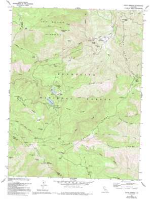
Fouts Springs Topo Map California
To zoom in, hover over the map of Fouts Springs
USGS Topo Quad 39122c6 - 1:24,000 scale
| Topo Map Name: | Fouts Springs |
| USGS Topo Quad ID: | 39122c6 |
| Print Size: | ca. 21 1/4" wide x 27" high |
| Southeast Coordinates: | 39.25° N latitude / 122.625° W longitude |
| Map Center Coordinates: | 39.3125° N latitude / 122.6875° W longitude |
| U.S. State: | CA |
| Filename: | o39122c6.jpg |
| Download Map JPG Image: | Fouts Springs topo map 1:24,000 scale |
| Map Type: | Topographic |
| Topo Series: | 7.5´ |
| Map Scale: | 1:24,000 |
| Source of Map Images: | United States Geological Survey (USGS) |
| Alternate Map Versions: |
Fouts Springs CA 1968, updated 1970 Download PDF Buy paper map Fouts Springs CA 1968, updated 1985 Download PDF Buy paper map Fouts Springs CA 1968, updated 1994 Download PDF Buy paper map Fouts Springs CA 1996, updated 2001 Download PDF Buy paper map Fouts Springs CA 2012 Download PDF Buy paper map Fouts Springs CA 2015 Download PDF Buy paper map |
| FStopo: | US Forest Service topo Fouts Springs is available: Download FStopo PDF Download FStopo TIF |
1:24,000 Topo Quads surrounding Fouts Springs
> Back to 39122a1 at 1:100,000 scale
> Back to 39122a1 at 1:250,000 scale
> Back to U.S. Topo Maps home
Fouts Springs topo map: Gazetteer
Fouts Springs: Basins
Lower Letts Valley elevation 1243m 4078′Mill Valley elevation 1226m 4022′
Summit Valley elevation 1668m 5472′
Fouts Springs: Dams
Letts Valley 1-039 Dam elevation 1418m 4652′Fouts Springs: Flats
Davis Flat elevation 497m 1630′Deafy Glade elevation 1059m 3474′
Moon Glade elevation 599m 1965′
Rattlesnake Glade elevation 1212m 3976′
Welton Glade elevation 839m 2752′
Fouts Springs: Lakes
Lily Pond elevation 1239m 4064′Fouts Springs: Populated Places
Fouts Springs elevation 522m 1712′Fouts Springs: Reservoirs
Upper Letts Lake elevation 1367m 4484′Fouts Springs: Ridges
Board Camp Ridge elevation 1675m 5495′Letts Ridge elevation 1146m 3759′
Little Sullivan Ridge elevation 1134m 3720′
Miner Ridge elevation 1301m 4268′
Sullivan Ridge elevation 1104m 3622′
Trough Spring Ridge elevation 1089m 3572′
Fouts Springs: Springs
Board Camp Spring elevation 1521m 4990′Candy Bucket Spring elevation 633m 2076′
Champagne Spring elevation 561m 1840′
Cold Spring elevation 1359m 4458′
Freezeout Spring elevation 1734m 5688′
Red Eye Spring elevation 523m 1715′
Trough Spring elevation 1022m 3353′
Fouts Springs: Streams
Letts Creek elevation 1007m 3303′Mill Creek elevation 483m 1584′
Miner Creek elevation 703m 2306′
Trout Creek elevation 535m 1755′
Fouts Springs: Summits
Goat Mountain elevation 1863m 6112′High Rock elevation 1929m 6328′
Potato Hill elevation 1045m 3428′
Fouts Springs: Trails
Bathhouse Trail elevation 902m 2959′Box Spring Loop elevation 1454m 4770′
Milk Ranch Trail elevation 1934m 6345′
Milk Ranch Trail elevation 1936m 6351′
Trout Creek Trail elevation 1175m 3854′
Fouts Springs digital topo map on disk
Buy this Fouts Springs topo map showing relief, roads, GPS coordinates and other geographical features, as a high-resolution digital map file on DVD:


