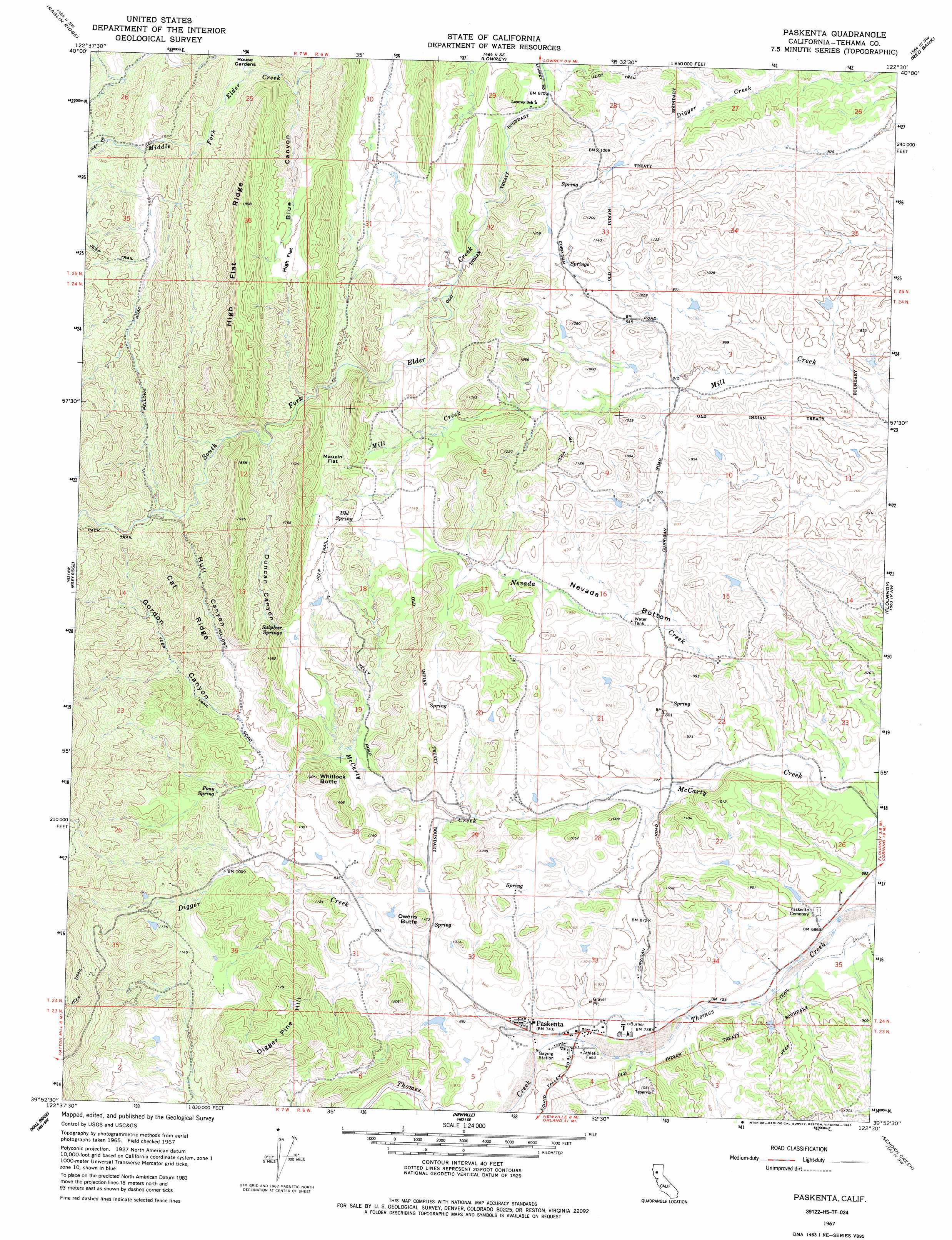
Paskenta Topo Map California
To zoom in, hover over the map of Paskenta
USGS Topo Quad 39122h5 - 1:24,000 scale
| Topo Map Name: | Paskenta |
| USGS Topo Quad ID: | 39122h5 |
| Print Size: | ca. 21 1/4" wide x 27" high |
| Southeast Coordinates: | 39.875° N latitude / 122.5° W longitude |
| Map Center Coordinates: | 39.9375° N latitude / 122.5625° W longitude |
| U.S. State: | CA |
| Filename: | o39122h5.jpg |
| Download Map JPG Image: | Paskenta topo map 1:24,000 scale |
| Map Type: | Topographic |
| Topo Series: | 7.5´ |
| Map Scale: | 1:24,000 |
| Source of Map Images: | United States Geological Survey (USGS) |
| Alternate Map Versions: |
Paskenta CA 1967, updated 1969 Download PDF Buy paper map Paskenta CA 1967, updated 1985 Download PDF Buy paper map Paskenta CA 1995, updated 2001 Download PDF Buy paper map Paskenta CA 2012 Download PDF Buy paper map Paskenta CA 2015 Download PDF Buy paper map |
| FStopo: | US Forest Service topo Paskenta is available: Download FStopo PDF Download FStopo TIF |
1:24,000 Topo Quads surrounding Paskenta
Tomhead Mountain |
Cold Fork |
Oxbow Bridge |
Blossom |
Red Bluff West |
South Yolla Bolly Mountains |
Raglin Ridge |
Lowrey |
Red Bank |
West Of Gerber |
Ball Mountain |
Riley Ridge |
Paskenta |
Flournoy |
Henleyville |
Log Spring |
Hall Ridge |
Newville |
Sehorn Creek |
Black Butte Dam |
Plaskett Meadows |
Alder Springs |
Chrome |
Julian Rocks |
Fruto Ne |
> Back to 39122e1 at 1:100,000 scale
> Back to 39122a1 at 1:250,000 scale
> Back to U.S. Topo Maps home
Paskenta topo map: Gazetteer
Paskenta: Basins
Nevada Bottom elevation 248m 813′Paskenta: Flats
Maupin Flat elevation 403m 1322′Rouse Gardens elevation 324m 1062′
Paskenta: Populated Places
Paskenta elevation 230m 754′Paskenta: Ridges
Cat Ridge elevation 432m 1417′High Flat Ridge elevation 576m 1889′
Paskenta: Springs
Pony Spring elevation 308m 1010′Sulphur Springs elevation 336m 1102′
Uhl Spring elevation 367m 1204′
Paskenta: Streams
Digger Creek elevation 225m 738′Nevada Creek elevation 208m 682′
Salt Creek elevation 316m 1036′
Paskenta: Summits
Digger Pine Hill elevation 514m 1686′Owens Butte elevation 354m 1161′
Whitlock Butte elevation 420m 1377′
Paskenta: Valleys
Blue Canyon elevation 303m 994′Duncan Canyon elevation 342m 1122′
Gordon Canyon elevation 301m 987′
Hull Canyon elevation 338m 1108′
Paskenta digital topo map on disk
Buy this Paskenta topo map showing relief, roads, GPS coordinates and other geographical features, as a high-resolution digital map file on DVD: