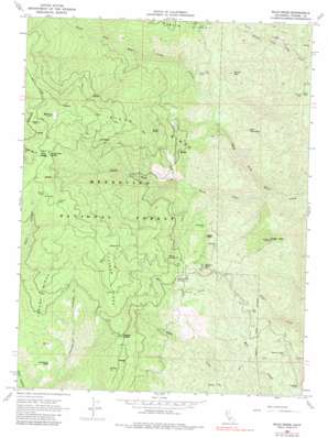
Riley Ridge Topo Map California
To zoom in, hover over the map of Riley Ridge
USGS Topo Quad 39122h6 - 1:24,000 scale
| Topo Map Name: | Riley Ridge |
| USGS Topo Quad ID: | 39122h6 |
| Print Size: | ca. 21 1/4" wide x 27" high |
| Southeast Coordinates: | 39.875° N latitude / 122.625° W longitude |
| Map Center Coordinates: | 39.9375° N latitude / 122.6875° W longitude |
| U.S. State: | CA |
| Filename: | o39122h6.jpg |
| Download Map JPG Image: | Riley Ridge topo map 1:24,000 scale |
| Map Type: | Topographic |
| Topo Series: | 7.5´ |
| Map Scale: | 1:24,000 |
| Source of Map Images: | United States Geological Survey (USGS) |
| Alternate Map Versions: |
Riley Ridge CA 1967, updated 1970 Download PDF Buy paper map Riley Ridge CA 1967, updated 1983 Download PDF Buy paper map Riley Ridge CA 1995, updated 2001 Download PDF Buy paper map Riley Ridge CA 2012 Download PDF Buy paper map Riley Ridge CA 2015 Download PDF Buy paper map |
| FStopo: | US Forest Service topo Riley Ridge is available: Download FStopo PDF Download FStopo TIF |
1:24,000 Topo Quads surrounding Riley Ridge
> Back to 39122e1 at 1:100,000 scale
> Back to 39122a1 at 1:250,000 scale
> Back to U.S. Topo Maps home
Riley Ridge topo map: Gazetteer
Riley Ridge: Capes
Crowfoot Point elevation 582m 1909′Riley Ridge: Cliffs
Eagle Rock elevation 1149m 3769′Stony Point elevation 1477m 4845′
Riley Ridge: Flats
Beehive Flat elevation 670m 2198′Henderson Glade elevation 968m 3175′
Riley Ridge: Gaps
Whiskey Saddle elevation 1454m 4770′Riley Ridge: Mines
Kleinsorge Mine elevation 567m 1860′South Elder Mine elevation 937m 3074′
Riley Ridge: Populated Places
Dawson Place elevation 1667m 5469′Mitchell Place elevation 1656m 5433′
Pellow Place elevation 471m 1545′
Steuben Place elevation 1870m 6135′
Riley Ridge: Ridges
Raglin Ridge elevation 1174m 3851′Riley Ridge elevation 1444m 4737′
Tatham Ridge elevation 1710m 5610′
Trough Ridge elevation 1508m 4947′
Riley Ridge: Springs
Cold Spring elevation 1912m 6272′Government Spring elevation 1243m 4078′
Rocky Cabin Spring elevation 1900m 6233′
Riley Ridge: Summits
All Top elevation 1575m 5167′Ball Rock elevation 2025m 6643′
Brush Mountain elevation 1051m 3448′
Eagle Peak elevation 1128m 3700′
Red Mountain elevation 967m 3172′
Round Mountain elevation 1307m 4288′
Riley Ridge digital topo map on disk
Buy this Riley Ridge topo map showing relief, roads, GPS coordinates and other geographical features, as a high-resolution digital map file on DVD:


