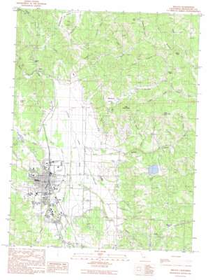
Willits Topo Map California
To zoom in, hover over the map of Willits
USGS Topo Quad 39123d3 - 1:24,000 scale
| Topo Map Name: | Willits |
| USGS Topo Quad ID: | 39123d3 |
| Print Size: | ca. 21 1/4" wide x 27" high |
| Southeast Coordinates: | 39.375° N latitude / 123.25° W longitude |
| Map Center Coordinates: | 39.4375° N latitude / 123.3125° W longitude |
| U.S. State: | CA |
| Filename: | o39123d3.jpg |
| Download Map JPG Image: | Willits topo map 1:24,000 scale |
| Map Type: | Topographic |
| Topo Series: | 7.5´ |
| Map Scale: | 1:24,000 |
| Source of Map Images: | United States Geological Survey (USGS) |
| Alternate Map Versions: |
Willits CA 1991, updated 1991 Download PDF Buy paper map Willits CA 2012 Download PDF Buy paper map Willits CA 2015 Download PDF Buy paper map |
1:24,000 Topo Quads surrounding Willits
> Back to 39123a1 at 1:100,000 scale
> Back to 39122a1 at 1:250,000 scale
> Back to U.S. Topo Maps home
Willits topo map: Gazetteer
Willits: Airports
Ells Field elevation 615m 2017′Willits: Areas
High Salt Ground elevation 731m 2398′Willits: Basins
Finney Valley elevation 580m 1902′Rocktree Valley elevation 577m 1893′
Willits: Dams
Chinquapin 1384-002 Dam elevation 620m 2034′Scout Lake 389 Dam elevation 571m 1873′
Willits: Flats
Manzanita Flat elevation 769m 2522′Willits: Gaps
Low Gap elevation 795m 2608′Willits: Lakes
Twin Lakes elevation 498m 1633′Willits: Parks
Babcock Park elevation 428m 1404′Highway Twenty Park elevation 423m 1387′
Willits City Park elevation 420m 1377′
Willits Rodeo Grounds elevation 413m 1354′
Willits: Populated Places
DeCamp elevation 409m 1341′Fair Oaks elevation 440m 1443′
Muir elevation 423m 1387′
Simerson elevation 420m 1377′
Upp elevation 409m 1341′
Valley Oaks Mobile Home Park elevation 421m 1381′
Wagon Wheel Mobile Home Park elevation 430m 1410′
Willits elevation 424m 1391′
Willits: Post Offices
Willits Post Office elevation 420m 1377′Willits: Ridges
Oat Ridge elevation 662m 2171′Willits: Streams
Alder Creek elevation 471m 1545′Baechtel Creek elevation 409m 1341′
Bee Branch Creek elevation 505m 1656′
Berry Creek elevation 408m 1338′
Broaddus Creek elevation 410m 1345′
Davis Creek elevation 405m 1328′
Digger Creek elevation 523m 1715′
Elk Creek elevation 612m 2007′
Elk Creek elevation 677m 2221′
Fulweiter Creek elevation 426m 1397′
Haehl Creek elevation 413m 1354′
Little Creek elevation 580m 1902′
Middle Spring Creek elevation 614m 2014′
Mill Creek elevation 410m 1345′
Moore Creek elevation 439m 1440′
North Fork String Creek elevation 604m 1981′
String Creek elevation 532m 1745′
Tartar Creek elevation 563m 1847′
Upp Creek elevation 408m 1338′
West Fork Shelving Rock Creek elevation 646m 2119′
Willits Creek elevation 438m 1437′
Willits: Summits
Big Darby Peak elevation 803m 2634′Grizzly Point elevation 639m 2096′
Little Darby Peak elevation 859m 2818′
Tenney Peak elevation 679m 2227′
The Island elevation 678m 2224′
Willits: Valleys
Berry Canyon elevation 433m 1420′Big Canyon elevation 533m 1748′
Little Lake Valley elevation 428m 1404′
Muir Canyon elevation 439m 1440′
Pepperwood Gulch elevation 591m 1938′
Wild Oat Canyon elevation 407m 1335′
Willits digital topo map on disk
Buy this Willits topo map showing relief, roads, GPS coordinates and other geographical features, as a high-resolution digital map file on DVD:


