Dutchmans Knoll Topo Map California
To zoom in, hover over the map of Dutchmans Knoll
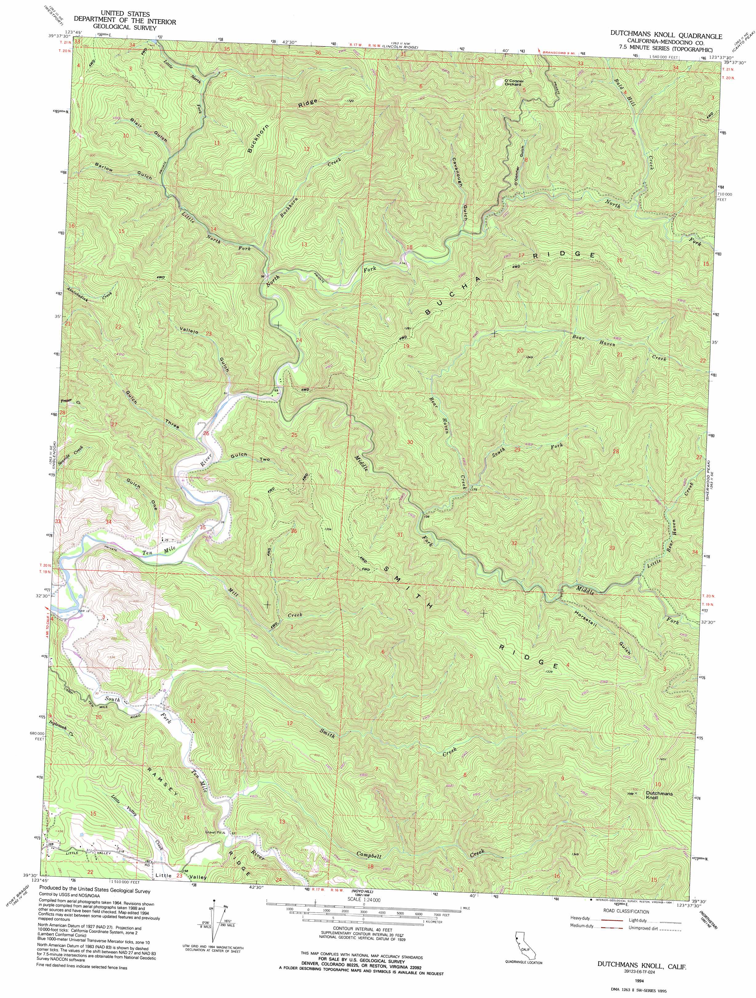
USGS Topo Quad 39123e6 - 1:24,000 scale
| Topo Map Name: | Dutchmans Knoll |
| USGS Topo Quad ID: | 39123e6 |
| Print Size: | ca. 21 1/4" wide x 27" high |
| Southeast Coordinates: | 39.5° N latitude / 123.625° W longitude |
| Map Center Coordinates: | 39.5625° N latitude / 123.6875° W longitude |
| U.S. State: | CA |
| Filename: | o39123e6.jpg |
| Download Map JPG Image: | Dutchmans Knoll topo map 1:24,000 scale |
| Map Type: | Topographic |
| Topo Series: | 7.5´ |
| Map Scale: | 1:24,000 |
| Source of Map Images: | United States Geological Survey (USGS) |
| Alternate Map Versions: |
Dutchmans Knoll CA 1966 Download PDF Buy paper map Dutchmans Knoll CA 1966, updated 1969 Download PDF Buy paper map Dutchmans Knoll CA 1966, updated 1969 Download PDF Buy paper map Dutchmans Knoll CA 1994, updated 1994 Download PDF Buy paper map Dutchmans Knoll CA 2012 Download PDF Buy paper map Dutchmans Knoll CA 2015 Download PDF Buy paper map |
1:24,000 Topo Quads surrounding Dutchmans Knoll
Mistake Point |
Hales Grove |
Leggett |
Tan Oak Park |
Iron Peak |
Westport |
Lincoln Ridge |
Cahto Peak |
Laytonville |
|
Inglenook |
Dutchmans Knoll |
Sherwood Peak |
Longvale |
|
Fort Bragg |
Noyo Hill |
Northspur |
Burbeck |
|
Mendocino |
Mathison Peak |
Comptche |
Greenough Ridge |
> Back to 39123e1 at 1:100,000 scale
> Back to 39122a1 at 1:250,000 scale
> Back to U.S. Topo Maps home
Dutchmans Knoll topo map: Gazetteer
Dutchmans Knoll: Ridges
Bucha Ridge elevation 398m 1305′Buckhorn Ridge elevation 380m 1246′
Dutchmans Knoll: Streams
Bald Hill Creek elevation 73m 239′Bear Haven Creek elevation 33m 108′
Buckhorn Creek elevation 51m 167′
Campbell Creek elevation 13m 42′
Little Bear Haven Creek elevation 58m 190′
Little North Fork Ten Mile River elevation 25m 82′
Middle Fork Ten Mile River elevation 15m 49′
Mill Creek elevation 5m 16′
North Fork Ten Mile River elevation 15m 49′
Smith Creek elevation 7m 22′
South Fork Bear Haven Creek elevation 56m 183′
South Fork Ten Mile River elevation 5m 16′
Dutchmans Knoll: Summits
Dutchmans Knoll elevation 505m 1656′Dutchmans Knoll: Valleys
Barlow Gulch elevation 69m 226′Blair Gulch elevation 70m 229′
Buckhorn Gulch elevation 35m 114′
Cavanough Gulch elevation 49m 160′
Gulch One elevation 15m 49′
Gulch Three elevation 11m 36′
Gulch Two elevation 10m 32′
Horsetail Gulch elevation 48m 157′
O'Conner Gulch elevation 56m 183′
Vallejo Gulch elevation 14m 45′
Dutchmans Knoll digital topo map on disk
Buy this Dutchmans Knoll topo map showing relief, roads, GPS coordinates and other geographical features, as a high-resolution digital map file on DVD: