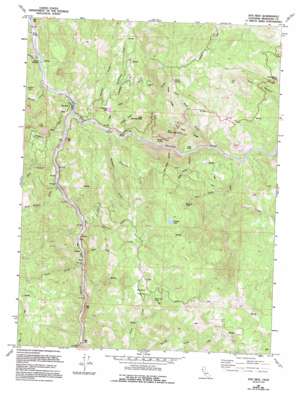
Dos Rios Topo Map California
To zoom in, hover over the map of Dos Rios
USGS Topo Quad 39123f3 - 1:24,000 scale
| Topo Map Name: | Dos Rios |
| USGS Topo Quad ID: | 39123f3 |
| Print Size: | ca. 21 1/4" wide x 27" high |
| Southeast Coordinates: | 39.625° N latitude / 123.25° W longitude |
| Map Center Coordinates: | 39.6875° N latitude / 123.3125° W longitude |
| U.S. State: | CA |
| Filename: | o39123f3.jpg |
| Download Map JPG Image: | Dos Rios topo map 1:24,000 scale |
| Map Type: | Topographic |
| Topo Series: | 7.5´ |
| Map Scale: | 1:24,000 |
| Source of Map Images: | United States Geological Survey (USGS) |
| Alternate Map Versions: |
Dos Rios CA 1967, updated 1969 Download PDF Buy paper map Dos Rios CA 1967, updated 1969 Download PDF Buy paper map Dos Rios CA 1967, updated 1985 Download PDF Buy paper map Dos Rios CA 1967, updated 1994 Download PDF Buy paper map Dos Rios CA 2012 Download PDF Buy paper map Dos Rios CA 2015 Download PDF Buy paper map |
1:24,000 Topo Quads surrounding Dos Rios
> Back to 39123e1 at 1:100,000 scale
> Back to 39122a1 at 1:250,000 scale
> Back to U.S. Topo Maps home
Dos Rios topo map: Gazetteer
Dos Rios: Basins
Rodeo Valley elevation 777m 2549′Dos Rios: Cliffs
Inspiration Point elevation 598m 1961′Windy Point elevation 407m 1335′
Dos Rios: Lakes
Dead Cow Lake elevation 863m 2831′Grassy Lake elevation 1008m 3307′
Howard Lake elevation 912m 2992′
Poonkinny Lake elevation 436m 1430′
Dos Rios: Populated Places
Dos Rios elevation 293m 961′Indian Springs elevation 365m 1197′
Tatu elevation 296m 971′
Dos Rios: Ridges
Hog Hole elevation 331m 1085′Hog Hole Ridge elevation 517m 1696′
Hosea Ridge elevation 682m 2237′
Dos Rios: Slopes
Sand Banks elevation 727m 2385′Dos Rios: Streams
Brad Turner Creek elevation 279m 915′Burger Creek elevation 258m 846′
Cable Creek elevation 274m 898′
Coal Creek elevation 374m 1227′
Dean Creek elevation 279m 915′
Division Creek elevation 295m 967′
Doghouse Creek elevation 276m 905′
Eastman Creek elevation 280m 918′
Gamache Creek elevation 253m 830′
Goforth Creek elevation 269m 882′
Hosea Creek elevation 285m 935′
Middle Fork Eel River elevation 263m 862′
Outlet Creek elevation 309m 1013′
Pickrell Creek elevation 279m 915′
Poonkinny Creek elevation 399m 1309′
Rock Creek elevation 298m 977′
Rodeo Creek elevation 292m 958′
Salt Creek elevation 302m 990′
Sand Bank Creek elevation 289m 948′
Tatu Creek elevation 292m 958′
Dos Rios: Summits
Big Chemise Knob elevation 673m 2208′Little Chemise Knob elevation 603m 1978′
Dos Rios: Valleys
Big Water Canyon elevation 286m 938′Little Water Canyon elevation 292m 958′
Dos Rios digital topo map on disk
Buy this Dos Rios topo map showing relief, roads, GPS coordinates and other geographical features, as a high-resolution digital map file on DVD:


