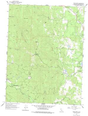
Cahto Peak Topo Map California
To zoom in, hover over the map of Cahto Peak
USGS Topo Quad 39123f5 - 1:24,000 scale
| Topo Map Name: | Cahto Peak |
| USGS Topo Quad ID: | 39123f5 |
| Print Size: | ca. 21 1/4" wide x 27" high |
| Southeast Coordinates: | 39.625° N latitude / 123.5° W longitude |
| Map Center Coordinates: | 39.6875° N latitude / 123.5625° W longitude |
| U.S. State: | CA |
| Filename: | o39123f5.jpg |
| Download Map JPG Image: | Cahto Peak topo map 1:24,000 scale |
| Map Type: | Topographic |
| Topo Series: | 7.5´ |
| Map Scale: | 1:24,000 |
| Source of Map Images: | United States Geological Survey (USGS) |
| Alternate Map Versions: |
Cahto Peak CA 1967, updated 1969 Download PDF Buy paper map Cahto Peak CA 1967, updated 1969 Download PDF Buy paper map Cahto Peak CA 1967, updated 1977 Download PDF Buy paper map Cahto Peak CA 1967, updated 1994 Download PDF Buy paper map Cahto Peak CA 1967, updated 1994 Download PDF Buy paper map Cahto Peak CA 2012 Download PDF Buy paper map Cahto Peak CA 2015 Download PDF Buy paper map |
1:24,000 Topo Quads surrounding Cahto Peak
> Back to 39123e1 at 1:100,000 scale
> Back to 39122a1 at 1:250,000 scale
> Back to U.S. Topo Maps home
Cahto Peak topo map: Gazetteer
Cahto Peak: Dams
Mast 1380 Dam elevation 589m 1932′Cahto Peak: Flats
Stoten Opening elevation 1140m 3740′Cahto Peak: Parks
Admiral William Standley State Recreation Area elevation 483m 1584′Cahto Peak: Springs
Mud Springs elevation 614m 2014′Cahto Peak: Streams
Bear Creek elevation 491m 1610′Big Rock Creek elevation 452m 1482′
Grapevine Creek elevation 535m 1755′
Haun Creek elevation 473m 1551′
Lewis Creek elevation 451m 1479′
Little Case Creek elevation 483m 1584′
Middleton Creek elevation 545m 1788′
Mill Creek elevation 503m 1650′
Misery Creek elevation 531m 1742′
Mud Creek elevation 478m 1568′
Mud Springs Creek elevation 482m 1581′
Stapp Creek elevation 455m 1492′
Streeter Creek elevation 446m 1463′
Taylor Creek elevation 485m 1591′
Tuttle Creek elevation 494m 1620′
Wilson Creek elevation 460m 1509′
Windem Creek elevation 540m 1771′
Cahto Peak: Summits
Big Rock elevation 813m 2667′Black Oak Mountain elevation 1124m 3687′
Cahto Peak elevation 1284m 4212′
Sand Rock elevation 693m 2273′
Signal Peak elevation 1241m 4071′
Cahto Peak: Valleys
Paralyze Canyon elevation 577m 1893′Wise Gulch elevation 503m 1650′
Cahto Peak digital topo map on disk
Buy this Cahto Peak topo map showing relief, roads, GPS coordinates and other geographical features, as a high-resolution digital map file on DVD:


