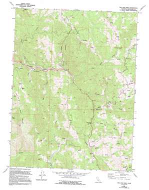
Tan Oak Park Topo Map California
To zoom in, hover over the map of Tan Oak Park
USGS Topo Quad 39123g5 - 1:24,000 scale
| Topo Map Name: | Tan Oak Park |
| USGS Topo Quad ID: | 39123g5 |
| Print Size: | ca. 21 1/4" wide x 27" high |
| Southeast Coordinates: | 39.75° N latitude / 123.5° W longitude |
| Map Center Coordinates: | 39.8125° N latitude / 123.5625° W longitude |
| U.S. State: | CA |
| Filename: | o39123g5.jpg |
| Download Map JPG Image: | Tan Oak Park topo map 1:24,000 scale |
| Map Type: | Topographic |
| Topo Series: | 7.5´ |
| Map Scale: | 1:24,000 |
| Source of Map Images: | United States Geological Survey (USGS) |
| Alternate Map Versions: |
Tan Oak Park CA 1969, updated 1974 Download PDF Buy paper map Tan Oak Park CA 1969, updated 1986 Download PDF Buy paper map Tan Oak Park CA 1969, updated 1994 Download PDF Buy paper map Tan Oak Park CA 2012 Download PDF Buy paper map Tan Oak Park CA 2015 Download PDF Buy paper map |
1:24,000 Topo Quads surrounding Tan Oak Park
> Back to 39123e1 at 1:100,000 scale
> Back to 39122a1 at 1:250,000 scale
> Back to U.S. Topo Maps home
Tan Oak Park topo map: Gazetteer
Tan Oak Park: Flats
Burns Flat elevation 696m 2283′Tan Oak Park: Parks
Empire Roadside Rest elevation 394m 1292′Tan Oak Park: Populated Places
Bowman Place elevation 714m 2342′Empire (historical) elevation 408m 1338′
Tan Oak Park elevation 406m 1332′
Twin Rocks elevation 433m 1420′
Tan Oak Park: Streams
Cold Creek elevation 458m 1502′Cummings Creek elevation 427m 1400′
Elk Creek elevation 390m 1279′
Foster Creek elevation 356m 1167′
Grapewine Creek elevation 465m 1525′
Grub Creek elevation 423m 1387′
Mad Creek elevation 377m 1236′
Peterson Creek elevation 422m 1384′
Spring Creek elevation 441m 1446′
Twin Rocks Creek elevation 430m 1410′
Tan Oak Park: Summits
Bald Mountain elevation 1053m 3454′Brush Mountain elevation 1065m 3494′
Chimney Rock elevation 831m 2726′
Cow Mountain elevation 1119m 3671′
Rattlesnake Summit elevation 625m 2050′
Twin Rocks elevation 1162m 3812′
Tan Oak Park: Valleys
Steep Gulch elevation 437m 1433′Tan Oak Park digital topo map on disk
Buy this Tan Oak Park topo map showing relief, roads, GPS coordinates and other geographical features, as a high-resolution digital map file on DVD:


