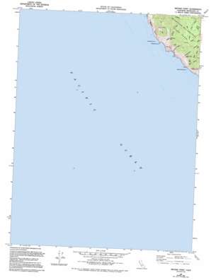
Mistake Point Topo Map California
To zoom in, hover over the map of Mistake Point
USGS Topo Quad 39123g8 - 1:24,000 scale
| Topo Map Name: | Mistake Point |
| USGS Topo Quad ID: | 39123g8 |
| Print Size: | ca. 21 1/4" wide x 27" high |
| Southeast Coordinates: | 39.75° N latitude / 123.875° W longitude |
| Map Center Coordinates: | 39.8125° N latitude / 123.9375° W longitude |
| U.S. State: | CA |
| Filename: | o39123g8.jpg |
| Download Map JPG Image: | Mistake Point topo map 1:24,000 scale |
| Map Type: | Topographic |
| Topo Series: | 7.5´ |
| Map Scale: | 1:24,000 |
| Source of Map Images: | United States Geological Survey (USGS) |
| Alternate Map Versions: |
Mistake Point CA 1969, updated 1974 Download PDF Buy paper map Mistake Point CA 1969, updated 1981 Download PDF Buy paper map Mistake Point CA 1969, updated 1994 Download PDF Buy paper map Mistake Point CA 2012 Download PDF Buy paper map Mistake Point CA 2015 Download PDF Buy paper map |
1:24,000 Topo Quads surrounding Mistake Point
Shelter Cove |
Briceland |
Garberville |
Harris |
|
Bear Harbor |
Piercy |
Noble Butte |
||
Mistake Point |
Hales Grove |
Leggett |
||
Westport |
Lincoln Ridge |
|||
Inglenook |
Dutchmans Knoll |
> Back to 39123e1 at 1:100,000 scale
> Back to 39122a1 at 1:250,000 scale
> Back to U.S. Topo Maps home
Mistake Point topo map: Gazetteer
Mistake Point: Capes
Mistake Point elevation 70m 229′Timber Point elevation 136m 446′
Mistake Point: Cliffs
Anderson Cliff elevation 69m 226′Mistake Point: Islands
Big White Rock elevation 0m 0′Jackass Cone elevation 0m 0′
Mistake Point: Streams
Little Jackass Creek elevation 10m 32′Mistake Point: Valleys
Anderson Gulch elevation 5m 16′Dark Gulch elevation 29m 95′
Northport Gulch elevation 5m 16′
Mistake Point: Woods
Sally Bell Grove elevation 417m 1368′Mistake Point digital topo map on disk
Buy this Mistake Point topo map showing relief, roads, GPS coordinates and other geographical features, as a high-resolution digital map file on DVD:


