Middle Island Topo Map New York
To zoom in, hover over the map of Middle Island
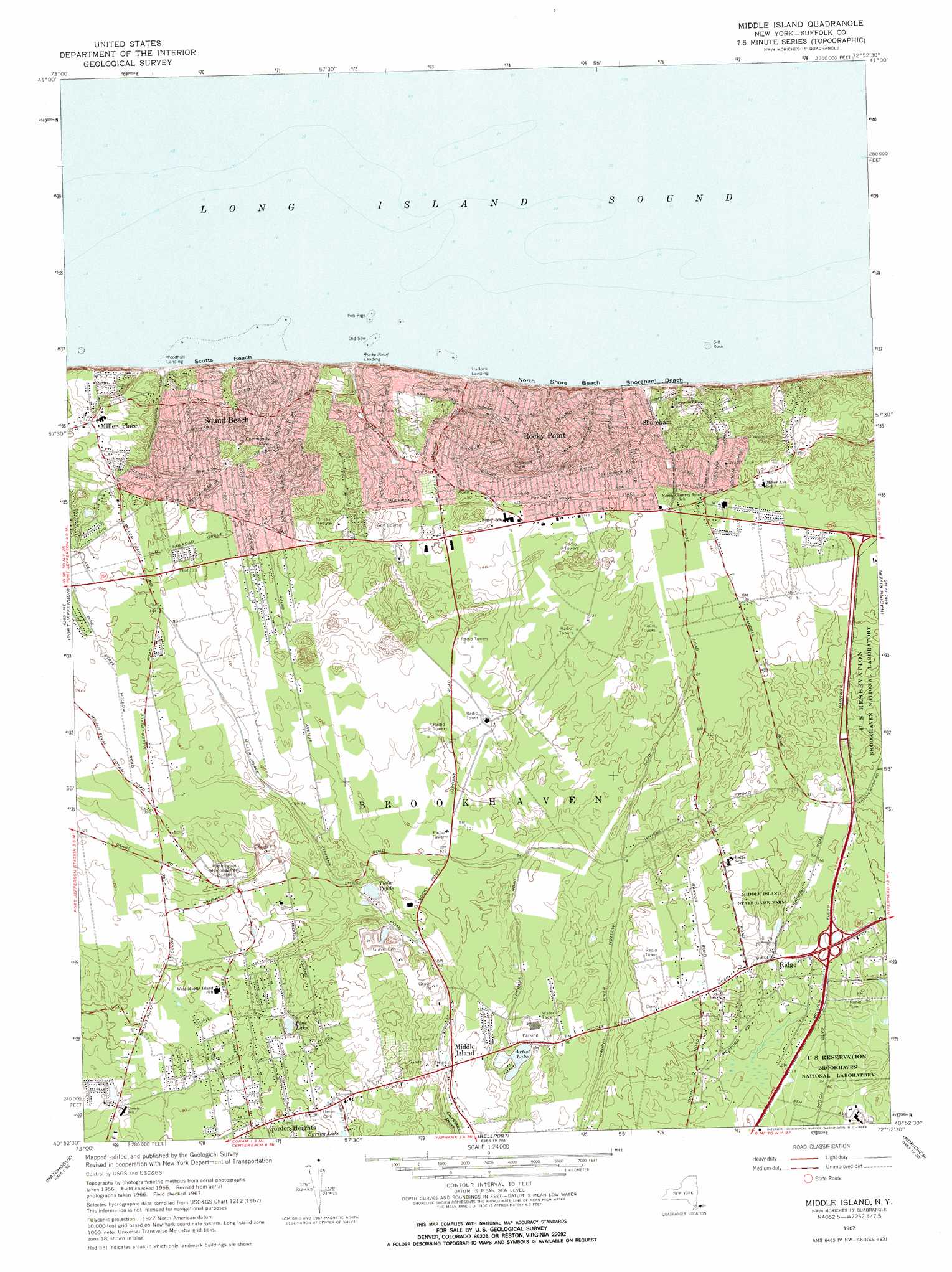
USGS Topo Quad 40072h8 - 1:24,000 scale
| Topo Map Name: | Middle Island |
| USGS Topo Quad ID: | 40072h8 |
| Print Size: | ca. 21 1/4" wide x 27" high |
| Southeast Coordinates: | 40.875° N latitude / 72.875° W longitude |
| Map Center Coordinates: | 40.9375° N latitude / 72.9375° W longitude |
| U.S. State: | NY |
| Filename: | o40072h8.jpg |
| Download Map JPG Image: | Middle Island topo map 1:24,000 scale |
| Map Type: | Topographic |
| Topo Series: | 7.5´ |
| Map Scale: | 1:24,000 |
| Source of Map Images: | United States Geological Survey (USGS) |
| Alternate Map Versions: |
Middle Island NY 1947 Download PDF Buy paper map Middle Island NY 1947 Download PDF Buy paper map Middle Island NY 1956, updated 1958 Download PDF Buy paper map Middle Island NY 1967, updated 1969 Download PDF Buy paper map Middle Island NY 2010 Download PDF Buy paper map Middle Island NY 2013 Download PDF Buy paper map Middle Island NY 2016 Download PDF Buy paper map |
1:24,000 Topo Quads surrounding Middle Island
Bridgeport |
Milford |
Woodmont |
||
Saint James |
Port Jefferson |
Middle Island |
Wading River |
Riverhead |
Central Islip |
Patchogue |
Bellport |
Moriches |
Eastport |
Bay Shore East |
Sayville |
Howells Point |
Pattersquash Island |
> Back to 40072e1 at 1:100,000 scale
> Back to 40072a1 at 1:250,000 scale
> Back to U.S. Topo Maps home
Middle Island topo map: Gazetteer
Middle Island: Bars
Old Sow elevation 0m 0′Sill Rock elevation 0m 0′
Two Pigs elevation 0m 0′
Middle Island: Beaches
North Shore Beach elevation 0m 0′Scotts Beach elevation 0m 0′
Shoreham Beach elevation 0m 0′
Middle Island: Lakes
Artist Lake elevation 14m 45′Pine Lake elevation 13m 42′
Twin Ponds elevation 13m 42′
Middle Island: Parks
Middle Island State Game Farm elevation 23m 75′Middle Island: Populated Places
East Shoreham elevation 37m 121′Middle Island elevation 25m 82′
Miller Place elevation 40m 131′
Ridge elevation 28m 91′
Rocky Point elevation 59m 193′
Shoreham elevation 20m 65′
Sound Beach elevation 54m 177′
Middle Island: Post Offices
Rocky Point Post Office elevation 49m 160′Shoreham Post Office elevation 21m 68′
Sound Beach Post Office elevation 56m 183′
Middle Island digital topo map on disk
Buy this Middle Island topo map showing relief, roads, GPS coordinates and other geographical features, as a high-resolution digital map file on DVD:
Atlantic Coast (NY, NJ, PA, DE, MD, VA, NC)
Buy digital topo maps: Atlantic Coast (NY, NJ, PA, DE, MD, VA, NC)
 map DVD")