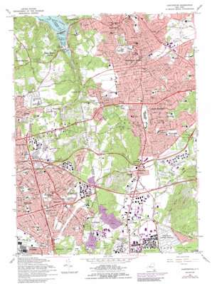
Huntington Topo Map New York
To zoom in, hover over the map of Huntington
USGS Topo Quad 40073g4 - 1:24,000 scale
| Topo Map Name: | Huntington |
| USGS Topo Quad ID: | 40073g4 |
| Print Size: | ca. 21 1/4" wide x 27" high |
| Southeast Coordinates: | 40.75° N latitude / 73.375° W longitude |
| Map Center Coordinates: | 40.8125° N latitude / 73.4375° W longitude |
| U.S. State: | NY |
| Filename: | o40073g4.jpg |
| Download Map JPG Image: | Huntington topo map 1:24,000 scale |
| Map Type: | Topographic |
| Topo Series: | 7.5´ |
| Map Scale: | 1:24,000 |
| Source of Map Images: | United States Geological Survey (USGS) |
| Alternate Map Versions: |
Huntington NY 1947 Download PDF Buy paper map Huntington NY 1954, updated 1956 Download PDF Buy paper map Huntington NY 1954, updated 1964 Download PDF Buy paper map Huntington NY 1967, updated 1969 Download PDF Buy paper map Huntington NY 1967, updated 1989 Download PDF Buy paper map Huntington NY 2010 Download PDF Buy paper map Huntington NY 2013 Download PDF Buy paper map Huntington NY 2016 Download PDF Buy paper map |
1:24,000 Topo Quads surrounding Huntington
> Back to 40073e1 at 1:100,000 scale
> Back to 40072a1 at 1:250,000 scale
> Back to U.S. Topo Maps home
Huntington topo map: Gazetteer
Huntington: Bays
Inner Harbor elevation 0m 0′Huntington: Beaches
Cold Spring Beach elevation 0m 0′Huntington: Crossings
Interchange 10 elevation 42m 137′Interchange 14 elevation 67m 219′
Interchange 36A elevation 56m 183′
Interchange 37 elevation 54m 177′
Interchange 37A elevation 67m 219′
Interchange 38 elevation 83m 272′
Interchange 39 elevation 73m 239′
Interchange 40 elevation 42m 137′
Interchange 41 elevation 55m 180′
Interchange 44 elevation 61m 200′
Interchange 45 elevation 60m 196′
Interchange 46 elevation 67m 219′
Interchange 48 elevation 61m 200′
Interchange 49 elevation 40m 131′
Huntington: Flats
Little Plains elevation 73m 239′Huntington: Parks
Battle Row Park elevation 53m 173′Bethpage Community Park elevation 38m 124′
Depot Park elevation 55m 180′
Fox Hollow Preserve elevation 42m 137′
Gwynne Park elevation 75m 246′
Howie Vogts Field elevation 37m 121′
Koster Park elevation 68m 223′
Little Plains Park elevation 64m 209′
Mannetto Hills Park elevation 70m 229′
Oakwood Park elevation 56m 183′
Plainview - Old Bethpage Community Park elevation 56m 183′
Ralph Bunche Plaza elevation 27m 88′
Stillwell Woods Park elevation 68m 223′
Syosset Woodbury Park elevation 71m 232′
The Great Lawn elevation 29m 95′
The Mall elevation 27m 88′
West Hills County Park elevation 75m 246′
Wolf Hill Park elevation 47m 154′
Huntington: Populated Places
Cold Spring Harbor elevation 10m 32′Huntington elevation 23m 75′
Huntington Station elevation 66m 216′
Laurel Hollow elevation 28m 91′
Lower Melville elevation 30m 98′
Melville elevation 41m 134′
Old Bethpage elevation 53m 173′
Plainview elevation 46m 150′
South Huntington elevation 63m 206′
Swedetown Village elevation 39m 127′
West Hills elevation 106m 347′
Woodbury elevation 54m 177′
Huntington: Post Offices
Cold Spring Harbor Post Office elevation 12m 39′Huntington Post Office elevation 16m 52′
Huntington: Summits
High Hill elevation 118m 387′Mannetto Hills elevation 85m 278′
West Hills elevation 106m 347′
Huntington digital topo map on disk
Buy this Huntington topo map showing relief, roads, GPS coordinates and other geographical features, as a high-resolution digital map file on DVD:
Atlantic Coast (NY, NJ, PA, DE, MD, VA, NC)
Buy digital topo maps: Atlantic Coast (NY, NJ, PA, DE, MD, VA, NC)


