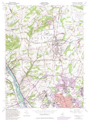
Pennington Topo Map New Jersey
To zoom in, hover over the map of Pennington
USGS Topo Quad 40074c7 - 1:24,000 scale
| Topo Map Name: | Pennington |
| USGS Topo Quad ID: | 40074c7 |
| Print Size: | ca. 21 1/4" wide x 27" high |
| Southeast Coordinates: | 40.25° N latitude / 74.75° W longitude |
| Map Center Coordinates: | 40.3125° N latitude / 74.8125° W longitude |
| U.S. States: | NJ, PA |
| Filename: | o40074c7.jpg |
| Download Map JPG Image: | Pennington topo map 1:24,000 scale |
| Map Type: | Topographic |
| Topo Series: | 7.5´ |
| Map Scale: | 1:24,000 |
| Source of Map Images: | United States Geological Survey (USGS) |
| Alternate Map Versions: |
Pennington NJ 1954, updated 1956 Download PDF Buy paper map Pennington NJ 1954, updated 1961 Download PDF Buy paper map Pennington NJ 1954, updated 1972 Download PDF Buy paper map Pennington NJ 1954, updated 1982 Download PDF Buy paper map Pennington NJ 1954, updated 1984 Download PDF Buy paper map Pennington NJ 1954, updated 1984 Download PDF Buy paper map Pennington NJ 1995, updated 1998 Download PDF Buy paper map Pennington NJ 2011 Download PDF Buy paper map Pennington NJ 2014 Download PDF Buy paper map Pennington NJ 2016 Download PDF Buy paper map |
1:24,000 Topo Quads surrounding Pennington
> Back to 40074a1 at 1:100,000 scale
> Back to 40074a1 at 1:250,000 scale
> Back to U.S. Topo Maps home
Pennington topo map: Gazetteer
Pennington: Airports
Department of Transportation elevation 38m 124′Ewing Complex elevation 45m 147′
Ksayian elevation 97m 318′
Mercer County Airport elevation 57m 187′
Pleasant Valley Airport elevation 24m 78′
Twin Pine Airport elevation 67m 219′
Weidel Airport elevation 90m 295′
Pennington: Crossings
Interchange 1 elevation 12m 39′Interchange 2 elevation 66m 216′
Interchange 3 elevation 54m 177′
Interchange 4 elevation 56m 183′
Interchange 5 elevation 42m 137′
Interchange 51A and 51B elevation 38m 124′
Pennington: Dams
Ceva Lake Dam elevation 30m 98′Sylva Lake Dam elevation 28m 91′
Pennington: Falls
Scudders Falls elevation 5m 16′Pennington: Parks
Ackerman Park elevation 34m 111′Armstrong Park elevation 40m 131′
Baldwin State Park elevation 61m 200′
Baldwin State Wildlife Management Area elevation 47m 154′
Banchoff Park elevation 56m 183′
Crestmont Park elevation 36m 118′
Curlis Lake County Park elevation 56m 183′
John S Watson Park elevation 41m 134′
Kunkel Park elevation 48m 157′
Lions Park elevation 34m 111′
Lions Stadium elevation 34m 111′
Moody Park elevation 33m 108′
Mountain View Park elevation 49m 160′
Old Mill Road County Park elevation 42m 137′
Rosedale Park elevation 49m 160′
Temple Park elevation 32m 104′
Washington Crossing State Park elevation 55m 180′
Pennington: Populated Places
Ackers Corner elevation 77m 252′Altura elevation 48m 157′
Baldwins Corner elevation 55m 180′
Bear Tavern elevation 58m 190′
Braeburn Heights elevation 36m 118′
Centerville elevation 61m 200′
Coopers Corner elevation 107m 351′
Ewing elevation 45m 147′
Ewingville elevation 44m 144′
Fernwood elevation 40m 131′
Ferry Road Manor elevation 34m 111′
Glenmoore elevation 62m 203′
Green Curve Heights elevation 36m 118′
Harbourton elevation 102m 334′
Harts Corner elevation 46m 150′
Heath Manor elevation 33m 108′
Marshalls Corner elevation 68m 223′
Parkway Village elevation 37m 121′
Pennington elevation 64m 209′
Scudders Falls elevation 30m 98′
Somerset elevation 40m 131′
Washington Crossing elevation 13m 42′
Washington Crossing elevation 20m 65′
West Trenton elevation 49m 160′
Wilburtha elevation 17m 55′
Pennington: Reservoirs
Ceva Lake elevation 30m 98′Curlis Lake elevation 47m 154′
Rosedale Lake elevation 37m 121′
Sylva Lake elevation 28m 91′
Pennington: Streams
Baldwins Creek elevation 42m 137′Dyers Creek elevation 3m 9′
Houghs Creek elevation 10m 32′
Jacobs Creek elevation 9m 29′
Lewis Brook elevation 43m 141′
Stony Brook Branch elevation 46m 150′
Woolsey Brook elevation 22m 72′
Pennington: Summits
Baldpate Mountain elevation 146m 479′Mount Canoe elevation 128m 419′
Pennington Mountain elevation 116m 380′
Pennington digital topo map on disk
Buy this Pennington topo map showing relief, roads, GPS coordinates and other geographical features, as a high-resolution digital map file on DVD:
Atlantic Coast (NY, NJ, PA, DE, MD, VA, NC)
Buy digital topo maps: Atlantic Coast (NY, NJ, PA, DE, MD, VA, NC)


