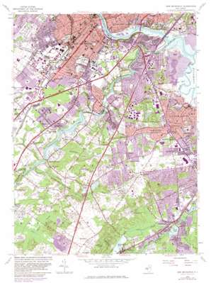
New Brunswick Topo Map New Jersey
To zoom in, hover over the map of New Brunswick
USGS Topo Quad 40074d4 - 1:24,000 scale
| Topo Map Name: | New Brunswick |
| USGS Topo Quad ID: | 40074d4 |
| Print Size: | ca. 21 1/4" wide x 27" high |
| Southeast Coordinates: | 40.375° N latitude / 74.375° W longitude |
| Map Center Coordinates: | 40.4375° N latitude / 74.4375° W longitude |
| U.S. State: | NJ |
| Filename: | o40074d4.jpg |
| Download Map JPG Image: | New Brunswick topo map 1:24,000 scale |
| Map Type: | Topographic |
| Topo Series: | 7.5´ |
| Map Scale: | 1:24,000 |
| Source of Map Images: | United States Geological Survey (USGS) |
| Alternate Map Versions: |
New Brunswick NJ 1954, updated 1956 Download PDF Buy paper map New Brunswick NJ 1954, updated 1965 Download PDF Buy paper map New Brunswick NJ 1954, updated 1972 Download PDF Buy paper map New Brunswick NJ 1954, updated 1982 Download PDF Buy paper map New Brunswick NJ 1954, updated 1982 Download PDF Buy paper map New Brunswick NJ 1995, updated 2000 Download PDF Buy paper map New Brunswick NJ 2011 Download PDF Buy paper map New Brunswick NJ 2014 Download PDF Buy paper map New Brunswick NJ 2016 Download PDF Buy paper map |
1:24,000 Topo Quads surrounding New Brunswick
> Back to 40074a1 at 1:100,000 scale
> Back to 40074a1 at 1:250,000 scale
> Back to U.S. Topo Maps home
New Brunswick topo map: Gazetteer
New Brunswick: Airports
East Brunswick elevation 1m 3′Jersey Turnpike Heliport elevation 24m 78′
Jersey Turnpike New Brunswick Helistop elevation 19m 62′
New Brunswick Gas Distribution Heliport elevation 33m 108′
Robert Wood Johnson Hospital Heliport elevation 28m 91′
Rutgers Helistop Sections A and B Heliport elevation 36m 118′
South Plainfield OMS Helistop elevation 8m 26′
Triangle Heliport elevation 36m 118′
Webcraft Heliport elevation 34m 111′
Zigfield elevation 33m 108′
New Brunswick: Bridges
Albany Street Bridge elevation 1m 3′Basilone Bridge elevation 1m 3′
Donald Goodkind Bridge elevation 1m 3′
Morris Goodkind Bridge elevation 1m 3′
New Brunswick: Canals
Great Ditch elevation 27m 88′New Brunswick: Channels
Rocky Reach elevation 1m 3′New Brunswick: Dams
Davidsons Millpond Dam elevation 19m 62′DeVoe Lake Dam elevation 3m 9′
Farrington Dam elevation 15m 49′
Helmetta Dam elevation 12m 39′
Westons Mill Pond Dam elevation 5m 16′
New Brunswick: Guts
Martins Creek elevation 2m 6′New Brunswick: Islands
Clancy Island elevation 13m 42′New Brunswick: Lakes
Whitney Pond elevation 2m 6′New Brunswick: Parks
Babbage Park elevation 30m 98′Baker Park elevation 22m 72′
Bicentennial Park elevation 21m 68′
Country Lane Park elevation 22m 72′
Daley's Pond Recreation Area elevation 2m 6′
Davidson Mill Pond County Park elevation 24m 78′
Donaldson County Park elevation 1m 3′
East Brunswick Community Park elevation 15m 49′
East Brunswick Community Park elevation 33m 108′
Elmer B Boyd Park elevation 1m 3′
Ireland Brook County Park elevation 21m 68′
Jamesburg County Park Conservation Area elevation 20m 65′
Kossuth Park elevation 25m 82′
Memorial Stadium elevation 28m 91′
North Brunswick Township Park elevation 20m 65′
Pacer's Field elevation 1m 3′
Pigeon Swamp State Park and Forest elevation 27m 88′
Pine Ridge Park elevation 15m 49′
Tices Lane Park elevation 20m 65′
New Brunswick: Populated Places
Adams elevation 36m 118′Berdines Corners elevation 33m 108′
Brookview elevation 29m 95′
Cottageville elevation 30m 98′
Dunhams Corners elevation 35m 114′
East Brunswick elevation 40m 131′
Edgebrook elevation 22m 72′
Fairview Knolls elevation 33m 108′
Farrington Lake Heights elevation 24m 78′
Feaster Park elevation 24m 78′
Fresh Ponds elevation 31m 101′
Gillilandtown elevation 30m 98′
Greensand elevation 14m 45′
Helmetta elevation 15m 49′
Herberts elevation 37m 121′
Highland Park elevation 30m 98′
Jamesburg Park elevation 31m 101′
Lawrence Brook Manor elevation 22m 72′
Lincoln Park elevation 24m 78′
Maple Meade elevation 33m 108′
Martins Landing elevation 20m 65′
Milltown elevation 25m 82′
New Brunswick elevation 26m 85′
Newton Heights elevation 43m 141′
Orchard Heights elevation 34m 111′
Outcalt elevation 9m 29′
Patricks Corners elevation 16m 52′
Paulas Corners elevation 28m 91′
Piscataway elevation 30m 98′
Raritan Gardens elevation 34m 111′
Red Lion elevation 33m 108′
Rutgers elevation 9m 29′
Somerset elevation 28m 91′
South River elevation 25m 82′
Spotswood elevation 9m 29′
Spotswood Manor elevation 9m 29′
Tanners Corners elevation 38m 124′
Voorhees elevation 30m 98′
Washington Heights elevation 17m 55′
Westons Mills elevation 14m 45′
New Brunswick: Post Offices
New Brunswick Main Post Office elevation 16m 52′New Brunswick: Reservoirs
Davidsons Millpond elevation 19m 62′DeVoe Lake elevation 3m 9′
Farrington Lake elevation 15m 49′
Helmetta Pond elevation 12m 39′
Lake Marguerite elevation 12m 39′
Silver Lake elevation 15m 49′
Westons Mill Pond elevation 5m 16′
New Brunswick: Streams
Beaverdam Brook elevation 15m 49′Cedar Brook elevation 3m 9′
Ireland Brook elevation 16m 52′
Lawrence Brook elevation 1m 3′
Manalapan Brook elevation 0m 0′
Matchaponix Brook elevation 2m 6′
Mill Brook elevation 1m 3′
Oakeys Brook elevation 16m 52′
Sawmill Brook elevation 6m 19′
South River elevation 1m 3′
Sucker Brook elevation 7m 22′
New Brunswick: Swamps
Pigeon Swamp elevation 27m 88′New Brunswick digital topo map on disk
Buy this New Brunswick topo map showing relief, roads, GPS coordinates and other geographical features, as a high-resolution digital map file on DVD:
Atlantic Coast (NY, NJ, PA, DE, MD, VA, NC)
Buy digital topo maps: Atlantic Coast (NY, NJ, PA, DE, MD, VA, NC)


