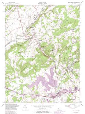
High Bridge Topo Map New Jersey
To zoom in, hover over the map of High Bridge
USGS Topo Quad 40074f8 - 1:24,000 scale
| Topo Map Name: | High Bridge |
| USGS Topo Quad ID: | 40074f8 |
| Print Size: | ca. 21 1/4" wide x 27" high |
| Southeast Coordinates: | 40.625° N latitude / 74.875° W longitude |
| Map Center Coordinates: | 40.6875° N latitude / 74.9375° W longitude |
| U.S. State: | NJ |
| Filename: | o40074f8.jpg |
| Download Map JPG Image: | High Bridge topo map 1:24,000 scale |
| Map Type: | Topographic |
| Topo Series: | 7.5´ |
| Map Scale: | 1:24,000 |
| Source of Map Images: | United States Geological Survey (USGS) |
| Alternate Map Versions: |
High Bridge NJ 1954, updated 1957 Download PDF Buy paper map High Bridge NJ 1954, updated 1965 Download PDF Buy paper map High Bridge NJ 1954, updated 1972 Download PDF Buy paper map High Bridge NJ 1954, updated 1979 Download PDF Buy paper map High Bridge NJ 2011 Download PDF Buy paper map High Bridge NJ 2014 Download PDF Buy paper map High Bridge NJ 2016 Download PDF Buy paper map |
1:24,000 Topo Quads surrounding High Bridge
> Back to 40074e1 at 1:100,000 scale
> Back to 40074a1 at 1:250,000 scale
> Back to U.S. Topo Maps home
High Bridge topo map: Gazetteer
High Bridge: Airports
Coach and Paddock Heliport elevation 110m 360′Lebanon Township Municipal Building Heliport elevation 291m 954′
Northwest Gas Division Elizabethtown Gas Heliport elevation 136m 446′
Sliker Strip elevation 254m 833′
Vliet Airport elevation 131m 429′
High Bridge: Crossings
Interchange 11 elevation 136m 446′Interchange 12 elevation 112m 367′
Interchange 13 elevation 127m 416′
Interchange 15 elevation 62m 203′
Interchange 16 elevation 63m 206′
Interchange 17 elevation 67m 219′
High Bridge: Dams
Clinton Mills Dam elevation 57m 187′Jutland Dam elevation 86m 282′
Lake Solitude Dam elevation 86m 282′
High Bridge: Parks
Clinton Wildlife Management Area elevation 86m 282′Spruce Run State Recreation Area elevation 97m 318′
Voorhees State Park elevation 211m 692′
High Bridge: Populated Places
Annandale elevation 91m 298′Anthony elevation 246m 807′
Bells Crossing elevation 151m 495′
Bunnvale elevation 216m 708′
Cedar Heights elevation 118m 387′
Changewater elevation 122m 400′
Charlestown elevation 219m 718′
Clarksville elevation 132m 433′
Clinton elevation 59m 193′
Franklin elevation 85m 278′
Glen Gardner elevation 140m 459′
Hampton elevation 165m 541′
Hampton Junction elevation 154m 505′
Hensfoot elevation 116m 380′
High Bridge elevation 99m 324′
Mariannes Corner elevation 80m 262′
New Hampton elevation 118m 387′
Newport elevation 189m 620′
Norton elevation 110m 360′
Perryville elevation 109m 357′
Pierce Heights elevation 111m 364′
Polktown elevation 204m 669′
Readingsburg elevation 97m 318′
Red Mill elevation 167m 547′
Spruce Run elevation 218m 715′
Stone Mill elevation 116m 380′
Union elevation 86m 282′
Van Syckel elevation 90m 295′
Woodglen elevation 294m 964′
High Bridge: Post Offices
Clinton Post Office elevation 57m 187′High Bridge: Reservoirs
Jutland Lake elevation 86m 282′Lake Solitude elevation 86m 282′
Lingerts Pond elevation 67m 219′
Spruce Run Reservoir elevation 79m 259′
High Bridge: Streams
Alpaugh Brook elevation 132m 433′Beaver Brook elevation 55m 180′
Black Brook elevation 79m 259′
Mulhockaway Creek elevation 79m 259′
Rocky Run elevation 92m 301′
Spruce Run elevation 80m 262′
Willoughby Brook elevation 80m 262′
High Bridge: Summits
Mount Kipp elevation 289m 948′High Bridge digital topo map on disk
Buy this High Bridge topo map showing relief, roads, GPS coordinates and other geographical features, as a high-resolution digital map file on DVD:
Atlantic Coast (NY, NJ, PA, DE, MD, VA, NC)
Buy digital topo maps: Atlantic Coast (NY, NJ, PA, DE, MD, VA, NC)


