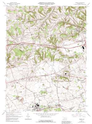
Topton Topo Map Pennsylvania
To zoom in, hover over the map of Topton
USGS Topo Quad 40075e6 - 1:24,000 scale
| Topo Map Name: | Topton |
| USGS Topo Quad ID: | 40075e6 |
| Print Size: | ca. 21 1/4" wide x 27" high |
| Southeast Coordinates: | 40.5° N latitude / 75.625° W longitude |
| Map Center Coordinates: | 40.5625° N latitude / 75.6875° W longitude |
| U.S. State: | PA |
| Filename: | o40075e6.jpg |
| Download Map JPG Image: | Topton topo map 1:24,000 scale |
| Map Type: | Topographic |
| Topo Series: | 7.5´ |
| Map Scale: | 1:24,000 |
| Source of Map Images: | United States Geological Survey (USGS) |
| Alternate Map Versions: |
Topton PA 1965, updated 1967 Download PDF Buy paper map Topton PA 1965, updated 1972 Download PDF Buy paper map Topton PA 1965, updated 1983 Download PDF Buy paper map Topton PA 1965, updated 1988 Download PDF Buy paper map Topton PA 1965, updated 1992 Download PDF Buy paper map Topton PA 1999, updated 2001 Download PDF Buy paper map Topton PA 2010 Download PDF Buy paper map Topton PA 2013 Download PDF Buy paper map Topton PA 2016 Download PDF Buy paper map |
1:24,000 Topo Quads surrounding Topton
> Back to 40075e1 at 1:100,000 scale
> Back to 40074a1 at 1:250,000 scale
> Back to U.S. Topo Maps home
Topton topo map: Gazetteer
Topton: Airports
Mid-State Heliport elevation 226m 741′Zettlemoyer Airport elevation 181m 593′
Topton: Flats
The Cove elevation 143m 469′Topton: Lakes
Fogelsville Pond elevation 131m 429′Topton: Parks
Longswamp Community Park elevation 153m 501′Topton Community Park elevation 151m 495′
Topton: Populated Places
Breinigsville elevation 124m 406′Claussville elevation 203m 666′
Country View Mobile Home Park elevation 137m 449′
Farmington elevation 144m 472′
Five Points elevation 149m 488′
Fogelsville elevation 144m 472′
Haafsville elevation 146m 479′
Hancock elevation 145m 475′
Hartzell (historical) elevation 137m 449′
Helfrichsville elevation 219m 718′
Hinterleiter elevation 134m 439′
Hynemansville elevation 210m 688′
Klines Corner elevation 143m 469′
Laros (historical) elevation 139m 456′
Leather Corner Post elevation 209m 685′
Maxatawny elevation 146m 479′
Mertztown elevation 143m 469′
Mill Creek Corner elevation 148m 485′
Monterey elevation 167m 547′
New Smithville elevation 171m 561′
Newtown elevation 140m 459′
North Fogelsville elevation 146m 479′
Oreville elevation 144m 472′
Ringtown elevation 149m 488′
Schofer elevation 161m 528′
Seiberlingville elevation 249m 816′
Seipstown elevation 224m 734′
Shamrock Station elevation 134m 439′
Topton elevation 147m 482′
Wallner (historical) elevation 146m 479′
Weisenberg elevation 172m 564′
Topton: Post Offices
Topton Post Office elevation 148m 485′Topton: Streams
Breinig Run elevation 121m 396′Toad Creek elevation 118m 387′
Topton: Summits
Cherry Hill elevation 190m 623′Haas Hill elevation 185m 606′
Topton digital topo map on disk
Buy this Topton topo map showing relief, roads, GPS coordinates and other geographical features, as a high-resolution digital map file on DVD:
Atlantic Coast (NY, NJ, PA, DE, MD, VA, NC)
Buy digital topo maps: Atlantic Coast (NY, NJ, PA, DE, MD, VA, NC)


