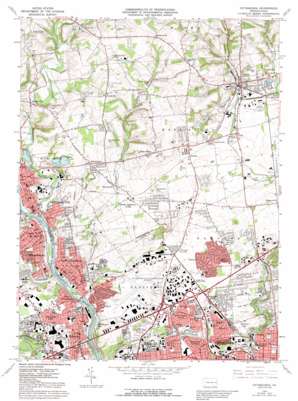
Catasauqua Topo Map Pennsylvania
To zoom in, hover over the map of Catasauqua
USGS Topo Quad 40075f4 - 1:24,000 scale
| Topo Map Name: | Catasauqua |
| USGS Topo Quad ID: | 40075f4 |
| Print Size: | ca. 21 1/4" wide x 27" high |
| Southeast Coordinates: | 40.625° N latitude / 75.375° W longitude |
| Map Center Coordinates: | 40.6875° N latitude / 75.4375° W longitude |
| U.S. State: | PA |
| Filename: | o40075f4.jpg |
| Download Map JPG Image: | Catasauqua topo map 1:24,000 scale |
| Map Type: | Topographic |
| Topo Series: | 7.5´ |
| Map Scale: | 1:24,000 |
| Source of Map Images: | United States Geological Survey (USGS) |
| Alternate Map Versions: |
Catasauqua PA 1964, updated 1966 Download PDF Buy paper map Catasauqua PA 1964, updated 1972 Download PDF Buy paper map Catasauqua PA 1964, updated 1973 Download PDF Buy paper map Catasauqua PA 1964, updated 1984 Download PDF Buy paper map Catasauqua PA 1964, updated 1992 Download PDF Buy paper map Catasauqua PA 1999, updated 2001 Download PDF Buy paper map Catasauqua PA 2010 Download PDF Buy paper map Catasauqua PA 2013 Download PDF Buy paper map Catasauqua PA 2016 Download PDF Buy paper map |
1:24,000 Topo Quads surrounding Catasauqua
> Back to 40075e1 at 1:100,000 scale
> Back to 40074a1 at 1:250,000 scale
> Back to U.S. Topo Maps home
Catasauqua topo map: Gazetteer
Catasauqua: Airports
Martin Airport elevation 106m 347′WSAN Heliport elevation 116m 380′
Catasauqua: Dams
Illicks Mill Dam elevation 85m 278′Lappawinzo Dam elevation 103m 337′
Mill Dam elevation 84m 275′
Mill Dam elevation 83m 272′
Supply Dam elevation 92m 301′
Catasauqua: Lakes
Catasauqua Lake elevation 79m 259′Catasauqua: Parks
Beth-Allen Park elevation 108m 354′Bicentennial Park elevation 118m 387′
Birchwood Park elevation 112m 367′
Boro Meadow Park elevation 134m 439′
Buchanan Park elevation 93m 305′
Clearview Park elevation 107m 351′
College Heights Park elevation 128m 419′
Delta Manor Park elevation 111m 364′
Fullerton Legion Field elevation 106m 347′
Gertrude B Fox County Park elevation 87m 285′
Hanover Township Municipal Park elevation 102m 334′
Hokendauqua Playground elevation 89m 291′
Holton Park elevation 104m 341′
Homertown Park elevation 125m 410′
Keystone Park elevation 134m 439′
Marricot Field elevation 111m 364′
Memorial Park elevation 113m 370′
Monocacy Park elevation 99m 324′
Peachtree Park elevation 125m 410′
Phard Park elevation 117m 383′
Sentee Heights Park elevation 100m 328′
Sherwood Park elevation 118m 387′
South Catty Field elevation 116m 380′
Stratford Park elevation 87m 285′
Village View Park elevation 112m 367′
Weaversville County Park elevation 120m 393′
Westgate Park elevation 109m 357′
William Kennedy Athletic Complex elevation 110m 360′
Catasauqua: Populated Places
Allen Junction elevation 93m 305′Arlington Knolls elevation 95m 311′
Bath elevation 129m 423′
Bath Junction elevation 127m 416′
Beersville elevation 159m 521′
Catasauqua elevation 95m 311′
Chickentown elevation 120m 393′
Clyde elevation 122m 400′
Coplay elevation 123m 403′
Dannersville elevation 221m 725′
Delta Manor elevation 110m 360′
Evergreen Park elevation 121m 396′
Franks Corner elevation 141m 462′
Fullerton elevation 113m 370′
Hanover elevation 118m 387′
Hawktown elevation 113m 370′
Hokendauqua elevation 112m 367′
Howertown elevation 130m 426′
Jacksonville elevation 127m 416′
Jamesville elevation 221m 725′
Juniper Circle elevation 115m 377′
Kaywin elevation 103m 337′
Kreidersville elevation 152m 498′
Lerchs elevation 128m 419′
Mickleys elevation 117m 383′
Midway Manor elevation 115m 377′
Miller Manor elevation 162m 531′
Nelighsville elevation 123m 403′
Newport elevation 94m 308′
North Catasauqua elevation 112m 367′
Northampton elevation 99m 324′
Notre Dame Hills elevation 115m 377′
Rosemont Terrace elevation 100m 328′
Schoenersville elevation 118m 387′
Seemsville elevation 204m 669′
Shimer elevation 112m 367′
Stafore Estates elevation 117m 383′
Weaversville elevation 122m 400′
West Catasauqua elevation 116m 380′
Westgate Hills elevation 107m 351′
Catasauqua: Post Offices
Lehigh Valley Post Office elevation 108m 354′Catasauqua: Reservoirs
Cheesebrough Pond elevation 196m 643′Miller Slate Pond elevation 156m 511′
Penn-Dixie Pond elevation 110m 360′
Catasauqua: Springs
Helfrichs Spring elevation 84m 275′Catasauqua: Streams
Catasauqua Creek elevation 77m 252′Coplay Creek elevation 82m 269′
Dry Run elevation 82m 269′
Hokendauqua Creek elevation 82m 269′
Catasauqua: Summits
Holiday Hill elevation 193m 633′Klein Hill elevation 209m 685′
Pinetop elevation 137m 449′
Sauerkraut Hill elevation 177m 580′
Catasauqua digital topo map on disk
Buy this Catasauqua topo map showing relief, roads, GPS coordinates and other geographical features, as a high-resolution digital map file on DVD:
Atlantic Coast (NY, NJ, PA, DE, MD, VA, NC)
Buy digital topo maps: Atlantic Coast (NY, NJ, PA, DE, MD, VA, NC)


