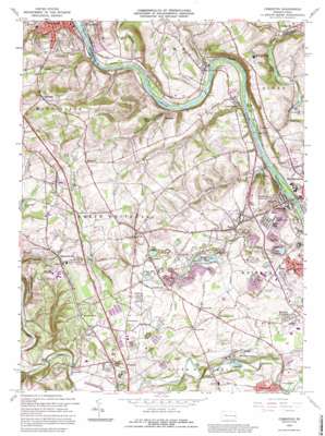
Cementon Topo Map Pennsylvania
To zoom in, hover over the map of Cementon
USGS Topo Quad 40075f5 - 1:24,000 scale
| Topo Map Name: | Cementon |
| USGS Topo Quad ID: | 40075f5 |
| Print Size: | ca. 21 1/4" wide x 27" high |
| Southeast Coordinates: | 40.625° N latitude / 75.5° W longitude |
| Map Center Coordinates: | 40.6875° N latitude / 75.5625° W longitude |
| U.S. State: | PA |
| Filename: | o40075f5.jpg |
| Download Map JPG Image: | Cementon topo map 1:24,000 scale |
| Map Type: | Topographic |
| Topo Series: | 7.5´ |
| Map Scale: | 1:24,000 |
| Source of Map Images: | United States Geological Survey (USGS) |
| Alternate Map Versions: |
Cementon PA 1964, updated 1966 Download PDF Buy paper map Cementon PA 1964, updated 1973 Download PDF Buy paper map Cementon PA 1964, updated 1984 Download PDF Buy paper map Cementon PA 1992, updated 1995 Download PDF Buy paper map Cementon PA 1999, updated 2001 Download PDF Buy paper map Cementon PA 2010 Download PDF Buy paper map Cementon PA 2013 Download PDF Buy paper map Cementon PA 2016 Download PDF Buy paper map |
1:24,000 Topo Quads surrounding Cementon
> Back to 40075e1 at 1:100,000 scale
> Back to 40074a1 at 1:250,000 scale
> Back to U.S. Topo Maps home
Cementon topo map: Gazetteer
Cementon: Airports
Alexanders-Roosevelt Heliport elevation 209m 685′Hi-Vu Airport elevation 205m 672′
Schneck Airport elevation 288m 944′
Cementon: Bridges
Geiger Covered Bridge elevation 115m 377′Manassas Guth Covered Bridge elevation 97m 318′
Rex Covered Bridge elevation 109m 357′
Wehr Covered Bridge elevation 100m 328′
Cementon: Dams
Kerns Dam elevation 105m 344′Northampton Dam elevation 85m 278′
Number Four Dam elevation 94m 308′
Old Laury Dam elevation 112m 367′
Spring Mill Dam elevation 98m 321′
Treichlers Dam elevation 100m 328′
Wehrs Dam elevation 100m 328′
Whitehall Dam elevation 86m 282′
Cementon: Lakes
Ranger Lake elevation 110m 360′Todd Lake elevation 138m 452′
Twin Lakes elevation 124m 406′
Cementon: Parks
Indian Trail Park elevation 136m 446′Neffs Park elevation 179m 587′
Sand Springs Park elevation 168m 551′
Victory Park elevation 197m 646′
Cementon: Populated Places
Balliettsville elevation 169m 554′Cementon elevation 96m 314′
Coffeetown elevation 149m 488′
Dewey Heights elevation 148m 485′
Egypt elevation 126m 413′
Friedens elevation 190m 623′
Greenawalds elevation 130m 426′
Home Park elevation 151m 495′
Ironton elevation 143m 469′
Kernsville elevation 130m 426′
Laurys Station elevation 115m 377′
Lockport elevation 116m 380′
Lockridge elevation 126m 413′
Mechanicsville elevation 133m 436′
Metamora Station elevation 126m 413′
Meyersville elevation 143m 469′
Mickleys Gardens elevation 112m 367′
Neffs elevation 209m 685′
Newhard elevation 220m 721′
North Coplay elevation 107m 351′
Orefield elevation 138m 452′
Ormrod elevation 127m 416′
Pennsville elevation 148m 485′
Raubs Mills elevation 164m 538′
Rising Sun elevation 198m 649′
River View elevation 191m 626′
Rockdale elevation 132m 433′
Ruchsville elevation 126m 413′
Scheidy elevation 197m 646′
Scherersville elevation 95m 311′
Schnecksville elevation 202m 662′
Seiple elevation 125m 410′
Shankweilers elevation 193m 633′
Slatington elevation 151m 495′
Stiles elevation 109m 357′
Treichlers elevation 117m 383′
Trout Creek elevation 125m 410′
Unionville elevation 207m 679′
Walnut Acres elevation 216m 708′
Walnutport Acres elevation 128m 419′
Wellington elevation 125m 410′
Williamstown elevation 132m 433′
Cementon: Reservoirs
Boyer Pond elevation 124m 406′Cementon Reservoir elevation 118m 387′
Clear Spring Pond elevation 104m 341′
Copeechan Pond elevation 182m 597′
Frey Pond elevation 190m 623′
Grouse Hall Pond elevation 125m 410′
Spring Pond elevation 94m 308′
Cementon: Springs
Sand Springs elevation 168m 551′Cementon: Streams
Bertsch Creek elevation 103m 337′Fells Creek elevation 88m 288′
Haasen Creek elevation 106m 347′
Indian Creek elevation 108m 354′
Rockdale Creek elevation 104m 341′
Spring Creek elevation 85m 278′
Cementon: Summits
Clover Hill elevation 257m 843′Hungary Hill elevation 205m 672′
Laurel Hill elevation 202m 662′
Sandstone Ridge elevation 311m 1020′
Sandstone Ridge elevation 211m 692′
Schantz Hill elevation 231m 757′
Cementon digital topo map on disk
Buy this Cementon topo map showing relief, roads, GPS coordinates and other geographical features, as a high-resolution digital map file on DVD:
Atlantic Coast (NY, NJ, PA, DE, MD, VA, NC)
Buy digital topo maps: Atlantic Coast (NY, NJ, PA, DE, MD, VA, NC)


