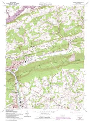
Palmerton Topo Map Pennsylvania
To zoom in, hover over the map of Palmerton
USGS Topo Quad 40075g5 - 1:24,000 scale
| Topo Map Name: | Palmerton |
| USGS Topo Quad ID: | 40075g5 |
| Print Size: | ca. 21 1/4" wide x 27" high |
| Southeast Coordinates: | 40.75° N latitude / 75.5° W longitude |
| Map Center Coordinates: | 40.8125° N latitude / 75.5625° W longitude |
| U.S. State: | PA |
| Filename: | o40075g5.jpg |
| Download Map JPG Image: | Palmerton topo map 1:24,000 scale |
| Map Type: | Topographic |
| Topo Series: | 7.5´ |
| Map Scale: | 1:24,000 |
| Source of Map Images: | United States Geological Survey (USGS) |
| Alternate Map Versions: |
Palmerton PA 1960, updated 1961 Download PDF Buy paper map Palmerton PA 1960, updated 1969 Download PDF Buy paper map Palmerton PA 1960, updated 1972 Download PDF Buy paper map Palmerton PA 1960, updated 1979 Download PDF Buy paper map Palmerton PA 1960, updated 1984 Download PDF Buy paper map Palmerton PA 1960, updated 1989 Download PDF Buy paper map Palmerton PA 1976, updated 1978 Download PDF Buy paper map Palmerton PA 1997, updated 1999 Download PDF Buy paper map Palmerton PA 2010 Download PDF Buy paper map Palmerton PA 2013 Download PDF Buy paper map Palmerton PA 2016 Download PDF Buy paper map |
1:24,000 Topo Quads surrounding Palmerton
> Back to 40075e1 at 1:100,000 scale
> Back to 40074a1 at 1:250,000 scale
> Back to U.S. Topo Maps home
Palmerton topo map: Gazetteer
Palmerton: Airports
Dieters Airport elevation 233m 764′Slatington Airport elevation 113m 370′
Palmerton: Areas
Devils Potato Patch elevation 333m 1092′Palmerton: Canals
Lehigh Canal elevation 111m 364′Palmerton: Dams
Constantini Dam elevation 203m 666′Kerns Dam elevation 112m 367′
Number Four Dam elevation 179m 587′
Number One Dam elevation 187m 613′
Palmerton: Gaps
Lehigh Gap elevation 156m 511′Little Gap elevation 332m 1089′
Palmerton: Islands
Craigs Island (historical) elevation 122m 400′Palmerton: Parks
Beltzville State Park elevation 193m 633′Palmerton: Pillars
Devils Pulpit elevation 267m 875′Palmerton: Populated Places
Apps elevation 174m 570′Aquashicola elevation 127m 416′
Berlinsville elevation 176m 577′
Bossards Corner elevation 198m 649′
Cherryville elevation 221m 725′
Christian Corner elevation 213m 698′
Danielsville elevation 208m 682′
Edgemont elevation 177m 580′
Harpers elevation 176m 577′
Howersville elevation 160m 524′
Indianland elevation 180m 590′
Jonesville elevation 197m 646′
Lehigh Gap elevation 116m 380′
Little Gap elevation 144m 472′
Palmerton elevation 122m 400′
Palmerton East elevation 122m 400′
Slate Valley elevation 139m 456′
Stemlersville elevation 277m 908′
Walkton elevation 133m 436′
Walnutport elevation 116m 380′
Weiders Crossing elevation 153m 501′
Welshtown elevation 136m 446′
Palmerton: Reservoirs
Indianola Lake elevation 170m 557′Palmerton: Ridges
Stony Ridge elevation 246m 807′Palmerton: Streams
Aquashicola Creek elevation 114m 374′Borger Creek elevation 145m 475′
Buckwha Creek elevation 132m 433′
Hunter Creek elevation 139m 456′
Mill Creek elevation 124m 406′
Trout Creek elevation 104m 341′
Palmerton: Valleys
Trinity Gorge elevation 199m 652′Palmerton digital topo map on disk
Buy this Palmerton topo map showing relief, roads, GPS coordinates and other geographical features, as a high-resolution digital map file on DVD:
Atlantic Coast (NY, NJ, PA, DE, MD, VA, NC)
Buy digital topo maps: Atlantic Coast (NY, NJ, PA, DE, MD, VA, NC)


