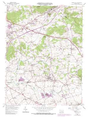
Terre Hill Topo Map Pennsylvania
To zoom in, hover over the map of Terre Hill
USGS Topo Quad 40076b1 - 1:24,000 scale
| Topo Map Name: | Terre Hill |
| USGS Topo Quad ID: | 40076b1 |
| Print Size: | ca. 21 1/4" wide x 27" high |
| Southeast Coordinates: | 40.125° N latitude / 76° W longitude |
| Map Center Coordinates: | 40.1875° N latitude / 76.0625° W longitude |
| U.S. State: | PA |
| Filename: | o40076b1.jpg |
| Download Map JPG Image: | Terre Hill topo map 1:24,000 scale |
| Map Type: | Topographic |
| Topo Series: | 7.5´ |
| Map Scale: | 1:24,000 |
| Source of Map Images: | United States Geological Survey (USGS) |
| Alternate Map Versions: |
Terre Hill PA 1956, updated 1957 Download PDF Buy paper map Terre Hill PA 1956, updated 1965 Download PDF Buy paper map Terre Hill PA 1956, updated 1970 Download PDF Buy paper map Terre Hill PA 1956, updated 1976 Download PDF Buy paper map Terre Hill PA 1956, updated 1978 Download PDF Buy paper map Terre Hill PA 1956, updated 1987 Download PDF Buy paper map Terre Hill PA 1999, updated 2001 Download PDF Buy paper map Terre Hill PA 2010 Download PDF Buy paper map Terre Hill PA 2013 Download PDF Buy paper map Terre Hill PA 2016 Download PDF Buy paper map |
1:24,000 Topo Quads surrounding Terre Hill
> Back to 40076a1 at 1:100,000 scale
> Back to 40076a1 at 1:250,000 scale
> Back to U.S. Topo Maps home
Terre Hill topo map: Gazetteer
Terre Hill: Parks
Brubaker Park elevation 133m 436′Memorial Park elevation 118m 387′
Terre Hill: Populated Places
Adamstown elevation 144m 472′Bowmansville elevation 132m 433′
Fivepointville elevation 140m 459′
Frysville elevation 109m 357′
Goodville elevation 163m 534′
Hahnstown elevation 128m 419′
Hinkletown elevation 113m 370′
Martindale elevation 115m 377′
Napiersville elevation 140m 459′
Reamstown elevation 118m 387′
Red Run elevation 124m 406′
Swartzville elevation 171m 561′
Terre Hill elevation 165m 541′
Union Grove elevation 138m 452′
Weaverland elevation 114m 374′
Terre Hill: Post Offices
Bowmansville Post Office (historical) elevation 132m 433′Fairville Post Office (historical) elevation 165m 541′
Goodville Post Office (historical) elevation 163m 534′
Muddy Creek Post Office (historical) elevation 140m 459′
Swartzville Post Office (historical) elevation 171m 561′
Weavers Mill Post Office (historical) elevation 114m 374′
Terre Hill: Streams
Black Creek elevation 115m 377′Cedar Creek elevation 115m 377′
Little Muddy Creek elevation 108m 354′
Muddy Creek elevation 97m 318′
Rock Run elevation 121m 396′
Shirks Run elevation 109m 357′
Terre Hill: Summits
Turkey Hill elevation 255m 836′Terre Hill digital topo map on disk
Buy this Terre Hill topo map showing relief, roads, GPS coordinates and other geographical features, as a high-resolution digital map file on DVD:
Atlantic Coast (NY, NJ, PA, DE, MD, VA, NC)
Buy digital topo maps: Atlantic Coast (NY, NJ, PA, DE, MD, VA, NC)


