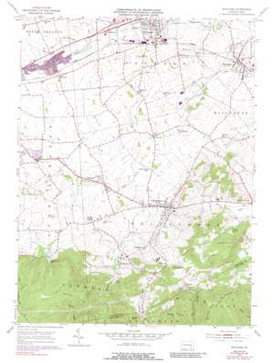
Richland Topo Map Pennsylvania
To zoom in, hover over the map of Richland
USGS Topo Quad 40076c3 - 1:24,000 scale
| Topo Map Name: | Richland |
| USGS Topo Quad ID: | 40076c3 |
| Print Size: | ca. 21 1/4" wide x 27" high |
| Southeast Coordinates: | 40.25° N latitude / 76.25° W longitude |
| Map Center Coordinates: | 40.3125° N latitude / 76.3125° W longitude |
| U.S. State: | PA |
| Filename: | o40076c3.jpg |
| Download Map JPG Image: | Richland topo map 1:24,000 scale |
| Map Type: | Topographic |
| Topo Series: | 7.5´ |
| Map Scale: | 1:24,000 |
| Source of Map Images: | United States Geological Survey (USGS) |
| Alternate Map Versions: |
Richland PA 1955, updated 1956 Download PDF Buy paper map Richland PA 1955, updated 1967 Download PDF Buy paper map Richland PA 1955, updated 1970 Download PDF Buy paper map Richland PA 1955, updated 1977 Download PDF Buy paper map Richland PA 1955, updated 1988 Download PDF Buy paper map Richland PA 1955, updated 1988 Download PDF Buy paper map Richland PA 2010 Download PDF Buy paper map Richland PA 2013 Download PDF Buy paper map Richland PA 2016 Download PDF Buy paper map |
1:24,000 Topo Quads surrounding Richland
> Back to 40076a1 at 1:100,000 scale
> Back to 40076a1 at 1:250,000 scale
> Back to U.S. Topo Maps home
Richland topo map: Gazetteer
Richland: Airports
Keller Brothers Airport elevation 165m 541′Lebanon Valley Airpark elevation 148m 485′
Richland: Dams
Lebanon Dam Number One elevation 183m 600′Rexmont Number Two Dam elevation 202m 662′
Tulpehocken Fishing Club Dam elevation 145m 475′
Richland: Populated Places
Avon Heights elevation 155m 508′Buffalo Springs elevation 159m 521′
Canaan Grove elevation 199m 652′
Dogtown elevation 191m 626′
Flintville elevation 188m 616′
Iona elevation 165m 541′
Johnstown elevation 158m 518′
Moonstown elevation 170m 557′
Myerstown elevation 146m 479′
Prescott elevation 152m 498′
Reistville elevation 166m 544′
Richland elevation 150m 492′
Schaefferstown elevation 176m 577′
Springhaven elevation 170m 557′
Waldeck elevation 197m 646′
Weavertown elevation 152m 498′
Richland: Ranges
Furnace Hills elevation 320m 1049′Richland: Reservoirs
Lebanon Reservoir elevation 194m 636′Rexmont Number Two Reservoir elevation 202m 662′
Richland: Ridges
Black Oak Ridge elevation 319m 1046′Richland: Springs
Schaefferstown Spring elevation 177m 580′Richland: Summits
Cannon Hill elevation 262m 859′Forge Hill elevation 259m 849′
White Oak Hill elevation 258m 846′
Richland: Trails
Horseshoe Trail elevation 196m 643′Richland digital topo map on disk
Buy this Richland topo map showing relief, roads, GPS coordinates and other geographical features, as a high-resolution digital map file on DVD:
Atlantic Coast (NY, NJ, PA, DE, MD, VA, NC)
Buy digital topo maps: Atlantic Coast (NY, NJ, PA, DE, MD, VA, NC)


