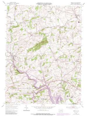
Bernville Topo Map Pennsylvania
To zoom in, hover over the map of Bernville
USGS Topo Quad 40076d1 - 1:24,000 scale
| Topo Map Name: | Bernville |
| USGS Topo Quad ID: | 40076d1 |
| Print Size: | ca. 21 1/4" wide x 27" high |
| Southeast Coordinates: | 40.375° N latitude / 76° W longitude |
| Map Center Coordinates: | 40.4375° N latitude / 76.0625° W longitude |
| U.S. State: | PA |
| Filename: | o40076d1.jpg |
| Download Map JPG Image: | Bernville topo map 1:24,000 scale |
| Map Type: | Topographic |
| Topo Series: | 7.5´ |
| Map Scale: | 1:24,000 |
| Source of Map Images: | United States Geological Survey (USGS) |
| Alternate Map Versions: |
Bernville PA 1955, updated 1956 Download PDF Buy paper map Bernville PA 1955, updated 1969 Download PDF Buy paper map Bernville PA 1955, updated 1970 Download PDF Buy paper map Bernville PA 1955, updated 1978 Download PDF Buy paper map Bernville PA 1955, updated 1987 Download PDF Buy paper map Bernville PA 1992, updated 1995 Download PDF Buy paper map Bernville PA 2010 Download PDF Buy paper map Bernville PA 2013 Download PDF Buy paper map Bernville PA 2016 Download PDF Buy paper map |
1:24,000 Topo Quads surrounding Bernville
> Back to 40076a1 at 1:100,000 scale
> Back to 40076a1 at 1:250,000 scale
> Back to U.S. Topo Maps home
Bernville topo map: Gazetteer
Bernville: Airports
Malmo Airport elevation 123m 403′Bernville: Bridges
Conrads Bridge elevation 86m 282′Lamms Bridge elevation 86m 282′
Werts Bridge elevation 97m 318′
Bernville: Dams
Blue Marsh Bernville Levee elevation 91m 298′Blue Marsh Dam elevation 86m 282′
Blue Marsh Dike A elevation 94m 308′
Blue Marsh Dike B elevation 93m 305′
Fox Lake Dam elevation 86m 282′
Fox Lake Dam elevation 86m 282′
Bernville: Parks
Blue Marsh Lake National Recreation Area elevation 104m 341′Dry Brooks Day-Use Area elevation 96m 314′
Jefferson Park elevation 103m 337′
Kisslings Field elevation 100m 328′
Stanton Clay Park elevation 97m 318′
Umbenhauer Park elevation 99m 324′
Bernville: Populated Places
Bernville elevation 100m 328′Bloomsburg elevation 175m 574′
Centerport elevation 101m 331′
Fairview Heights elevation 168m 551′
Garfield elevation 120m 393′
Mount Pleasant elevation 107m 351′
Pleasant Valley elevation 85m 278′
Bernville: Reservoirs
Blue Marsh Lake elevation 86m 282′Blue Marsh Lake Stilling Basin elevation 71m 232′
Detention Basin Number One elevation 96m 314′
Detention Basin Number Two elevation 98m 321′
Fox Lake elevation 86m 282′
Bernville: Streams
Lesher Run elevation 102m 334′Licking Creek elevation 86m 282′
Little Northkill Creek elevation 97m 318′
Mollhead Creek elevation 140m 459′
Northkill Creek elevation 87m 285′
Plum Creek elevation 96m 314′
Spring Creek elevation 86m 282′
Wolf Creek elevation 128m 419′
Bernville: Summits
Scull Hill elevation 202m 662′Scull Hill elevation 273m 895′
Bernville: Trails
Blue Marsh Lake Hiking Trail elevation 97m 318′Eyes of the Eagle Sensory Trail elevation 124m 406′
Foxtrot Hiking Loop elevation 115m 377′
Great Oak Nature Trail elevation 126m 413′
Skinners Loops elevation 110m 360′
Bernville digital topo map on disk
Buy this Bernville topo map showing relief, roads, GPS coordinates and other geographical features, as a high-resolution digital map file on DVD:
Atlantic Coast (NY, NJ, PA, DE, MD, VA, NC)
Buy digital topo maps: Atlantic Coast (NY, NJ, PA, DE, MD, VA, NC)


