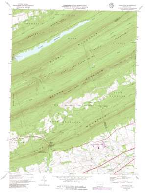
Grantville Topo Map Pennsylvania
To zoom in, hover over the map of Grantville
USGS Topo Quad 40076d6 - 1:24,000 scale
| Topo Map Name: | Grantville |
| USGS Topo Quad ID: | 40076d6 |
| Print Size: | ca. 21 1/4" wide x 27" high |
| Southeast Coordinates: | 40.375° N latitude / 76.625° W longitude |
| Map Center Coordinates: | 40.4375° N latitude / 76.6875° W longitude |
| U.S. State: | PA |
| Filename: | o40076d6.jpg |
| Download Map JPG Image: | Grantville topo map 1:24,000 scale |
| Map Type: | Topographic |
| Topo Series: | 7.5´ |
| Map Scale: | 1:24,000 |
| Source of Map Images: | United States Geological Survey (USGS) |
| Alternate Map Versions: |
Manada Gap PA 1947 Download PDF Buy paper map Manada Gap PA 1947, updated 1947 Download PDF Buy paper map Manada Gap PA 1947, updated 1965 Download PDF Buy paper map Grantville PA 1969, updated 1972 Download PDF Buy paper map Grantville PA 1969, updated 1978 Download PDF Buy paper map Grantville PA 1969, updated 1979 Download PDF Buy paper map Grantville PA 1969, updated 1979 Download PDF Buy paper map Grantville PA 1969, updated 1986 Download PDF Buy paper map Grantville PA 1969, updated 1986 Download PDF Buy paper map Grantville PA 1999, updated 2001 Download PDF Buy paper map Grantville PA 2010 Download PDF Buy paper map Grantville PA 2013 Download PDF Buy paper map Grantville PA 2016 Download PDF Buy paper map |
1:24,000 Topo Quads surrounding Grantville
> Back to 40076a1 at 1:100,000 scale
> Back to 40076a1 at 1:250,000 scale
> Back to U.S. Topo Maps home
Grantville topo map: Gazetteer
Grantville: Dams
Dehart Dam elevation 196m 643′Grantville: Gaps
Manada Gap elevation 171m 561′Grantville: Parks
Penn National Race Course elevation 160m 524′State Game Lands Number 211 elevation 313m 1026′
Grantville: Populated Places
Grantville elevation 162m 531′Manada Gap elevation 173m 567′
Grantville: Reservoirs
Dehart Reservoir elevation 196m 643′DeHart Reservoir elevation 196m 643′
Grantville: Streams
Devils Race Course elevation 313m 1026′Rattling Run elevation 203m 666′
Grantville: Summits
Stony Mountain elevation 491m 1610′Grantville: Trails
Second Mountain Trail elevation 386m 1266′Grantville digital topo map on disk
Buy this Grantville topo map showing relief, roads, GPS coordinates and other geographical features, as a high-resolution digital map file on DVD:
Atlantic Coast (NY, NJ, PA, DE, MD, VA, NC)
Buy digital topo maps: Atlantic Coast (NY, NJ, PA, DE, MD, VA, NC)


