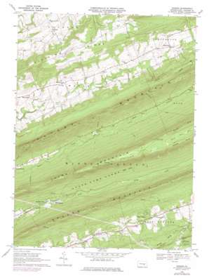
Enders Topo Map Pennsylvania
To zoom in, hover over the map of Enders
USGS Topo Quad 40076d7 - 1:24,000 scale
| Topo Map Name: | Enders |
| USGS Topo Quad ID: | 40076d7 |
| Print Size: | ca. 21 1/4" wide x 27" high |
| Southeast Coordinates: | 40.375° N latitude / 76.75° W longitude |
| Map Center Coordinates: | 40.4375° N latitude / 76.8125° W longitude |
| U.S. State: | PA |
| Filename: | o40076d7.jpg |
| Download Map JPG Image: | Enders topo map 1:24,000 scale |
| Map Type: | Topographic |
| Topo Series: | 7.5´ |
| Map Scale: | 1:24,000 |
| Source of Map Images: | United States Geological Survey (USGS) |
| Alternate Map Versions: |
Enders PA 1947 Download PDF Buy paper map Enders PA 1947, updated 1962 Download PDF Buy paper map Enders PA 1969, updated 1972 Download PDF Buy paper map Enders PA 1969, updated 1977 Download PDF Buy paper map Enders PA 1969, updated 1984 Download PDF Buy paper map Enders PA 1969, updated 1984 Download PDF Buy paper map Enders PA 1995, updated 1999 Download PDF Buy paper map Enders PA 2010 Download PDF Buy paper map Enders PA 2013 Download PDF Buy paper map Enders PA 2016 Download PDF Buy paper map |
1:24,000 Topo Quads surrounding Enders
> Back to 40076a1 at 1:100,000 scale
> Back to 40076a1 at 1:250,000 scale
> Back to U.S. Topo Maps home
Enders topo map: Gazetteer
Enders: Airports
Gusler Airport elevation 208m 682′Enders: Areas
Devils Race Course elevation 486m 1594′Enders: Gaps
Heckert Gap elevation 209m 685′Enders: Parks
Joseph E. Ibberson Conservation Area elevation 321m 1053′Mount Laurel Park elevation 182m 597′
Enders: Populated Places
Carsonville elevation 224m 734′Ellendale Forge elevation 134m 439′
Enders elevation 204m 669′
Enterline elevation 201m 659′
Piketown elevation 192m 629′
Ritzie Village elevation 191m 626′
White Spring elevation 132m 433′
Enders: Ridges
Dividing Ridge elevation 342m 1122′Peters Mountain elevation 388m 1272′
Enders: Streams
North Fork Powells Creek elevation 189m 620′South Fork Powells Creek elevation 190m 623′
Enders: Summits
Third Mountain elevation 488m 1601′Enders: Trails
Rattling Run Trail elevation 495m 1624′Shikellimy Trail elevation 301m 987′
Victoria Trail elevation 272m 892′
Water Tank Trail elevation 364m 1194′
Enders digital topo map on disk
Buy this Enders topo map showing relief, roads, GPS coordinates and other geographical features, as a high-resolution digital map file on DVD:
Atlantic Coast (NY, NJ, PA, DE, MD, VA, NC)
Buy digital topo maps: Atlantic Coast (NY, NJ, PA, DE, MD, VA, NC)


